Knocknarea and Queen Medb’s Cairn / Knocknarea et le cairn de la reine Maeve
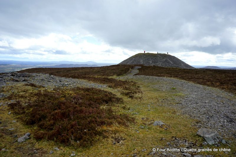
Visitors are asked not to climb on the cairn, and not to remove stones from it, as large visitor numbers are causing damage to the structure. / Il est interdit de monter sur le cairn, et d’y prendre des pierres. Le grand nombre de visiteurs endommage peu à peu la structure.
The wind has bundled up the clouds high over Knocknarea,
And thrown the thunder on the stones for all that Maeve can say.
W.B. Yeats
There are two trails, both well signposted, leading to the summit of Knocknarea, Co Sligo — the new Knocknarea Queen Maeve Trail starts at the Strandhill Rugby Club and involves a ‘bog bridge’; the trailhead for the second one is at the Queen Maeve’s Grave car park.
Well, we managed to miss both.
Take a lack of preparation, and combine with an over-reliance on technology (namely, Google Maps), and you end up on a random car park with only a vague idea of which way to go.
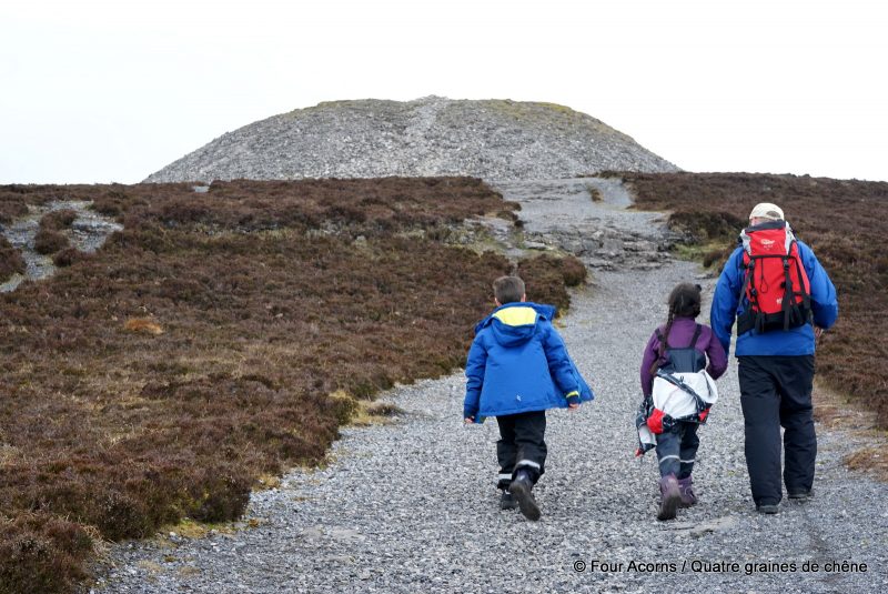
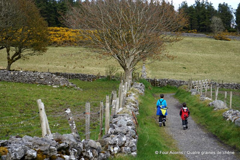
Starting from the entrance for Rathcarrick Forest, a Coillte woodland that doesn’t even appear on the Coillte Outdoors map, it was supposed to be a short and steep hike to Knocknarea and the unmissable cairn that tops it. In fact, this route added a good bit of length to the walk.
Nevermind. Ill prepared we might have been, but we still were dressed for the weather (blustery rain showers in between fresh, sunny spells), with a backpack full of snacks and drinks to keep us going.
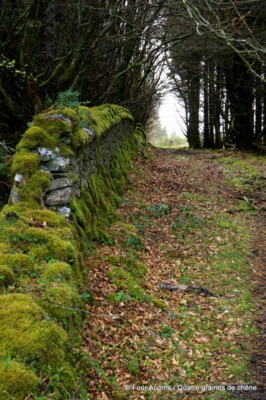
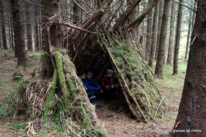
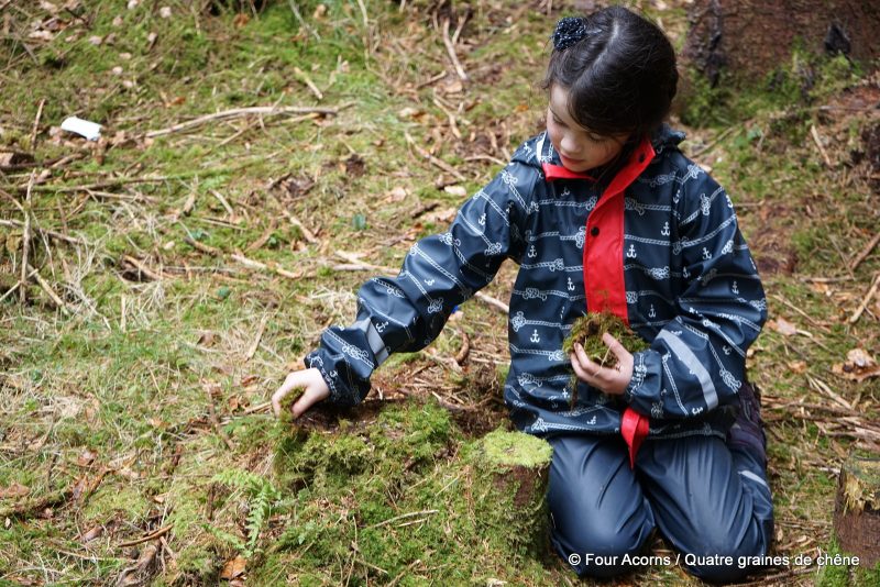
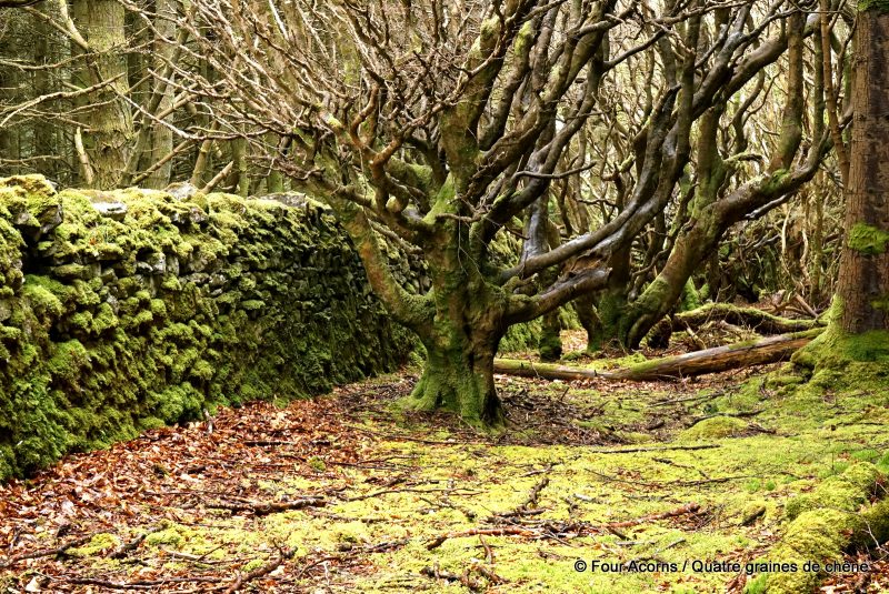
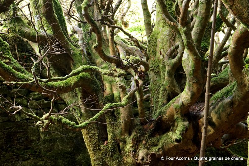
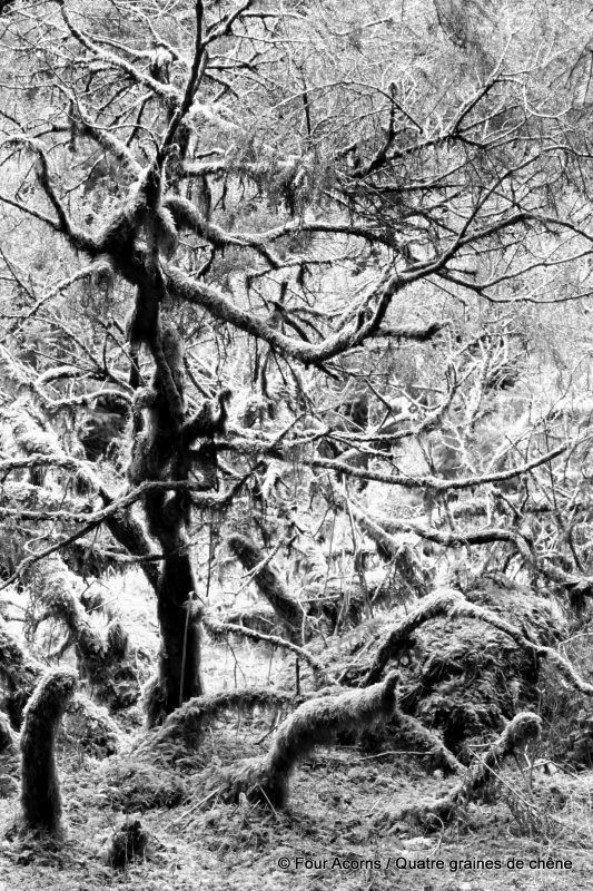
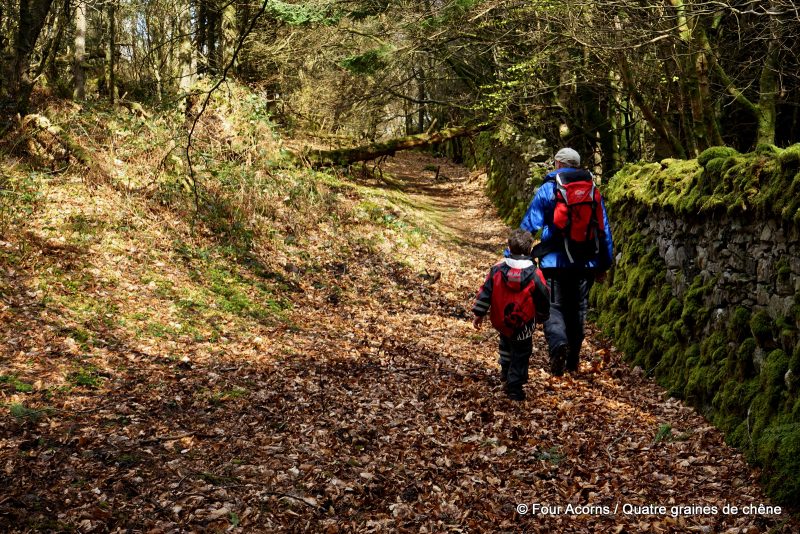
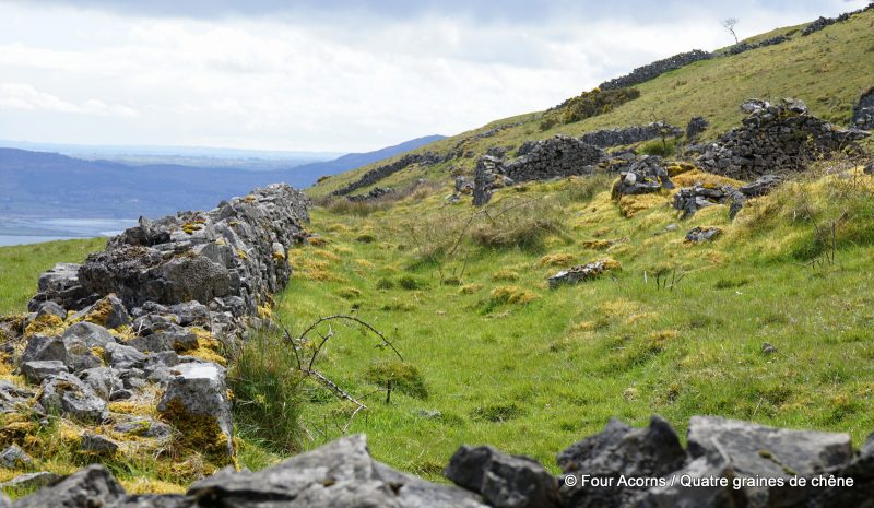
After a couple of hairpin bends, the wide forest track turned into a muddy, rocky footpath, lined with ancient dry-stone walls and mossy trees. In the sun-dappled woodland, a well-built den suddenly appeared amongst the trees. Further up, conifers gave way to an phantasmagorical grove of old coppiced trees, their gnarled branches covered in thick, bright green moss.
Le vent a tassé les nuages sur les hauts de Knocknarea,
Et jeté le tonnerre sur les pierres pour ce que Maeve en dit.
W. B. Yeats
Deux sentiers balisés montent au sommet de Knocknarea, Co Sligo : le sentier Knocknarea Queen Maeve démarre du club de rugby de Strandhill et comprend un trottoir en planches ; le second part du parking indiqué Queen Maeve’s Grave.
Nous avons manqué les deux.
Prenez un manque de préparation, et ajoutez-y un excès de confiance dans la technologie (Google Maps, pour être précis), et vous atterrissez sur un parking improbable, avec une vague idée de la direction à prendre.
En partant de l’entrée du bois de Rathcarrick, une forêt publique qui n’apparaît même pas sur le site de Coillte Outdoors, la randonnée devait être courte et raide pour atteindre le sommet de Knocknarea et le cairn immanquable qui le coiffe. En réalité, cet itinéraire a sérieusement rallongé la balade.
Peu importe. Tout mal préparés que nous étions, nous portions toutefois nos vêtements de randonnée et un sac à dos bien rempli.
Après quelques virages en épingle à cheveux, la large route forestière se changea en un sentier boueux et rocailleux, bordé de murs de pierre sèche sans âge et d’arbres moussus. Dans le sous-bois tacheté de lumière, une cabane en branches apparut soudain au milieu des troncs. Plus haut, les conifères cédèrent le pas à un bosquet fantasmagorique d’arbres de taillis, dont les branches noueuses étaient couvertes d’une épaisse mousse verte.
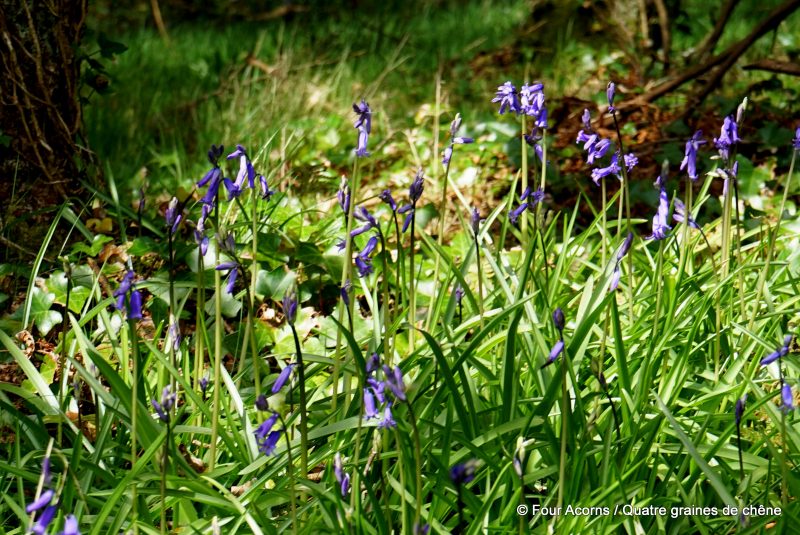
Bluebells
Jacinthes des bois
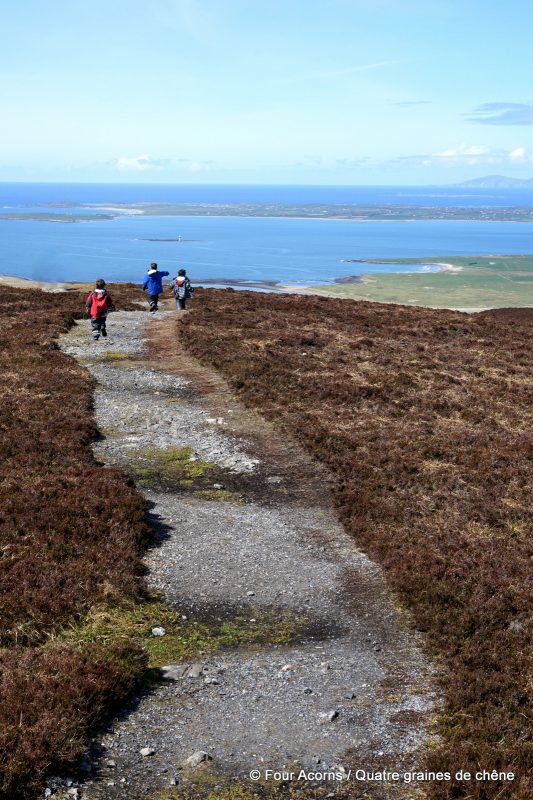
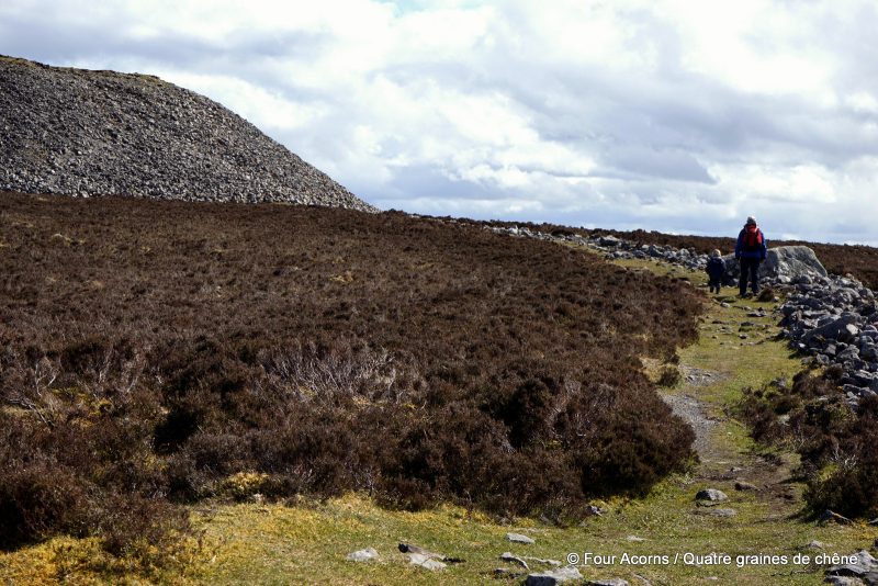
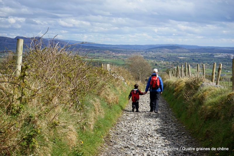
As we walked alongside a crumbling stone wall, stepping over rotten branches and ducking under fallen trees, Knocknarea came into view through a clearing, well above the canopy. The path plunged towards another stone wall, and a boggy field beyond. On the opposite side of the field, was the ‘official’ trail to Knocknarea.
From then on, the ascent was truly steep. The rocky trail goes straight up to the summit, through open pastures and heathland. Everywhere you look, the views are breathtaking.
Comme nous longions un mur de pierre croulant, enjambant des branches pourries et évitant des arbres tombés, Knocknarea apparut soudain dans une clairière, très haut au-dessus de la canopée. Le sentier plongea alors vers un autre mur de pierre, au-delà duquel s’étendait un champ hérissé de joncs. A l’autre bout du pré, se trouvait le sentier “officiel” de Knocknarea.
A partir de là, l’ascension devint vraiment raide. Le sentier rocailleux montait tout droit à flanc de montagne, traversant pâturages et bruyères rases. Tout autour, la vue était d’une beauté saisissante.
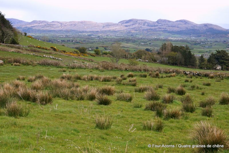
A field with a view – over the Bricklieve Mountains
Champ avec vue, sur les monts de Bricklieve
The deserted village, which was probably abandoned during the Famine (ca.1850)
Le village déserté, probablement abandonné pendant la Famine (vers 1850).
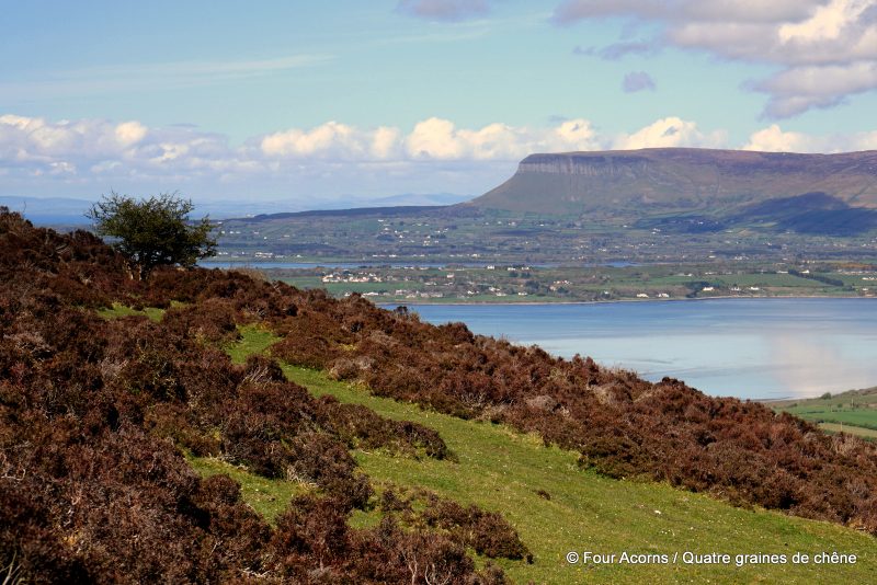
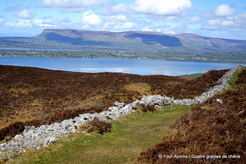
The iconic Ben Bulben, across Sligo Bay
Ben Bulben, sur l’autre rive de la baie de Sligo.
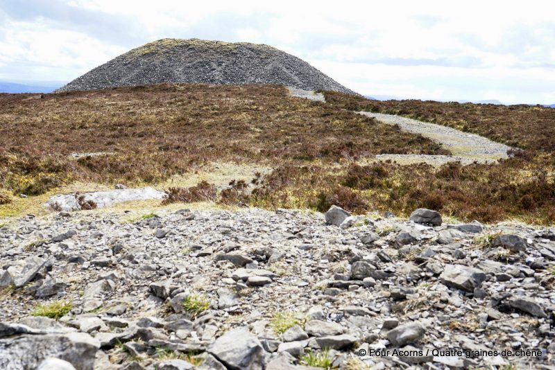
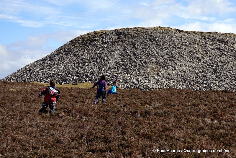
The limestone mountain of Knocknarea (alt. 327m/1,073ft) dominates the skyline of Sligo. Standing on the Cúil Irra (Coolera) peninsula between the bays of Sligo and Ballysadare, it is crowned by Medb’s Cairn.
Measuring 55m (180ft) in width and 10m (33ft) in height, the great cairn, which remains unexcavated, is believed to conceal a Neolithic passage tomb, probably erected about 3400BC. Legend has it that Queen Medb of Connacht was buried inside, standing and spear in hand.
‘This queen must have had a big body’ Jedi quipped as we huffed and puffed up the final approach.
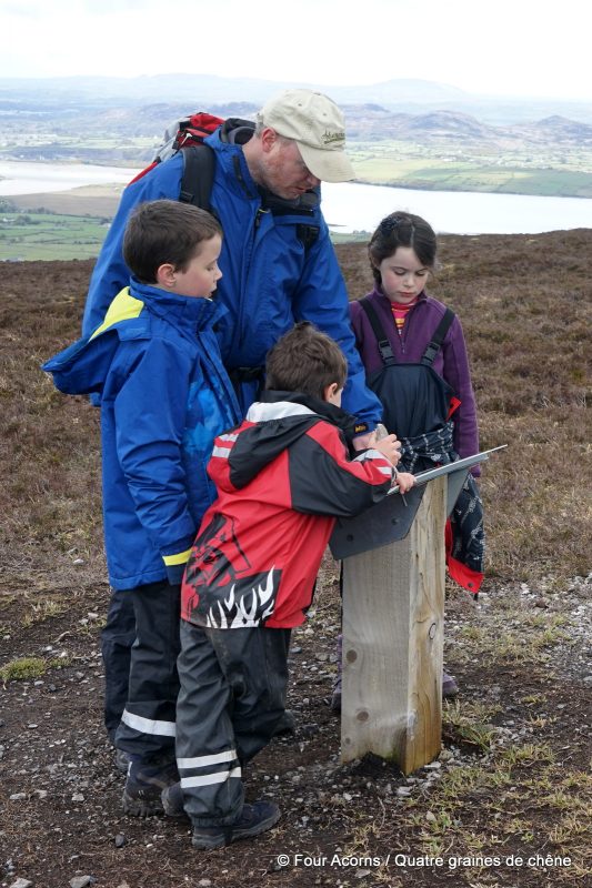
A few information panels help make sense of the scale of the site. For Queen Medb’s Cairn is the largest of a number of monuments. Sligo Walks describes the summit of Knocknarea—
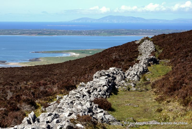
The presence of other passage tombs, along with circular house foundations and an extensive system of earthen banks enclosing the eastern approach to the summit, are all reminders that this was a place of intense ritual activity. The large cairn was probably built around 3400BC, while some of the smaller passage tombs are potentially a few hundred years older.
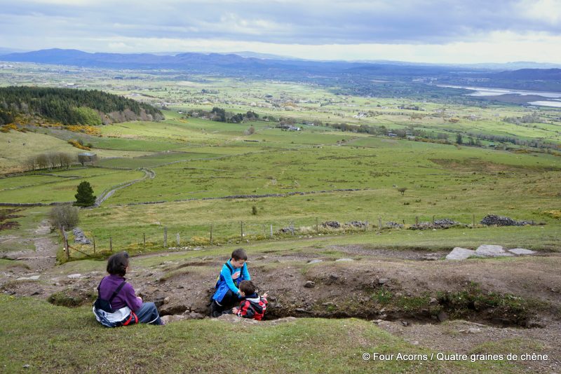
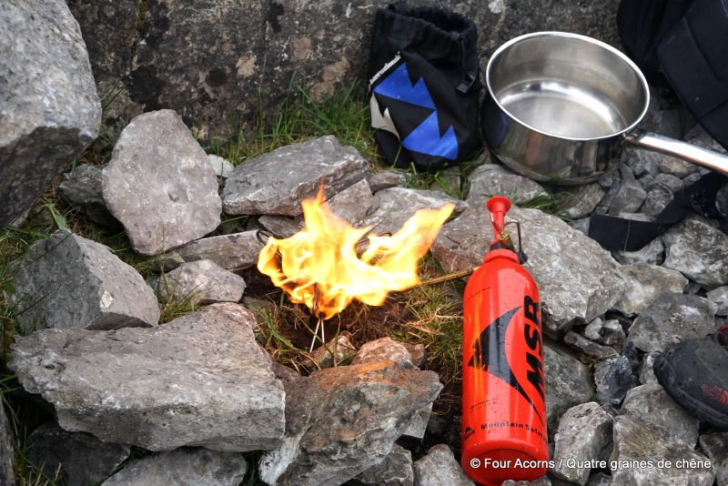
As a blustery shower blew in from the ocean, we looked for a sheltered spot to set up the MSR® stove. The only place we could find was a 5,000 year old stone ditch. No less.
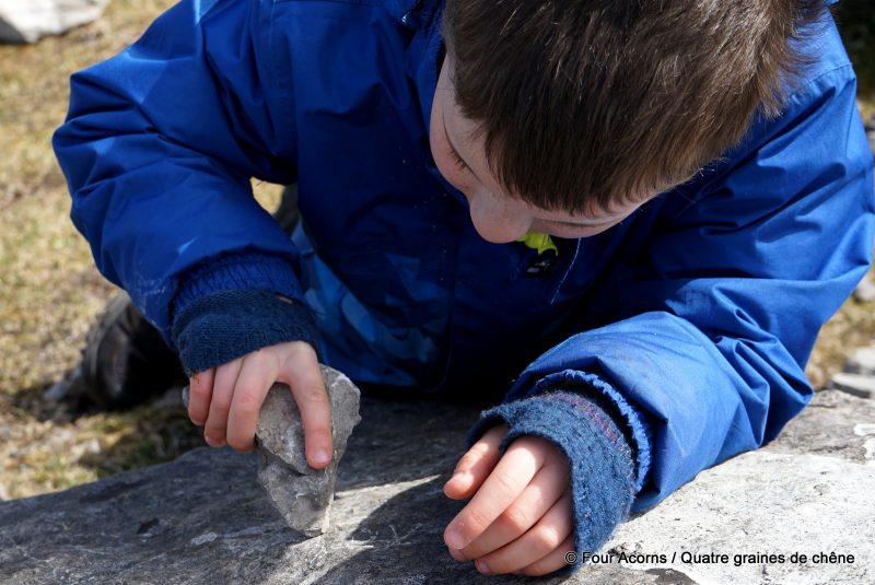
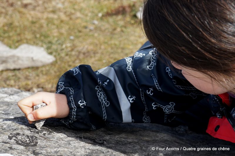
True to the spirit of the place, Mermaid and Jedi started drawing a ‘legend’ on a large slab of limestone, rock on rock, while Squirrel used a stone as a blunt carving tool. Pebbles, as always, practiced his stone-throwing.
Knocknarea (alt. 327 m) est une montagne calcaire qui se dresse entre les baies de Sligo et Ballysadare, sur la péninsule de Coolera (Cúil Irra). Son sommet est couronné par le grand cairn de la reine Maeve.
Mesurant 55 mètres de large par 10 mètres de haut, le cairn n’a pas été fouillé, mais il abrite probablement une tombe à couloir du Néolithique. A en croire la légende, la reine Maeve de Connacht y est enterrée, debout et lance à la main.
“Cette reine devait être grosse !” s’exclama Jedi alors que nous gravissions péniblement l’approche finale.
Des panneaux d’information bien placés aident à saisir l’échelle du site. Car le cairn de Maeve n’est qu’un seul de plusieurs monuments. Le site touristique Sligo Walks décrit ainsi le sommet de Knocknarea :
La présence d’autres tombes à couloir, ainsi que de fondations d’habitations circulaires et d’un système complexe de talus de terre encerclant l’approche orientale du sommet, rappellent que ce site était jadis un lieu d’activité rituelle intense. Le grand cairn fut probablement bâti vers 3400 av. J.-C., tandis que les autres tombes à couloir sont sans doute antérieures de quelques siècles.
Comme un grain arrivait en bourrasques de l’océan, nous avons cherché un lieu abrité pour installer notre réchaud MSR®. Le seul recoin disponible était un fossé de pierre âgé de plus de 5000 ans. Rien que ça.
Fidèles à l’esprit des lieux, Sirène et Jedi ont commencé à graver une “légende” sur une grande dalle calcaire, tandis qu’Ecureuil martelait les rochers à l’aide d’une pierre. Comme à l’accoutumée, Caillou jetait des pierres à l’envî.
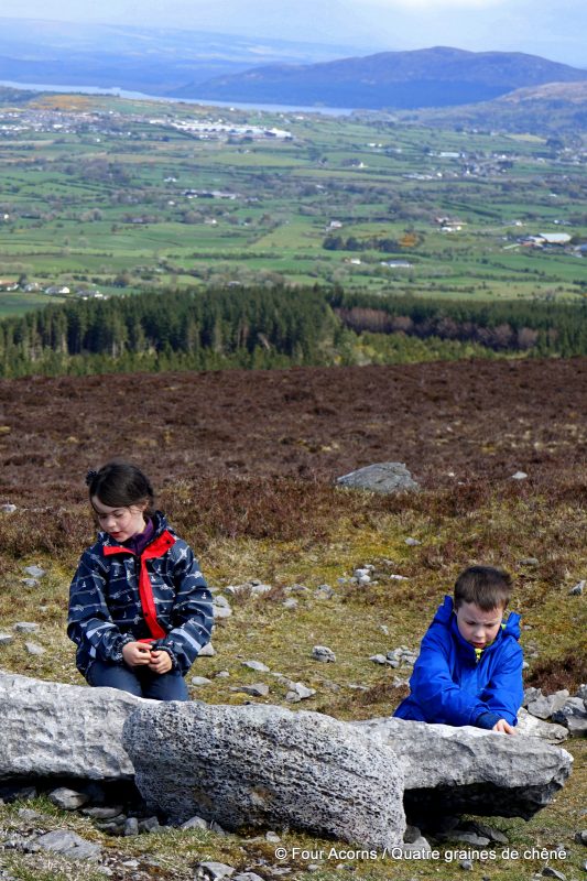
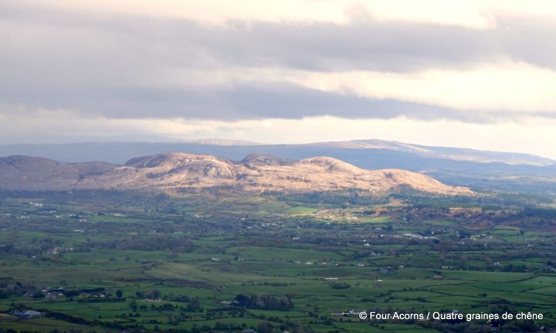
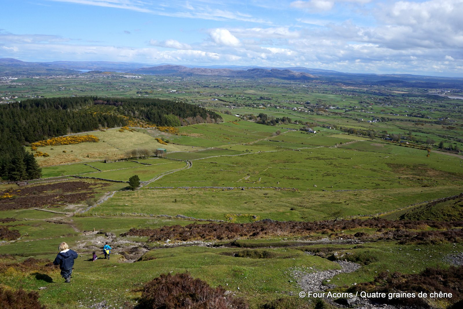
A few minutes later, the sun started shining again, brighter than ever, revealing panoramic vistas that took our breath away. To the north, the extraordinary cliffs of Slieve League, Co Donegal, shimmered in the far distance, between sea and sky. To the east, the Bricklieve Mountains (‘speckled mountains’ in Irish) looked like a cloud of ochre rock, trapped between the green fields and the grey sky.
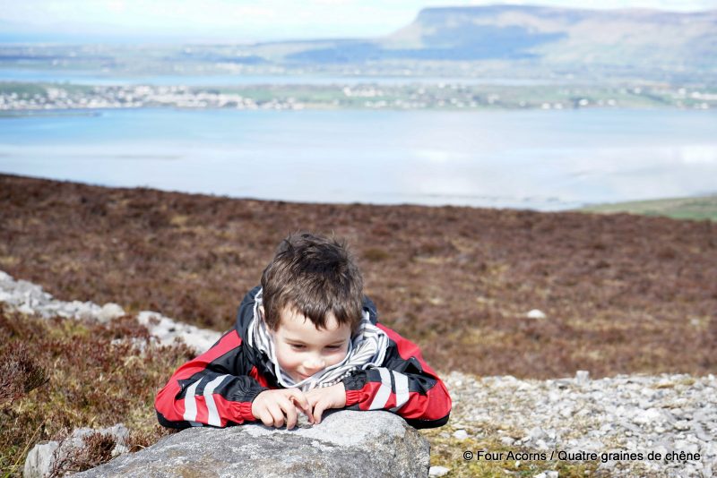
It is considered bad luck to take a rock from the mound. But if you bring a stone up the hill and make a wish as you add it to the great cairn, Queen Medb will grant your wish. The acorns happily complied.
Quelques minutes plus tard, le soleil brillait à nouveau, révélant un panorama époustouflant. Au nord, les extraordinaires falaises de Slieve League, Co Donegal, se dressaient au loin dans la brume bleue, entre ciel et mer. A l’est, les monts de Bricklieve (“montagnes mouchetées” en gaélique) ressemblaient à un gros nuage ocre, coincé entre le vert des champs et le gris du ciel.
Enlever une pierre du cairn est considéré de mauvais augure. En revanche, si on ramasse une pierre pendant l’ascension pour faire un voeu en l’ajoutant au tumulus, alors la reine Maeve l’exaucera. Les graines de chêne se sont joyeusement prêtées à la tradition.
In the far distance, the cliffs of Slieve League, Co Donegal
Au loin, les falaises de Slieve League, Co Donegal
Bricklieve Mountains, Co Sligo
Les monts de Bricklieve, Co Sligo
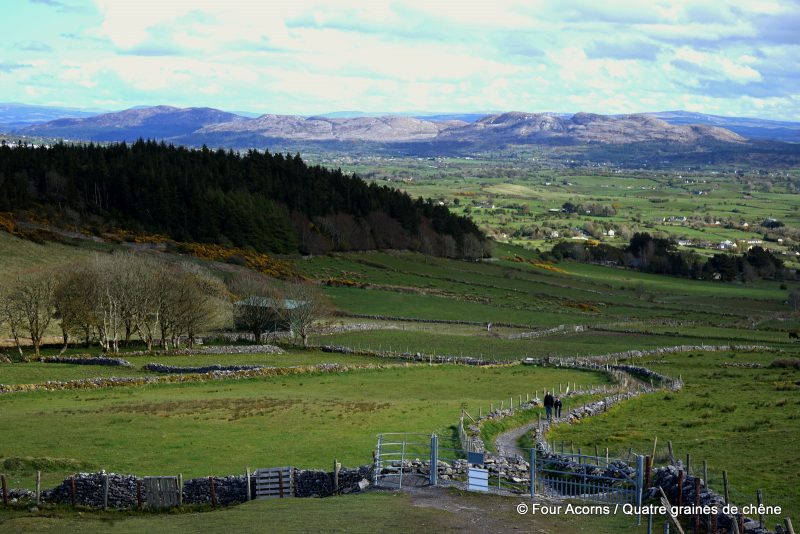
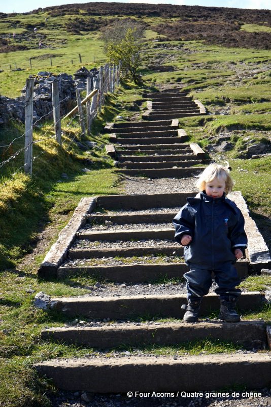
On the way down again
A la descente
Getting there
![]() These directions are for the newly-established Knocknarea Queen Maeve trail, starting from Strandhill Rugby Club, off the R292.
These directions are for the newly-established Knocknarea Queen Maeve trail, starting from Strandhill Rugby Club, off the R292.
Upon leaving the car park follow the stone path for 1.2km then continue along the ‘bog bridge’, or raised boardwalk, to the summit above. The ascent takes approximately 1 hour and the descent 40 minutes (1.5-2 hours in total). Good footwear/boots are recommended as the trail can be both wet and slippery. Please take extra care on the ‘bog bridge’ section of the trail, particularly during icy conditions.
Visitors are asked not to climb on the cairn, and not to remove stones from it, as large visitor numbers are causing damage to the structure.
The property traversed by this route is private and access is available by the kind permission of the landowners. Dogs are not permitted on sections of the trail that cross the open farmland above the wood due to the presence of grazing sheep and lambs.
S’y rendre
Ces indications concernent le sentier Knocknarea Queen Maeve, récemment établi, qui part du club de rugby de Strandhill, au bord de la R292.
A la sortie du parking, suivez le sentier de pierre pendant 1,2 km puis prenez le trottoir en planches jusqu’au sommet. Comptez une heure environ pour l’ascension, et 40 minutes pour la descente (1h30-2h en tout). Il est recommandé de porter de bonnes chaussures de marche, car le sentier peut être mouillé et glissant. Soyez particulièrement vigilant sur le trottoir en planches, notamment par grand froid.
Il est interdit de monter sur le cairn, et d’y prendre des pierres. Le grand nombre de visiteurs endommage peu à peu la structure.
Enfin, ce sentier traverse une propriété privée, où l’accès n’est possible que grâce à la permission du propriétaire. Les chiens sont interdits sur la section du sentier qui traverse les pâturages, au-dessus de la forêt, à cause de la présence de moutons et d’agneaux.
 Previous Post
 Next Post
What a wonderful place to explore. It sounds truly magical, with some amazing photography! #adventurecalling
Thank you for the lovely comment Andrea x 🙂
Some fabulous photos there!
#adventurecalling
This is the second amazing hill adornment that you’ve shared with us. This cairn, like the last, is just awesome – we so t get anything like this Wales! I can feel a walking holiday being booked just tick off some unique cairns haha. Thanks for sharing on #adventurecalling wonderful photos as always
I meant to say ‘we don’t get anything like this in Wales!’
Haha these are the two cairns we’ve hiked to so far so I’ll stop now! If you’re going to book a hiking holiday to tick off some cairns, then Sligo is the place for you. There are countless cairns, passage tombs and other megalithic remains in that county.
Thank you for hosting #Adventurecalling 🙂
Your posts always transport me to such magical places and your photos are always beautiful. I love the idea of Queen Medb standing tall and proud with her spear! I hope she granted your wishes. Thank you for linking up with us at #adventurecalling
You’re not supposed to climb the cairn. The very first photo shows people standing on the cairn despite extensive signage asking people not to.
We took heed of the signage and didn’t climb the cairn. But as seen in the first pic, many people are not so respectful, unfortunately.