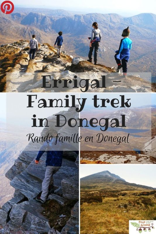
Errigal – Family trek to the top of Donegal / Randonnée au sommet de Donegal
We were lucky with the weather. The Easter weekend in Ireland was allegedly warmer than in Mallorca, one of the sun-drenched Balearic Islands in the Mediterranean! But we spent Easter in the northwest of the Emerald Isle, between Co Tyrone and Co Donegal, an area that truly looks magical in the sunshine.
Yes, we were lucky with the weather. So everyone kept telling us, before adding, “It might be the only summer we get.” And so while most locals busied themselves with summer jobs around their houses and gardens, we trekked up Errigal (An Earagail in Irish, alt. 751m/2,464ft), Donegal’s iconic county top.
Errigal appears as a beautifully perfect cone of glistering whiteness from all directions, except when viewed from the west, when it appears with a double apex […] Errigal is certainly the most perfect pyramidal mountain in Ireland, perhaps in the British Islands.
Memoirs of the Geological Survey (1891)
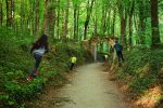
We had spent a gloriously sunny Easter weekend in this part of Ireland before (5 years ago, to be exact), exploring the beautiful Ards Forest Park on the north coast of Donegal. Everywhere you look in that corner of the county, the elegant cone of Errigal dominates the skyline, with the flat-topped Muckish (Mucais/an Mhucais in Irish, alt. 667m/2,189ft) nearby.
La météo était de notre côté. En Irlande, le long weekend de Pâques a été plus chaud qu’à Majorque, une île des Baléares baignée de soleil méditerranéen ! Mais nous avons passé ces quatre jours dans le nord-ouest de l’île d’Emeraude, entre les comtés de Tyrone et Donegal, une région qui, sous le soleil, se transforme comme sous l’effet d’un coup de baguette magique.
La météo était de notre côté. C’est ce que tout le monde nous a répété, avant d’ajouter avec un haussement d’épaules : “C’est peut-être bien le seul été que l’on aura.” Alors, comme les gens du coin s’affairaient à maintes taches estivales dans leurs maisons et jardins, nous avons gravi Errigal (An Earagail en gaëlique, alt. 751 m), le sommet emblématique de Donegal.
Errigal apparaît comme un cône parfait d’une blancheur resplendissante dans toutes les directions, sauf s’il est vu de l’ouest, où il apparaît avec un double sommet. Errigal est certainement la montagne pyramidale la plus parfaite d’Irlande, si ce n’est des îles Britanniques.
Memoirs of the Geological Survey (1891)
Il y a cinq ans, nous avions déjà passé un weekend de Pâques plein soleil dans ce coin d’Irlande d’où Brian est originaire. Nous avions alors découvert la magnifique forêt littorale de Ards (Ards Forest Park), sur la côte nord. Dans cette partie du comté, où que l’on regarde, le profil conique de Errigal domine l’horizon, avec tout près, le sommet plat caractéristique de Muckish (Mucais/an Mhucais en gaëlique, alt. 667 m).
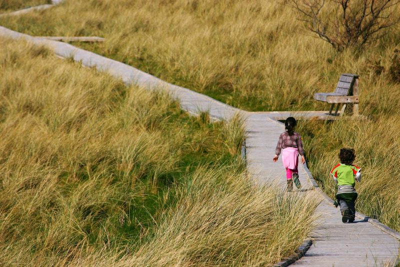
Exploring Ards Forest Park, Co Donegal, Easter 2014 /
A la découverte de la forêt littorale de Ards, Co Donegal, à Pâques 2014.
Yet as we drove ever closer through the Derryveagh Mountains, the conical-shaped mountain I had told the acorns about turned out to have two summits – the “double apex” mentioned by the authors of Memoirs of the Geological Survey.
Nevermind. In the bright spring sunshine, we parked in the small car park by the R251 and got ready to go. Even the breeze was warm! Leaving our waterproofs in the car, we set off with our fleeces and as many bottles of water as we could carry.
Brian and I had hiked up Errigal some 20 years ago – our first time in Ireland together. It was a typical Donegal summer afternoon – a mix of sea mist and sunny spells, with always a chance of rain. I remembered distinctly the muddy start of the trail, through spongy grass and wet bog.
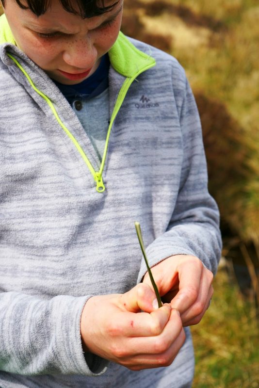
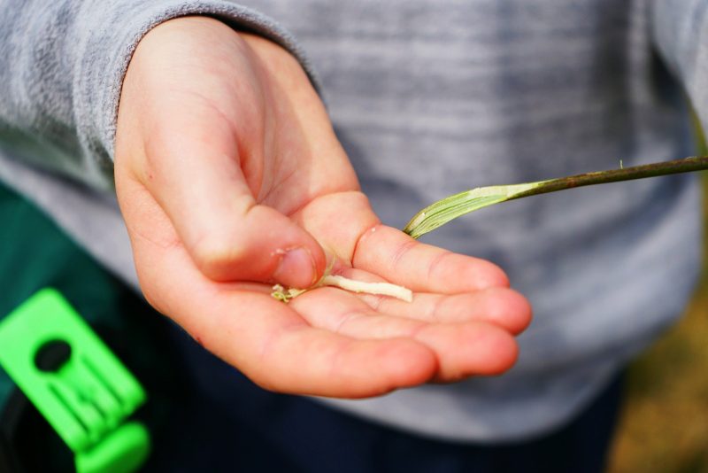
Jedi picked a few reeds and took them apart to extract the spongy pith inside, which he intends to use as tinder next time he lights a fire.
Pourtant, comme nous nous rapprochions de la chaîne de Derryveagh, la montagne conique dont j’avais parlé aux graines de chêne révéla deux sommets : exactement comme l’écrivirent les auteurs de Memoirs of the Geological Survey.
Peu importe. Sous le grand soleil printanier, nous avons garé la voiture dans le parking au bord de la R251 et les préparatifs de départ purent commencer. Même la brise était tiède ! Abandonnant les ensembles imperméables dans le coffre, nous avons enfilé nos polaires et emporté autant d’eau que nous pouvions en porter.
Brian et moi avions déjà gravi Errigal, il y a une vingtaine d’années. La première fois que nous visitions l’Irlande (et sa famille !) ensemble. C’était un après-midi d’août typiquement irlandais : un mélange de brume atlantique et d’éclaircies inespérées, avec toujours une possibilité d’averse. Je me souvenais distinctement du départ du sentier, à travers la tourbe gorgée d’eau.
Jedi cueillit immédiatement quelques joncs, pour en extraire la moëlle blanche qu’il compte utiliser la prochaine fois qu’il allumera un feu.
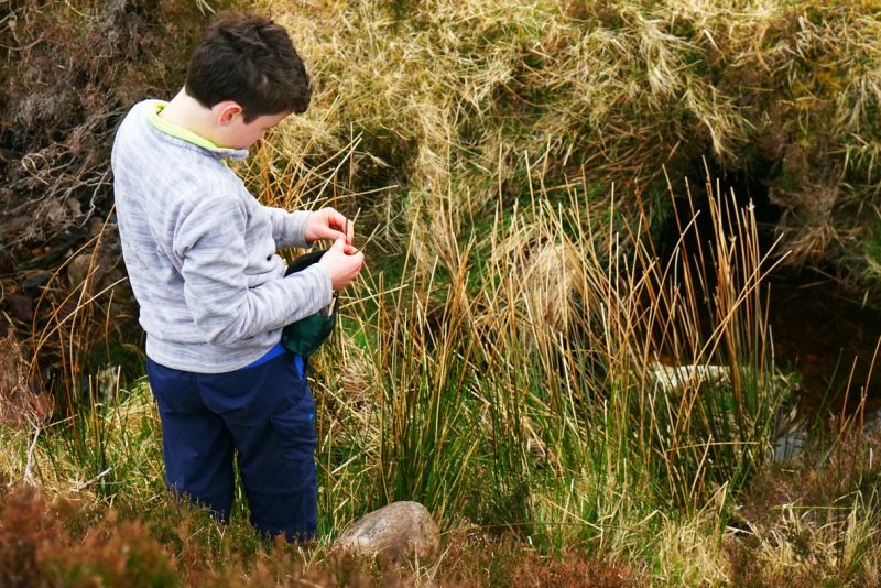
Extracting the soft pith of reeds to use as tinder /
Extrayant la moëlle blanche d’un jonc pour s’en servir d’amadou.
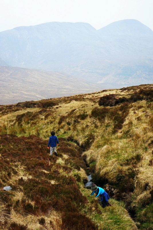
The acorns started off by jumping over the stream from grassy bank to peat hag. Until Squirrel landed feet first in a bog hole! Brian quickly pulled him out, but the experience taught him a lesson.
Les graines de chêne démarrèrent la rando en sautant au-dessus du ruisseau de pierre en motte de tourbe. Jusqu’à ce qu’Ecureuil plonge les pieds les premiers dans un trou de tourbe ! Brian l’a vite aidé à en sortir, mais l’expérience lui a donné une bonne leçon.
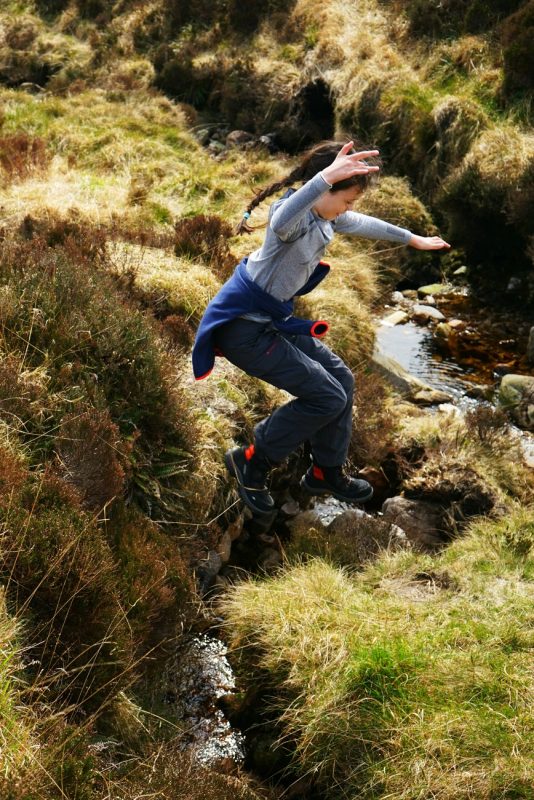
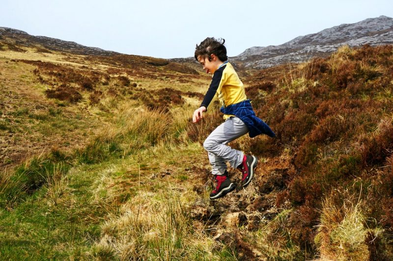
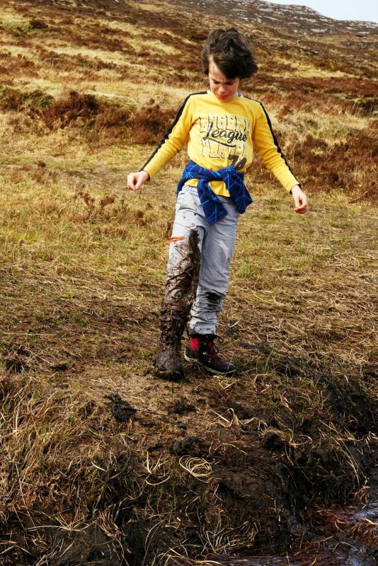
Trapped in a bog hole – lesson learnt! /
Embourbé dans la tourbe : leçon comprise !
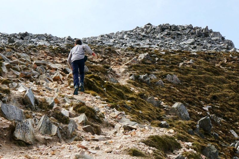
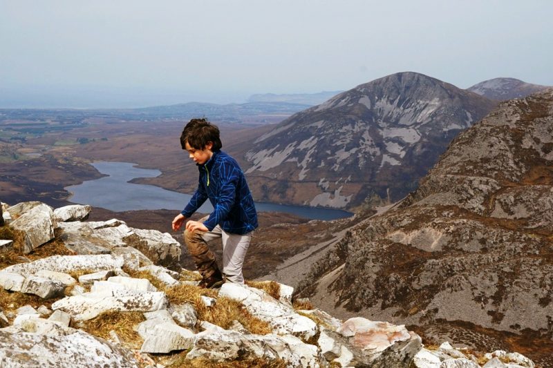
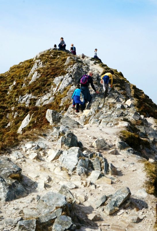
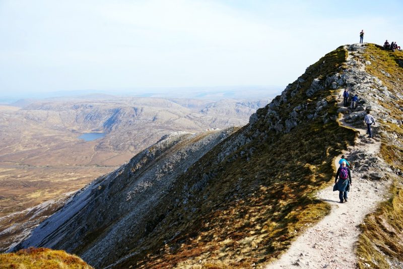
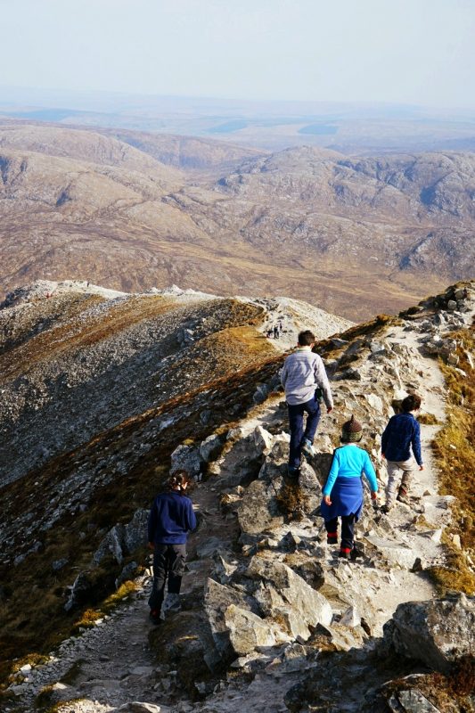
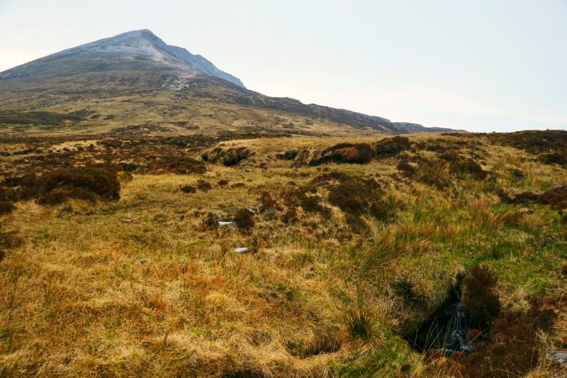
But I had somehow forgotten the endless tracts of treacherous scree leading up to the summit.
The trail is well-beaten (countless hillwalkers had the same idea on this sunny Good Friday), but Errigal is no walk in the park. Despite our recent family hike to Luggala, Co Wicklow, the steep gradient took us by surprise.
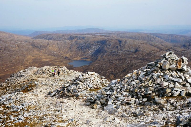
The trail is marked by several cairns, some bigger than others, but always a good target to aim for and take a breather in this treeless landscape. Those cairns probably serve as navigational aids when the mountain is engulfed in fog and cloud – a regular occurrence on Errigal.
Cependant, j’avais réussi à oublier les interminables éboulis qui mènent au sommet de Errigal.
Le chemin est bien battu (d’innombrables randonneurs avaient eu la même idée par ce jour férié ensoleillé), mais Errigal n’est pas une balade dans le parc. Malgré notre récente randonnée en famille à Luggala, Co Wicklow, la dénivellation nous a pris par surprise.
Le sentier est jalonné de plusieurs stèles de pierre, certaines plus grosses que d’autres. Toutes constituent de bons points étapes pour reprendre son souffle dans ce paysage dépourvu d’arbres. Ces stèles doivent aussi servir de balises quand la visibilité est nulle ou limitée à cause du brouillard – une chose fréquente sur Errigal.
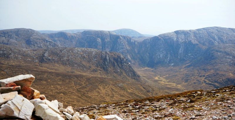
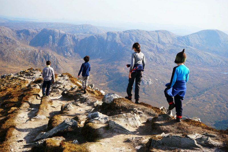
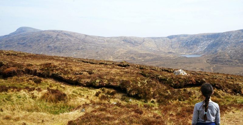
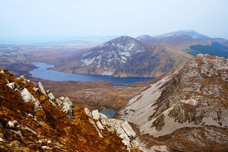
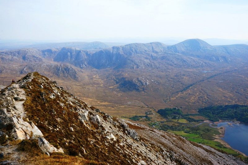
The Poisoned Glen and the Derryveagh Mountains come into view /
Poisoned Glen et les montagnes de Derryveagh se révèlent peu à peu.
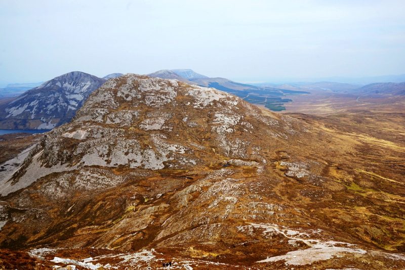
Mackoght, a.ka.a Little Erriga,l in the foreground, Aghla More to the left, and flat-topped Muckish in the far distance /
Mackoght (ou Petit Errigal) au premier plan, Aghla More sur la gauche, et le sommet aplati de Muckish tout au fond.
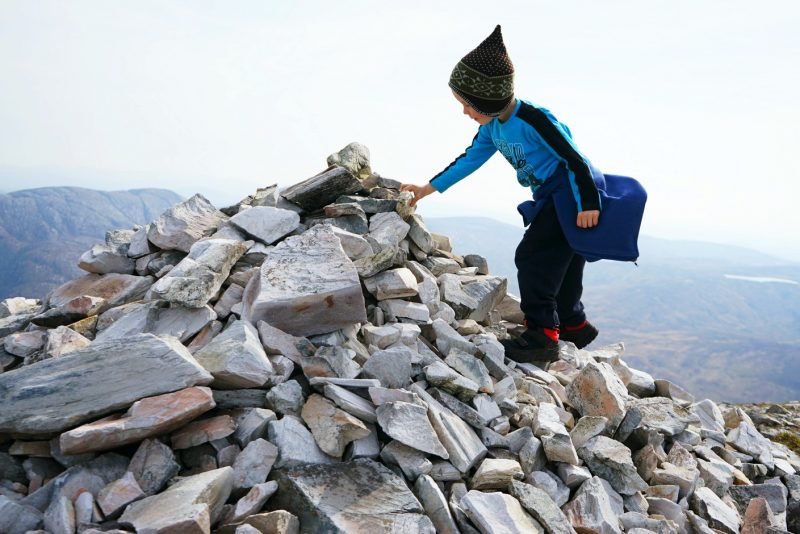
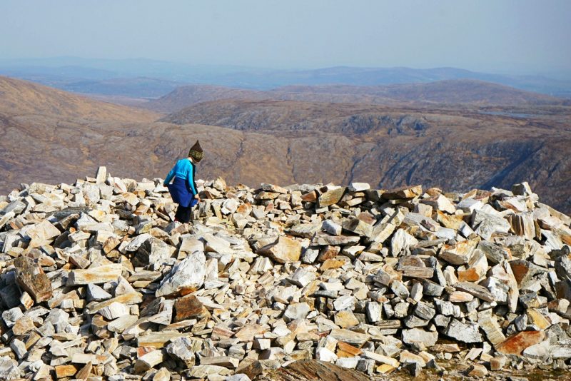
Pebbles adds a stone to one of Errigal’s many cairns /
Caillou ajoute une pierre à l’édifice, comme le veut la tradition.
But we were lucky with the weather. The double apex of Errigal was always in sight, tantalisingly close and heartbreakingly far.
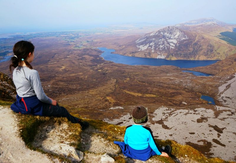
As we slowly huffed and puffed up the mountain, breathtaking views gradually appeared all around – the rounded tops of the Derryveagh Mountains to the south, shadowing the unmistakable Poisoned Glen below; the immense Altan Lough to the north-east, wrapped around the scree-covered slopes of Aghla More (Eachla Mór in Irish, alt. 584m/1,916ft); and the sandy crescent of Tramore Beach in the hazy distance to the north.
Mais la météo était de notre côté. Le double sommet de Errigal restait visible, aparemment si proche et désespérément loin.
Péniblement, nous commencions à prendre de l’altitude et une vue à couper le souffle (si ce n’était pas déjà le cas !) se révéla peu à peu tout autour de nous : les sommets arrondis des montagnes de Derryveagh au sud, renfermant l’étonnant Poisoned Glen (ou “vallée empoisonnée”) ; l’immense Altan Lough au nord-est, dont les eaux profondes s’enroulent autour des pentes en éboulis de Aghla More (Eachla Mór en gaëlique, alt. 584 m) ; et le long croissant de sable doré de la plage de Tramore, au loin dans la brume de la côte nord.
Trekking up Errigal’s unforgiving scree /
Grimpant péniblement par les pierriers interminables de Errigal.
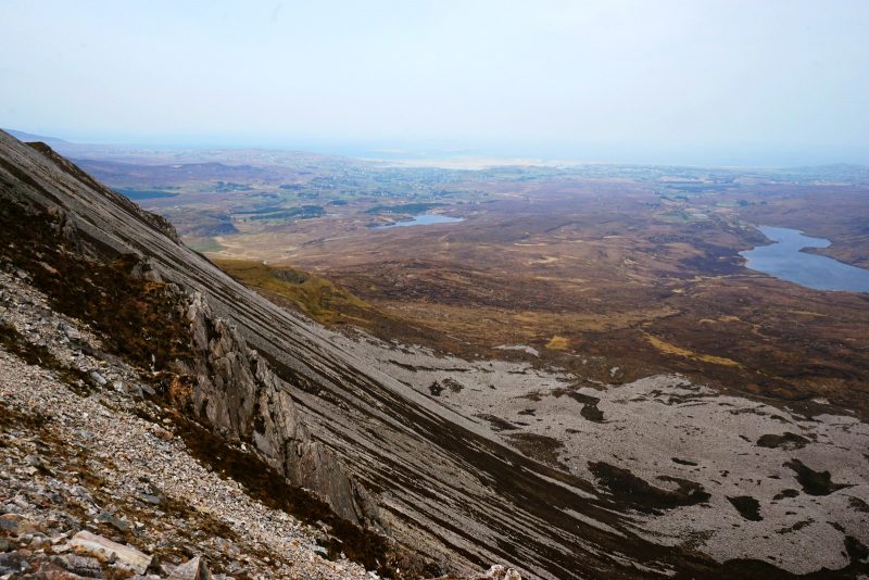
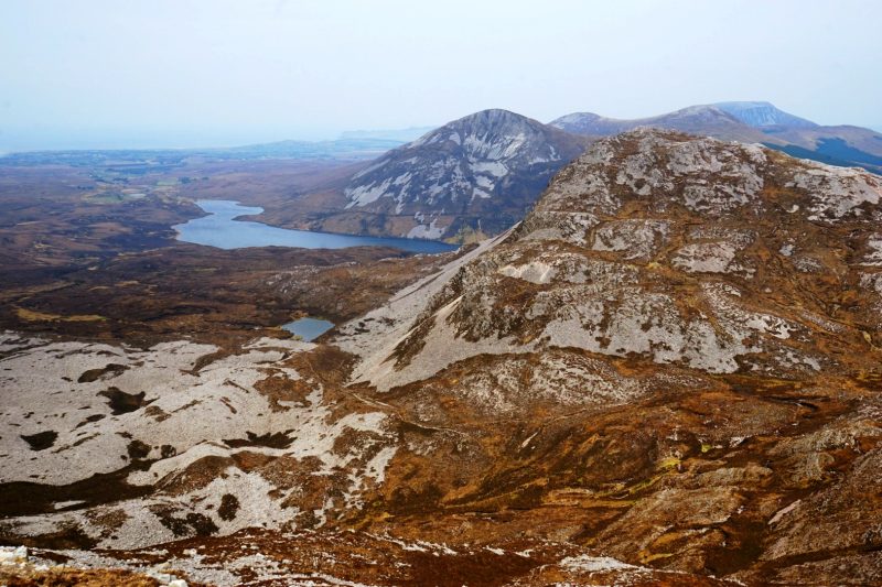
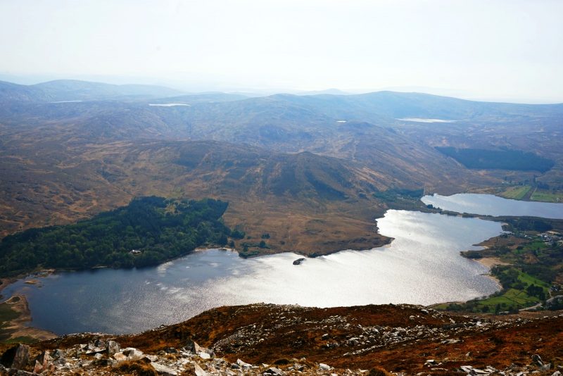
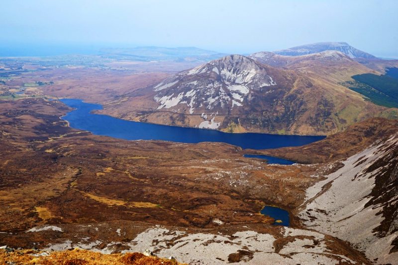
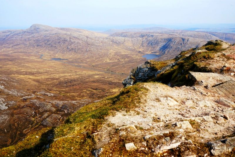
Errigal’s vertiginous scree slope, with Altan Lough to the right, Lough Agannive in the middle, and the beach of Magheraroarty in the far distance /
Le versant en éboulis de Errigal, Altan Lough sur la droite, Lough Agannive au milieu et la plage de Magheraroarty au loin.
Mackoght, a.k.a. Little Errigal, in the foreground, Aghla More to the left, and Muckish in the far distance /
Mackoght (ou Petit Errigal) au premier plan, Aghla More sur la gauche, et Muckish tout au fond.
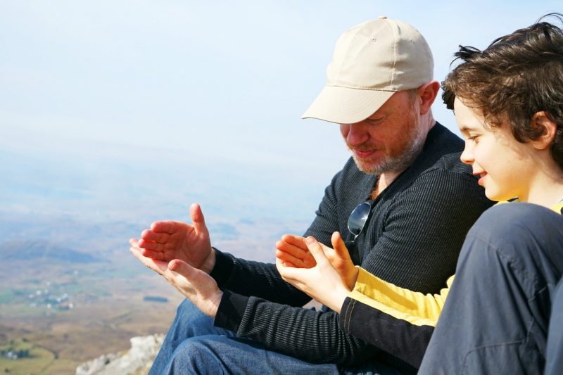
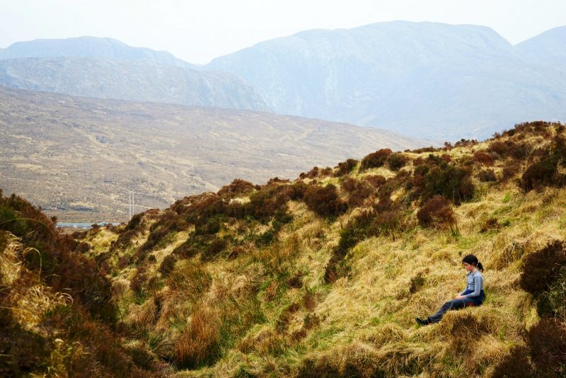
“I am not going to the top!” Mermaid announced as we reached the bottom of the final ascent. Luckily, the ridge was topped by a large stone ring, in which we sheltered from the wind to have a bite to eat.
This being a weekend at the grand-parents’, neither our trusty MSR stove (affiliate link) nor our beloved Kelly kettle (affiliate link) were packed for our usual meal of trailside noodles. We trekked light, which means our food supplies for the day were limited.
Still, that was enough to get the acorns going again, for the last and most spectacular section of the hike.
“Je ne monte pas plus haut !” annonça Sirène comme nous arrivions au pied de la section finale. Heureusement, la butte était coiffée d’un grand cercle de pierre, idéal pour s’abriter du vent et casser la croûte.
Etant donné que nous passions le weekend chez les grand-parents, nous n’avions apporté ni notre fidèle réchaud MSR (lien partenaire) ni notre Kelly kettle (lien partenaire) bien-aimée pour préparer des nouilles instantanées. Nous randonnions léger, si bien que nos provisions pour la journée étaient plutôt maigres.
Malgré tout, elles suffirent à revigorer les graines de chêne avant l’ascension finale, de loin la plus spectaculaire de la randonnée.
This stone ring provided shelter from the wind during a frugal trailside picnic /
Ce cercle de pierre nous abrita du vent pour un pique-nique frugal en bord de sentier.
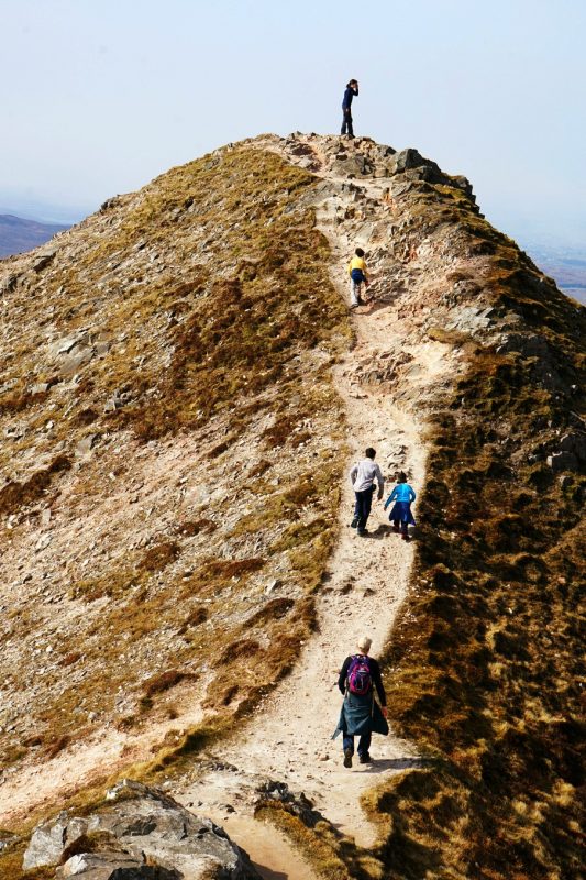
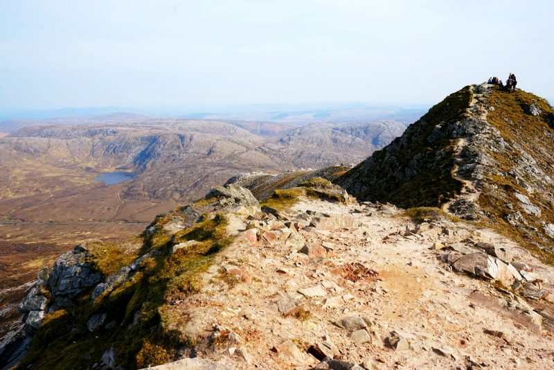
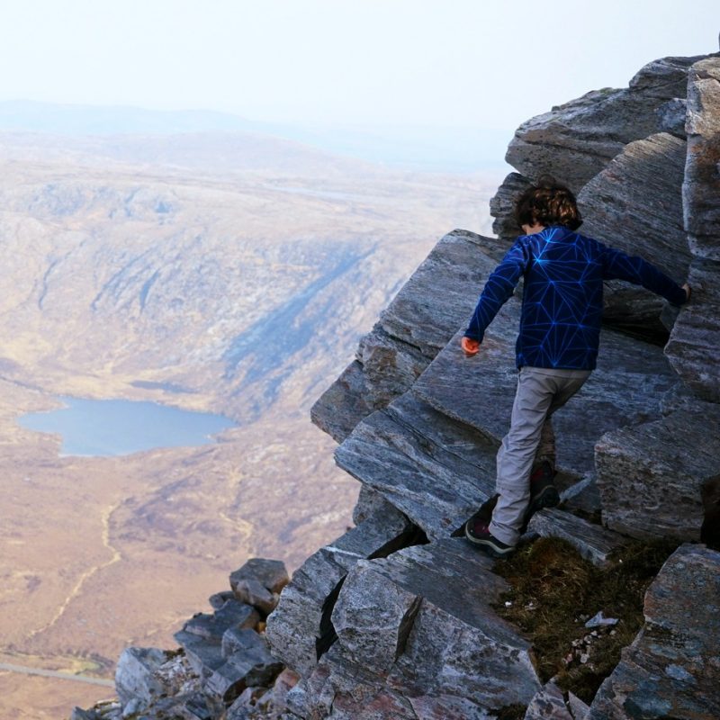
As we walked in a single file up the narrow ridge to the summit, the navy blue waters of Dunlewy Lough appeared dizzingly far below, shimmering in the afternoon sunshine. The view stretched westwards as far as the ocean, beyond the town of Bunbeg.
Unfortunately, this wasn’t to last. The thick smoke of a gorse fire slowly spread across the entire lowlands surrounding Errigal – one of a number of wildfires which scorched hundreds of acres of land in west Donegal over the Easter weekend.
Comme nous gravissions à la queue leu leu la dernière arête, les eaux bleu marine de Dunlewy Lough apparurent vertigineusement loin en contrebas, scintillant sous le soleil d’après-midi. La vue s’étendait à l’ouest jusqu’à l’océan, au-delà de la ville côtière de Bunbeg.
Malheureusement, cela ne devait pas durer. Un voile de fumée épaisse se répandissait déjà sur l’ensemble de la plaine côtière autour de Errigal. Ce jour-là, plusieurs feux de forêt ont détruit plusieurs centaines d’hectares dans l’ouest de Donegal.
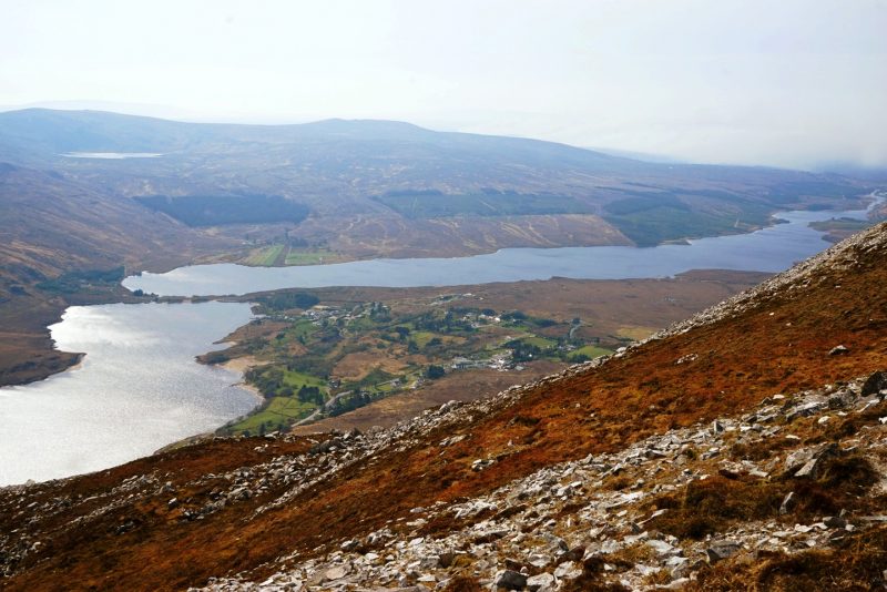
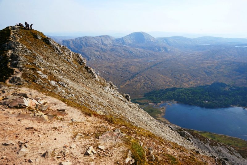
Dunlewy Lough and Lough Nacung Upper appeared precipitously far below /
Les lacs Dunlewy Lough et Lough Nacung Upper apparurent loin, très loin en contrebas.
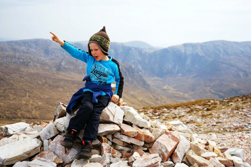
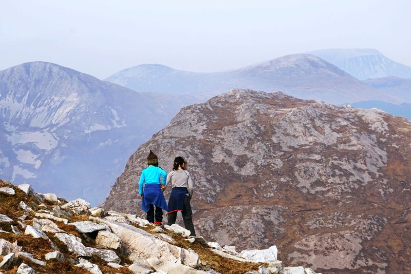
Mermaid was the first to reach the top of Errigal. Unsurprisingly, the summit of a somewhat conical mountain doesn’t offer vast amounts of space, especially on a busy, sunny day. So as soon as the second apex was free, we made a beeline for it.
Sirène atteignit le sommet de Errigal la première. Sans surprise, le sommet d’une montagne plus ou conique n’offre qu’un espace restreint, notamment par une belle journée ensoleillée. Aussi, avons nous rallié le deuxième sommet dès qu’il fut disponible.
Mermaid was the first to top Errigal, closely followed by Jedi /
Sirène atteignit le sommet la première, suivie de près par Jedi.
Making a beeline for Errigal’s second summit /
En route pour le second sommet de Errigal.
Errigal’s top viewed from the second summit, with Dunlewy Lough and the Poisoned Glen down below /
Errigal vu du second sommet, avec Dunlewy Lough et Poisoned Glen en contrebas.
Sitting on the thin grass and sharp rocks of Errigal, we finally could take in the breathtaking views – the breeze, a gentle caress on our faces, the views, an irresistible invitation to simply be.
Time seemed to slow down a little.
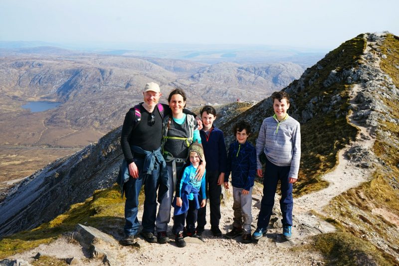
Just the six of us, sitting in the sunshine at the top of Donegal. Chatting, laughing, savouring the moment – bliss.
Assis sur l’herbe maigre et les cailloux saillants de Errigal, nous avons enfin pu apprécier la vue époustouflante. La brise, une douce caresse sur nos visages ; la vue, une invitation irrésistible à simplement être.
Le temps sembla ralentir sa course.
Juste nous six, assis au soleil au sommet de Donegal. Bavardant, riant, savourant le moment : bonheur.
Learning to whistle /
On apprend à siffler.
We were lucky with the weather.
As we trudged back down the mountain, light clouds dimmed the sun for a while. The smoke of the wildfire hovered over the entire landscape, but the summit of Errigal.
Those 10 minutes to ourselves at the top, suspended between sky and ocean, felt all the more precious, like a moment stolen from both weather and misfortune. The highlight of an unforgettable day.
A day well spent adventuring on majestic Errigal, in the awe-inspiring northwest of Ireland.
La météo était de notre côté.
Comme nous rescendions prudemment, des nuages estompèrent le soleil pendant un moment. La fumée du feu de forêt flottait sur tout le paysage, à l’exception de la pointe de Errigal.
Ces dix minutes de solitude partagée au sommet, suspendues entre ciel et océan, parurent d’autant plus précieuses. Un moment volé à la météo et à la déveine. Le temps fort d’une journée inoubliable.
Une journée passée à explorer le majestueux Errigal, dans le grandiose nord-ouest de l’Irlande.
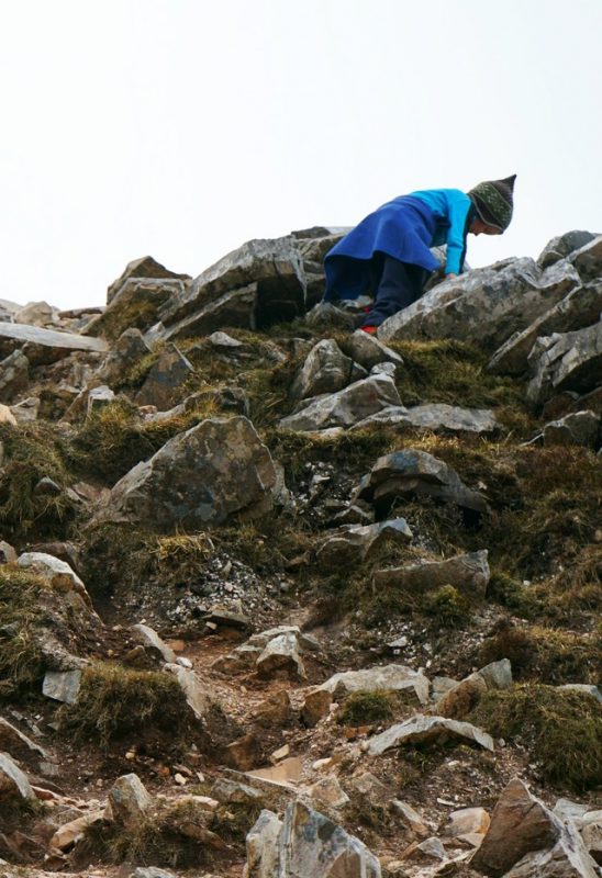
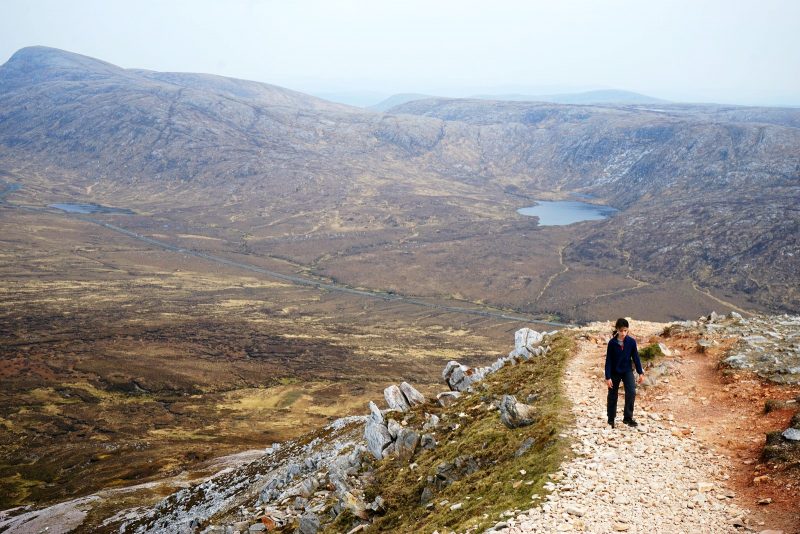
The knee-buckling, ankle-twisting descent begins /
La descente à tordre les genoux commence.
More on Errigal
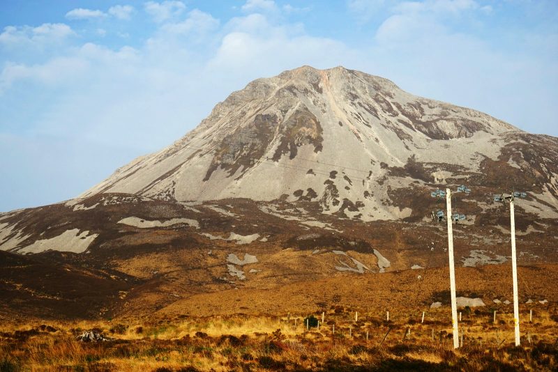
Errigal is the tallest peak of the Derryveagh Mountains and the tallest peak in Co Donegal. It is also the most southern, steepest and highest of the mountain chain, called the Seven Sisters – Muckish, Crocknalaragagh, Aghla Beg, Ardloughnabrackbaddy, Aghla More, Mackoght (also known as Little Errigal or Wee Errigal, an Earagail Bheag in Irish) and Errigal.
Errigal is well known for the pinkish glow of its quartzite in the setting sun.
Quartzite is a former sandstone changed by intense heat and enormous pressure, i.e. tectonic activity. Since it is a very hard rock it resists weathering and forms impressive pointy mountains like the Sugar Loaf in Wicklow, Croagh Patrick in Mayo, Errigal in Donegal and the Twelve Bens in Connemara.
Errigal’s name comes from the Latin orare (to pray) and the Greek ekklesia (church). It is considered one of the oldest placenames in Ireland.
Yet in 2016, Ireland’s national tourism authority, Fáilte Ireland, erroneously referred to it as Mount Errigal in its widely circulated brochures – a glaring mistake it apologised for. The official name is An Earagail or Errigal.
Errigal viewed from the service station at Money Beg, where we stopped for a well-deserved ice-cream after completed the hike /
Errigal vu de la station service de Money Beg, où nous avons mangé une glace bien méritée après la randonnée.
En savoir plus
Errigal est le point culminant des montagnes de Derryveagh et du comté de Donegal. Il est aussi le plus méridionnal, le plus abrupt et le plus haut de la chaîne dite des Seven Sisters (“sept sœurs”) : Muckish, Crocknalaragagh, Aghla Beg, Ardloughnabrackbaddy, Aghla More, Mackoght (ou Petit Errigal, an Earagail Bheag en gaëlique) et Errigal.
Errigal est bien connu pour la couleur rose que prend son quartzite au soleil couchant.
Le quartzite est une roche métamorphique, un ancien calcaire transformé par la chaleur intense et l’énorme pression de l’activité tectonique. Très dur, il résiste si bien à l’érosion qu’il finit par former des montagnes coniques comme le Sugar Loaf de Wicklow, Croagh Patrick (Mayo), Errigal en Donegal et les Douze Bens du Connemara.
Le nom Errigal provient du latin orare (“prier”) et du grec ekklesia (“église”). C’est un des toponymes les plus anciens d’Irlande.
Malgré tout, en 2016, l’office de tourisme national Fáilte Ireland l’a erronément appelé Mont Errigal dans ses brochures touristiques largement diffusées – une erreur flagrante pour laquelle Fáilte Ireland a dû présenter des excuses. Le nom officiel est An Earagail ou Errigal.
Disclosure: This post contains some affiliate links. Should you choose to make a purchase after clicking on one of them, I may receive a small commission and your purchase will help support this site.
Avertissement : Cet article contient des liens partenaires. Si vous décidez d’effectuer un achat après avoir cliqué sur l’un d’eux, je recevrai une commission qui contribuera à soutenir ce site.


Related / Similaire
- 7 tips for hiking with kids / 7 conseils pour la randonnée en famille
- Malin Head feels the force of Star Wars / Malin Head sent passer la force de Star Wars
- Wild on Doagh Isle / La plage de Doagh à l’état sauvage
- Hiking the Slieve League cliffs / Randonnée sur les falaises de Slieve League
- Romantic stay in an Irish lighthouse / Weekend romantique dans un phare irlandais
- A guided family hike in the Mournes / Randonnée guidée dans les Mournes
 Previous Post
 Next Post
Looks absolutely stunning and fairplay to you young ones – it’s not the easiest of walks – you obviously hit the jackpot weatherwise 🙂