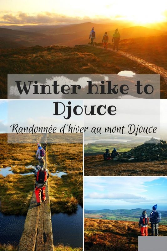
Winter hike to Djouce Mountain / Randonnée d’hiver au mont Djouce
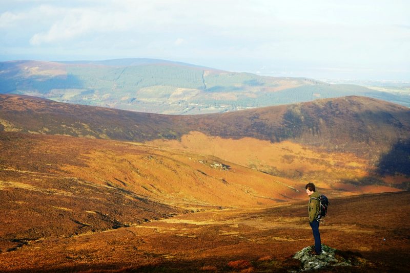
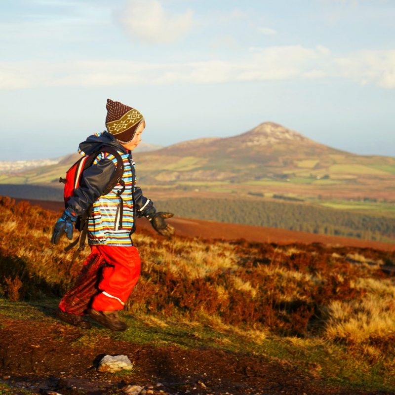
Walking into 2020… Our first family hike of the year took us to Djouce Mountain (725m/2,379ft), Co Wicklow.
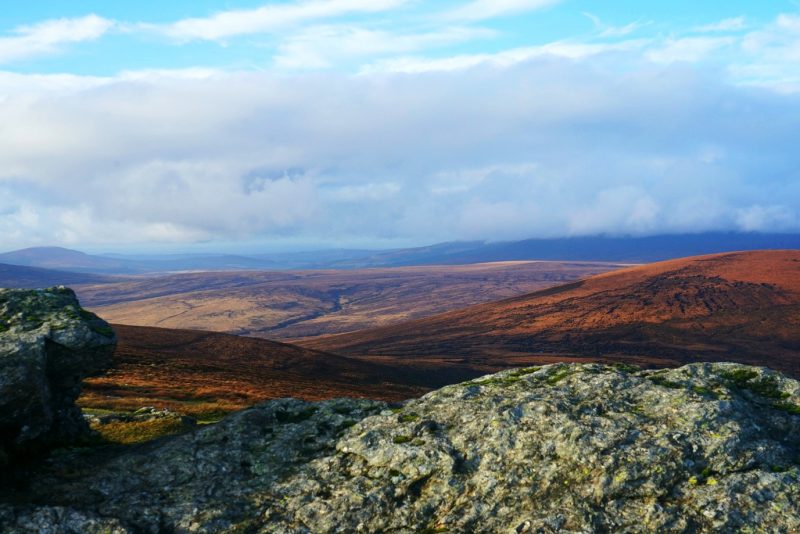
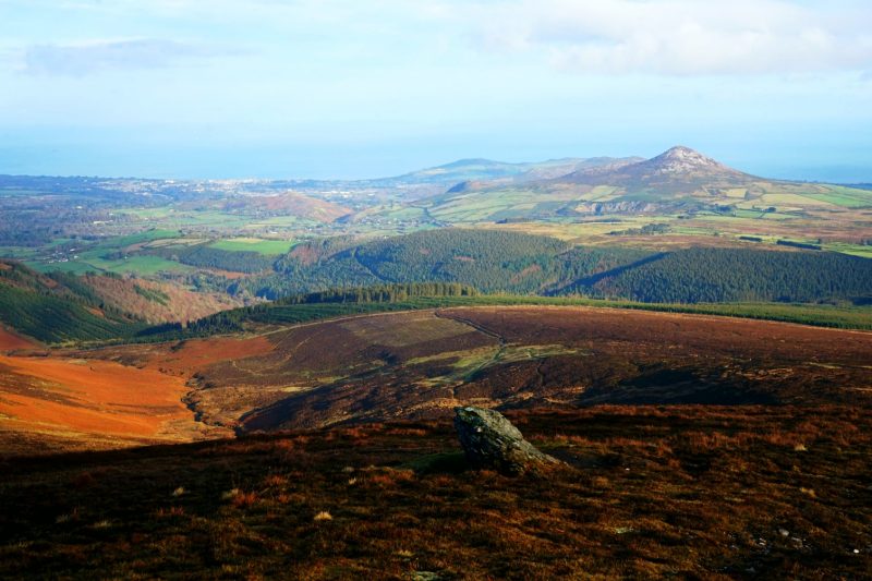
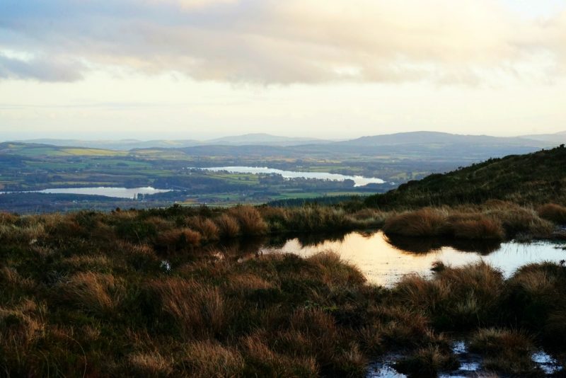
Djouce is one of the most accessible hikes in the county, with breathtaking views all along over Luggala and the Guinness Lake, but also the Vartry Lakes, the Great Sugar Loaf and the Irish Sea in the distance. Yet we hadn’t walked the full route in over four years – at the time, Pebbles was still carried in the sling, and the mist was so dense that the views were but inexistent.
Premiers kilomètres à pied de 2020… Notre première randonnée familiale de l’année nous a emmenés au sommet du mont Djouce (alt. 725 m), Co Wicklow.
Le sentier de Djouce, une des randos les plus accessibles du comté, offre une vue imprenable sur Luggala et le lac Guinness, mais aussi sur les lacs de Vartry, le Great Sugar Loaf et la mer d’Irlande au loin. Il y avait pourtant plus de quatre ans que nous ne l’avions pas faite. A l’époque, Caillou était encore dans l’écharpe porte-bébé, et la brume était si dense que la vue était inexistante.
Our first hike to Djouce was in 2015 /
Notre première rando au mont Djouce remonte à 2015.
Two years ago, another attempt on Djouce unexpectedly turned into an unforgettable ice-breaking hike in a winter wonderland of ice and frost.
Il y a deux ans, une autre tentative hivernale s’était soldée, contre toute attente, en une randonnée brise-glace dans un paradis blanc de neige et de givre.
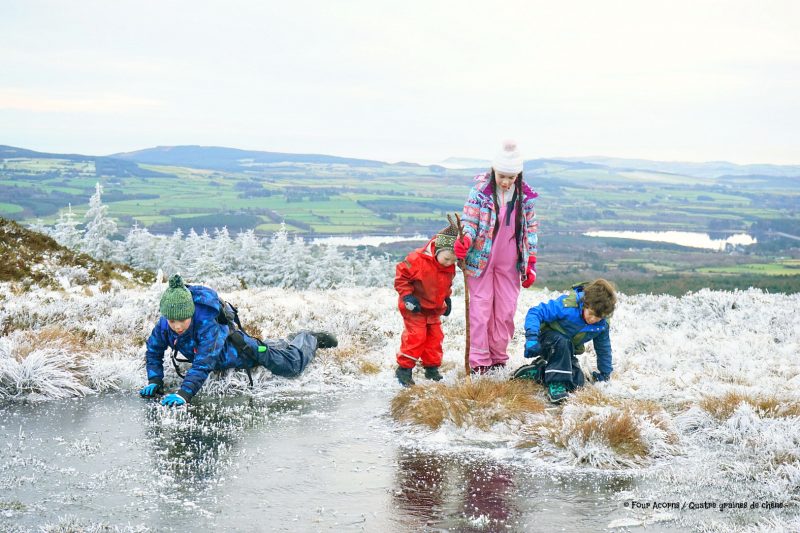
Two years ago, Djouce briefly looked like a winter wonderland of frosty heather and frozen bog pools / Il y a deux ans, Djouce fut brièvement transformé en paradis blanc.
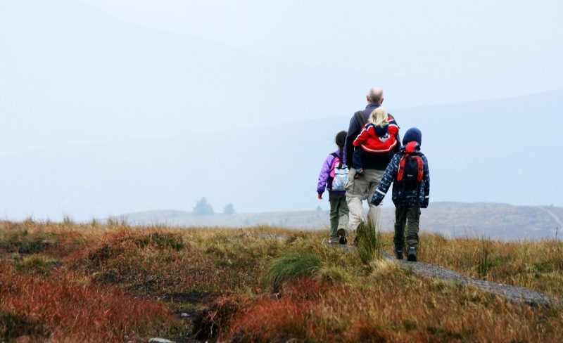
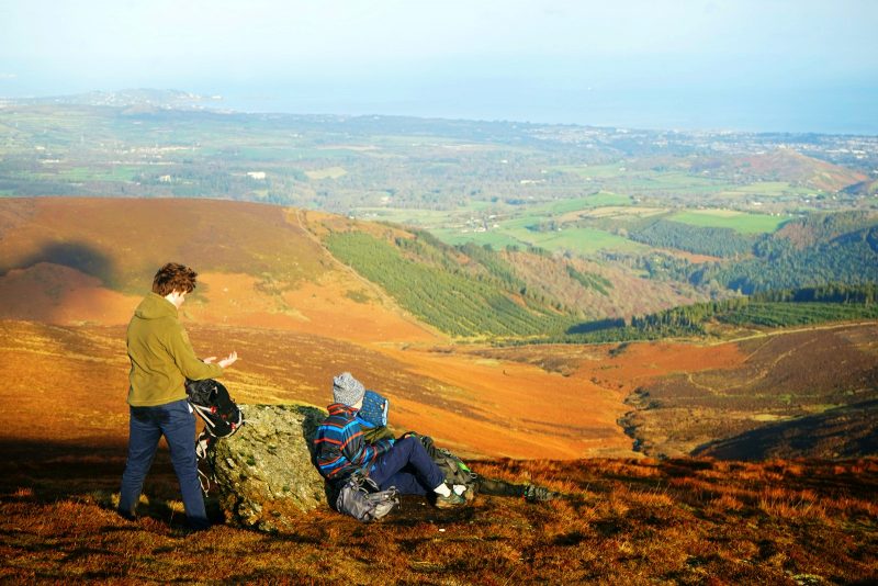
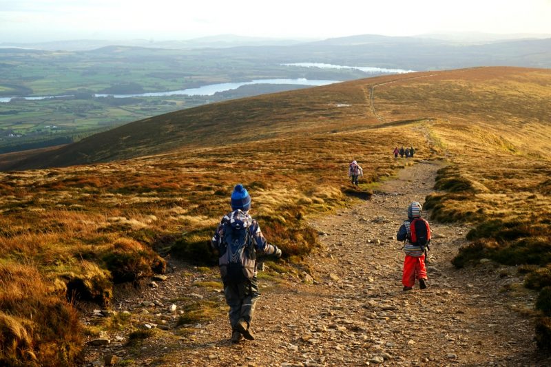
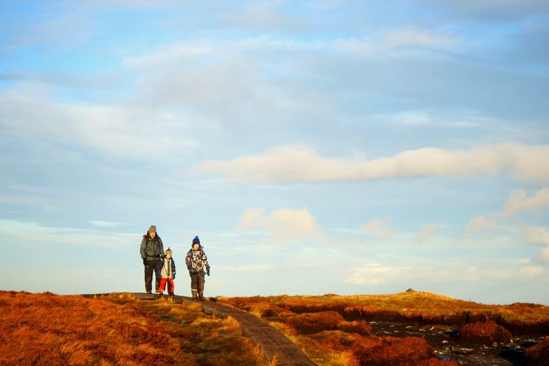
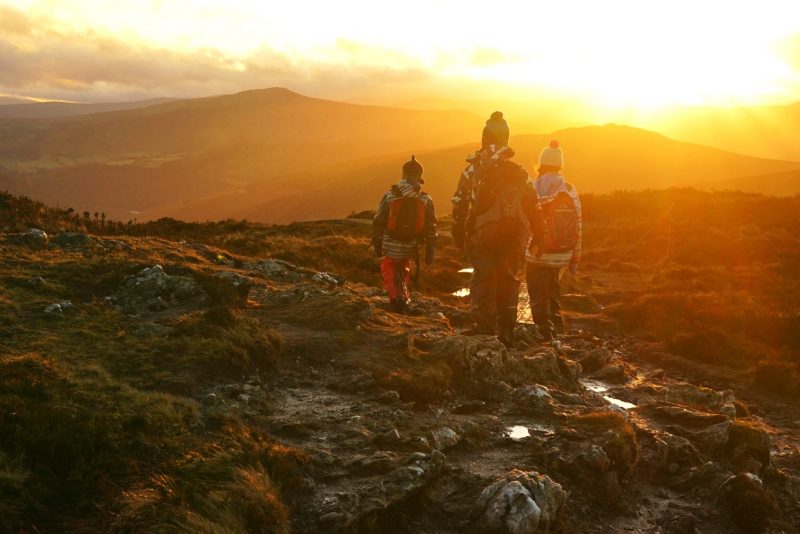
This time, we walked to Djouce with our friend Mary Ann and her two sons, long time friends of Jedi’s. Without frozen pools or penguin slides to improvise, the hike to Djouce felt shorter and easier than expected. Whether it is a sign of our memories failing, or of the children getting older and fitter, I don’t know!
Cette fois, nous sommes partis avec notre amie Mary Ann et ses deux fils, copains d’enfance de Jedi. Sans trous d’eau gelés ni glissade de pingouin à improviser, la randonnée au mont Djouce nous parut plus courte et plus facile qu’anticipé. Reste à savoir si notre mémoire nous joue des tours, ou si c’est parce que les enfants avancent plus vite, maintenant qu’ils sont plus grands !
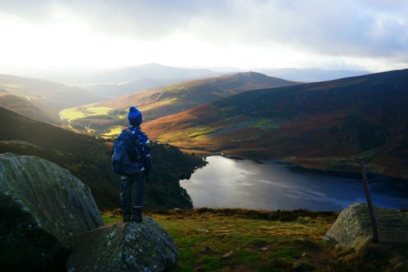
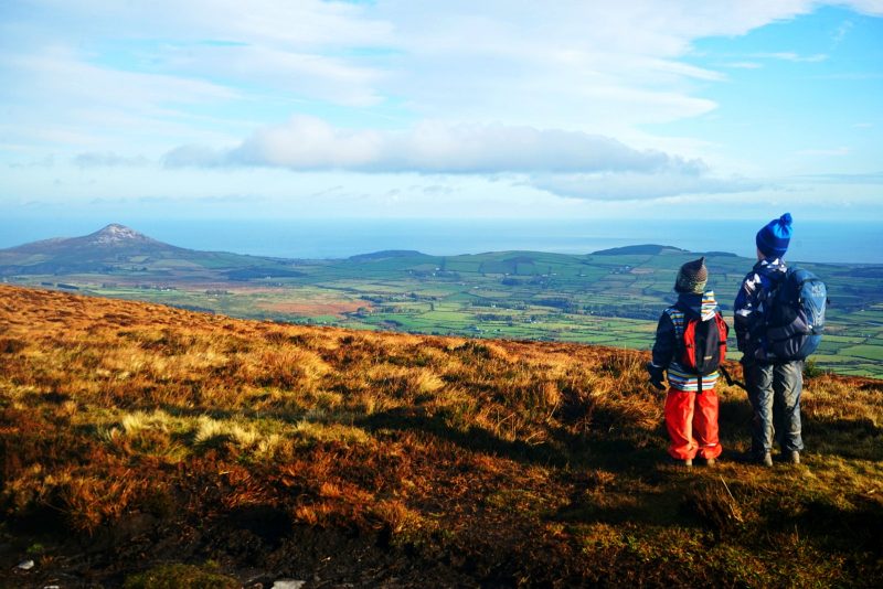
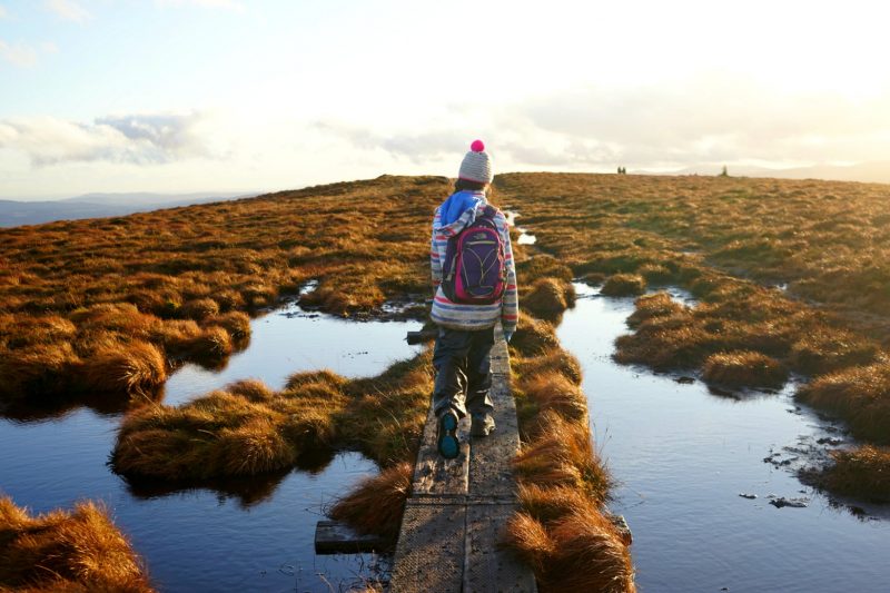
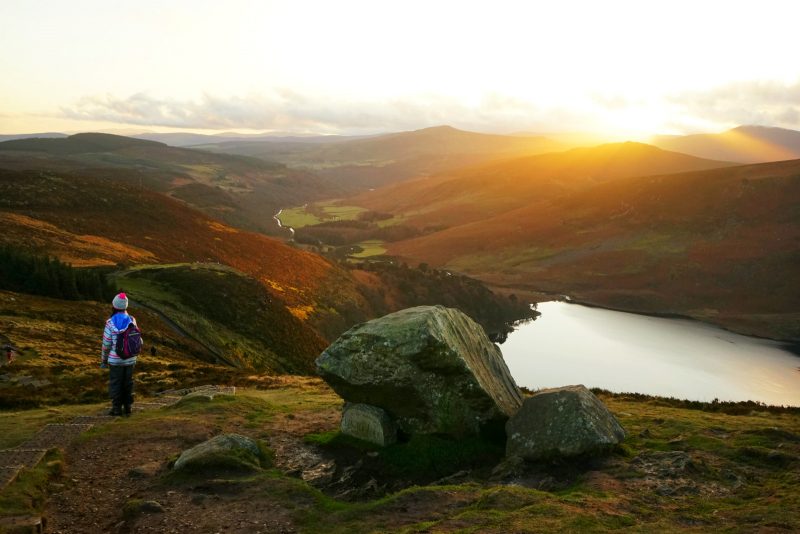
Admiring the Great Sugar Loaf in the distance, which the acorns had scaled only a week prior /
Vue sur le Great Sugar Loaf, que les graines de chêne avaient gravi une semaine auparavant.
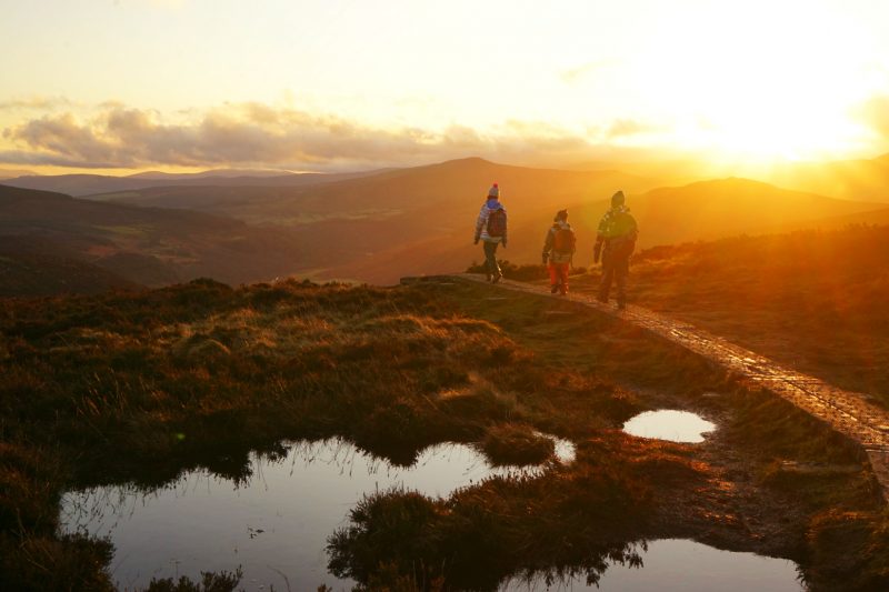
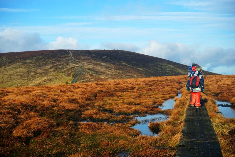
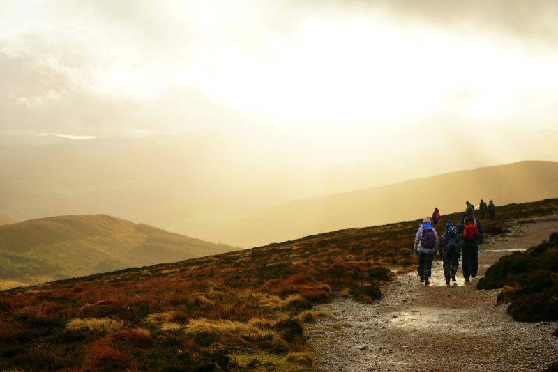
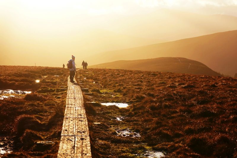
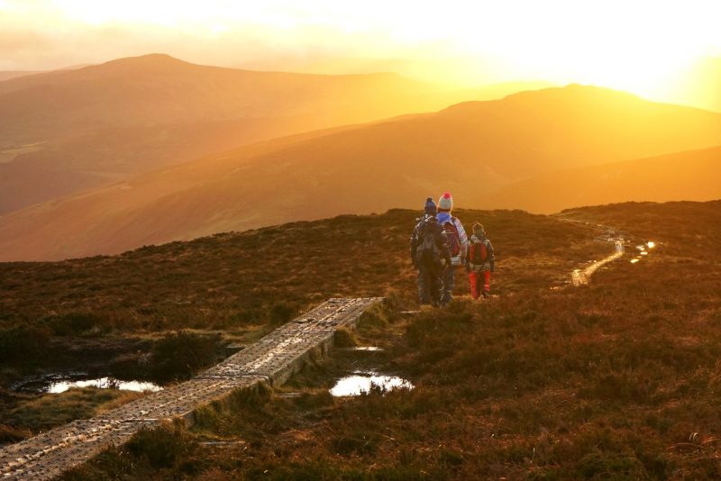
This time, the views were clear but the wind was constant, hissing around our ears and nearly blowing us off the boardwalk.
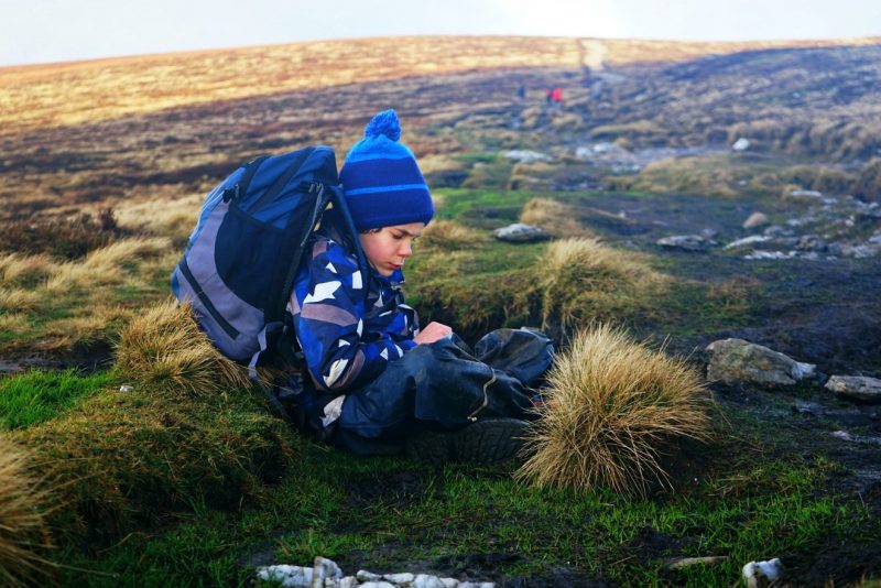
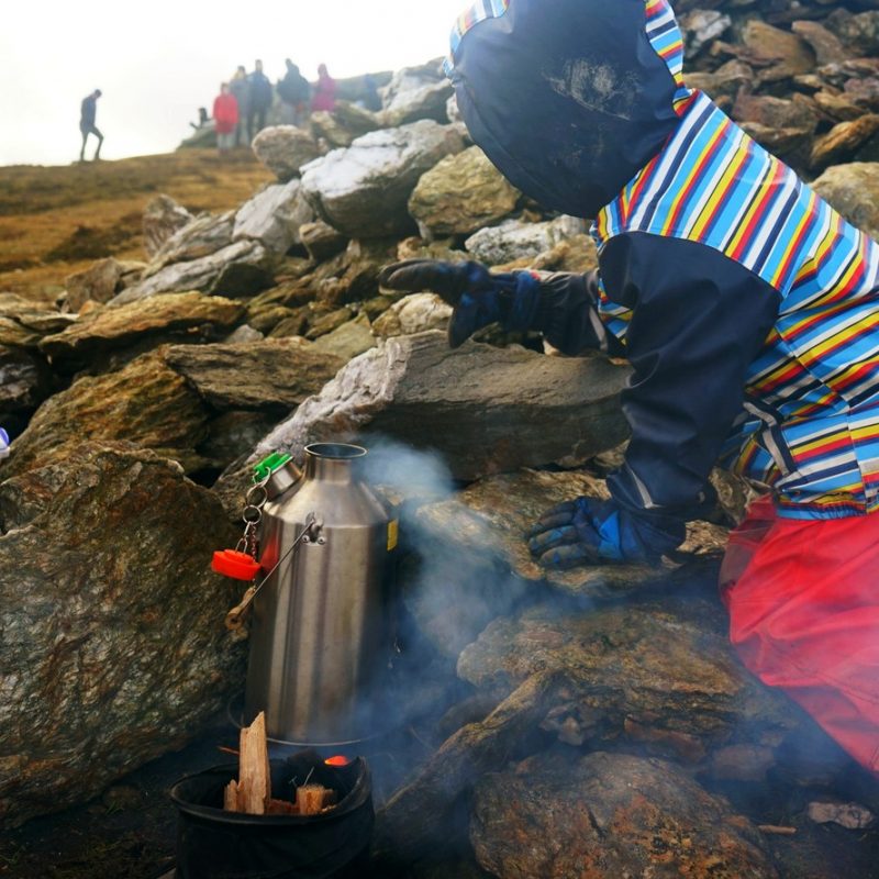
Boy did we get cold in the sub-zero windchill! At the summit of Djouce, the obligatory bowl of trailside noodles, cooked with our trusty Kelly kettle (affiliate link), never felt so warming.
Cette fois, le panorama était clair mais le vent soufflait sans relâche, sifflant à nos oreilles et menaçant de nous faire tomber du trottoir de planches.
Qu’est-ce qu’il faisait froid au sommet ! A cause du vent glacial, la température ressentie était certainement inférieure à zéro. Notre traditionnel bol de nouilles instantanées, préparées bien sûr avec la Kelly kettle, a rarement été aussi revigorant.
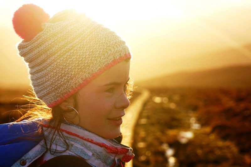
Huddling on the trail to keep from the icy wind /
Recroquevillé dans une ornière pour se protéger du vent glacial.
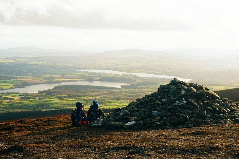
View over the Great Sugar Loaf and the Irish Sea from the summit of Djouce /
Le Great Sugar Loaf et la mer d’Irlande vus du sommet de Djouce.
Boy did we get cold in the sub-zero windchill! /
A cause du vent, la température ressentie au sommet était inférieure à zéro.
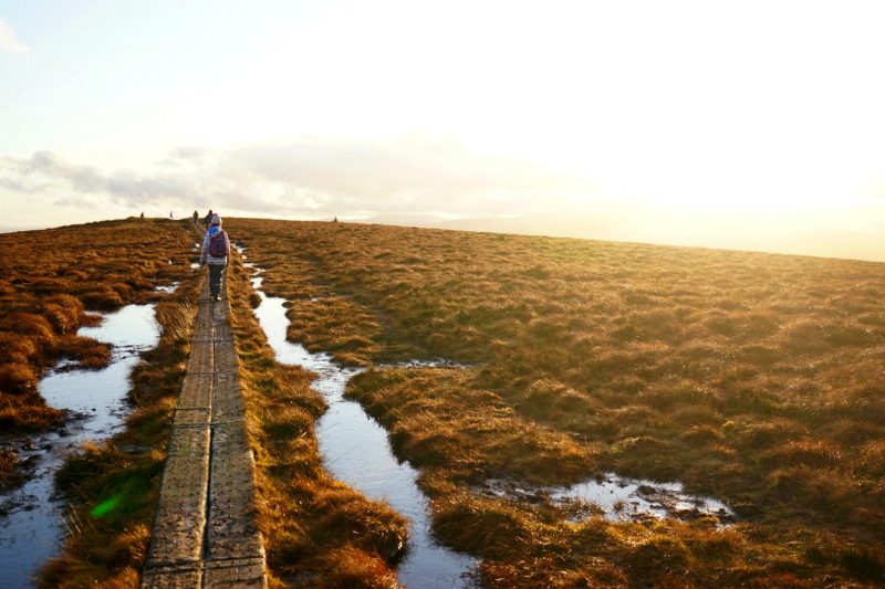
But this time, all day, the winter sun played with the clouds in the most spectacular light show.
Streaking through the clouds in radiant beams of light;
Tinting the late afternoon mist a dusky shade of pink;
Painting the usually dark waters of Lough Tay in splashes of peach and orange under the sunset sky.
Mais cette fois, le soleil d’hiver jouait avec les nuages, toute la journée, pour produire un sublime spectacle d’illuminations.
Rayonnant entre les nuages en faisceaux lumineux constamment renouvelés ;
Illuminant la brume de fin d’après-midi d’une douce teinte rose ;
Dessinant sur les eaux sombres de Lough Tay des taches orangées sous le ciel du crépuscule.

It might have been cold, but I can’t think of a better way to spend our first ever self-imposed “no screen day”!
Certes, il a fait froid, mais y a-t-il meilleure façon de passer notre première “journée sans écran”?
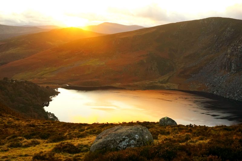
Lough Tay, a.k.a. the Guinness Lake, glows under the winter sunset sky /
Lough Tay, surnommé le lac Guinness, illuminé par le soleil couchant.
A degraded landscape
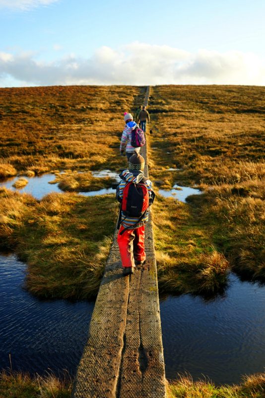
For most of this hiking route to Djouce, a boardwalk made of railway sleepers climbs and twists its way towards the barren summit, in an effort by the National Parks and Wildlife Service (NPWS) to protect the blanket bog from further erosion by trampling.
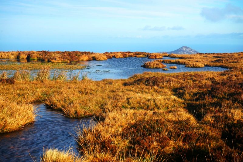
Heavy rain and high winds on those forbiddingly exposed mountain tops have worn out the thick cloak of soft dark peat, leaving behind countless bog pools and stretches of bare gravel. A result of the historic deforestation of Ireland, the relentless degradation of the Wicklow uplands is further exacerbated by trampling, sheep overgrazing and periodic burning.
In his 2016 book Whittled Away – Ireland’s Vanishing nature (affiliate link), Pádraig Fogarty writes about the continued deterioration and downright neglect of supposedly protected habitats in the Wicklow Mountains.
Peat, the characteristic soil of the uplands, has, in most places, stopped growing and is eroding; a consequence of a changing climate, burning, turf-cutting, recreational pressure and over-grazing.
If, as outdoor enthusiasts, we can do little to mitigate the ill-effects of hill farming on Wicklow’s landscapes, we can at least make sure we do no further harm.
Travel and camp on durable ground
With one access route starting near the iconic “Guinness Lake”, Djouce attracts ever-increasing numbers of recreational users and hill-walkers. But as it is located within the boundaries of the Wicklow Mountains National Park, “people enjoying the area must remember that the primary purpose of the National Park is the conservation of wildlife, habitats and landscape.”
In this age of climate & biodiversity emergency, it is more important than ever to strictly follow the principles of Leave No Trace, in this case, “travel and camp on durable ground”.
Un paysage en détérioration
L’essentiel de la randonnée au mont Djouce consiste en un trottoir fait de traverses de chemin de fer, afin de protéger la tourbe de l’érosion par piétinement.
Les précipitations et les vents violents sur les sommets exposés de Wicklow ont progressivement érodé l’épaisse couche naturelle de tourbe, qui cède le pas à des trous d’eau et autres étendues de gravier où rien ne pousse. Séquelle de la déforestation historique de l’Irlande, cette détérioration continue est exacerbée par le piétinement, le surpâturage des moutons et le brûlage incontrôlé.
Dans un ouvrage publié en 2016 sur le triste état de la nature d’Irlande, l’auteur Pádraig Fogarty fait état de la dégradation avancée d’habitats soit-disant protégés par le Parc national des Monts de Wicklow.
La tourbe, sol caractéristique des hauteurs, a, pour la plupart, cessé de pousser et s’érode, conséquence de conditions climatiques changeantes, du brûlage, de l’exploitation de la tourbe, de la pression due aux activités de loisirs et du surpâturage.
Si, en tant qu’amateurs de plein air, nous ne pouvons pas faire grand’chose pour atténuer les effets nocifs de l’élevage de montagne, il nous faut au moins faire en sorte de ne pas aggraver la situation.
Sans Traces – Utilisez les surfaces durables
Avec un sentier démarrant au-dessus de l’ionique lac Guinness, le mont Djouce attire un nombre croissant de visiteurs et randonneurs. Etant donné que Djouce fait partie du Parc national des Monts de Wicklow, n’oublions pas que “l’objectif principal du parc national est la conservation de la faune, des habitats et des paysages”.
A cette époque d’urgence climatique, il faut, plus que jamais, appliquer strictement les principes de Sans Traces – dans ce cas précis, “Utilisez les surfaces durables”.
Getting there
Travelling northbound (Dublin) on the N11, take Exit 8 (Kilmacanogue), then the first exit on the roundabout, signposted for Roundwood and Glendalough (R755). At the next roundabout, take the second exit and continue straight ahead on the R755.
Travelling southbound (Wexford) on the N11, take Exit 8 (Kilmacanogue), immediately after the Topaz petrol station, following signposts to Roundwood and Glendalough (R755). At the roundabout, take the last exit, to Kilmacanogue and Roundwood (R755). At the next roundabout, take the first exit for the R755.
Follow the R755 for 11km, then turn right onto the R759, signposted for Sally Gap. Drive 4.5km up this road to the J.B. Malone car park on the wayside.
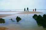
Walk across the road for a plunging view over Lough Tay. Alternatively, start walking through the trees behind the car park to catch the boardwalk trail to Djouce.
S’y rendre
Circulant en direction du nord (Dublin) sur la N11, prenez la sortie 8 (Kilmacanogue) puis, au rond-point, la première sortie, en direction de Roundwood et Glendalough (R755). Au deuxième rond-point, prenez la deuxième sortie et continuez tout droit sur la R755.
Circulant en direction du sud (Wexford) sur la N11, prenez la sortie 8 (Kilmacanogue), tout de suite après la station service Topaz, et suivez les panneaux indiquant Roundwood et Glendalough (R755). Au rond-point, prenez la dernière sortie pour Roundwood et Glendalough (R755). Au rond-point suivant, prenez la première sortie pour la R755.
Continuez sur la R755 pendant 11 km, puis tournez à droite sur la R759, indiquant Sally Gap. Continuez sur cette route pendant 4,5 km jusqu’au parking J.B. Malone, en bord de route.
De là, traversez la route pour une vue plongeante sur Lough Tay en contrebas. Ou traversez la pinède au dos du parking pour rejoindre le trottoir en planches qui monte à Djouce.
Related / Similaire
- Luggala – Walk to the cliff side / Randonnée côté falaise
- Lough Dan – Walk to the lake side / Randonnée côté lac
- A deserted village in a deserted forest / Un village abandonné dans un désert forestier
- An ice-breaking hike to Djouce Mountain / Randonnée brise-glace au mont Djouce
- 7 tips for hiking with kids / 7 conseil pour la randonnée en famille
Disclosure: This post contains some affiliate links. Should you choose to make a purchase after clicking on one of them, I may receive a small commission and your purchase will help support this site.
Avertissement : Cet article contient des liens partenaires. Si vous décidez d’effectuer un achat après avoir cliqué sur l’un d’eux, je recevrai une commission qui contribuera à soutenir ce site.


 Previous Post
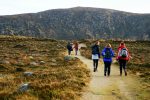 Next Post
How long is the hike?
The hike to Djouce from the JB Malone carpark is 1.30-2 hours – longer if you have children with you. Hope this helps.