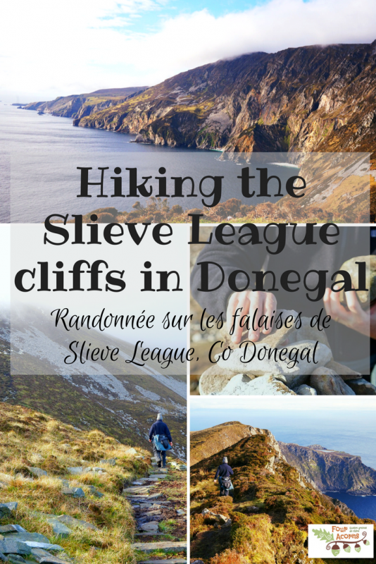
Hiking the Slieve League cliffs / Randonnée sur les falaises de Slieve League
Last April, Brian and I hiked together the highest sea cliffs in Europe – Slieve League, Co Donegal.
You may remember that I had won a two-night stay at St. John’s Point lighthouse, Co Donegal, in a giveaway by the Irish Landmark Trust. This was our first romantic (read, child-free) weekend in well over 10 years.
It is a long way to St. John’s Point lighthouse. Turning off the N56 shortly after the village of Dunkineely, the narrow, bumpy road winds its pot-holed way along the thin finger-shaped peninsula, stretching out into the Atlantic Ocean, to the lighthouse at the very bottom.
On Saturday morning, after our first night at the lighthouse, we took the long road back to the N56 and headed further west still, to the Slieve League cliffs.
The plan was to hike up the cliffs from the viewing point known as Bunglas, and hopefully as far as the infamous One Man’s Pass.
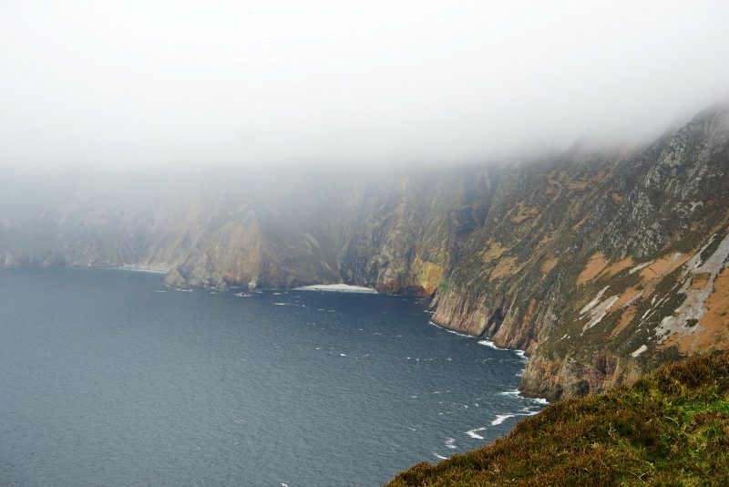
But the cliffs were engulfed in mist. Anxiously checking the weather forecast on Brian’s phone, we waited in the car for 15 minutes as a heavy downpour blew in from the ocean.
With the cloud cover showing no sign of clearing up, we sadly decided to turn back and go for a drive, vaguely hoping to try again later in the day.
En avril dernier, Brian et moi avons gravi la deuxième falaise la plus haute d’Europe : Slieve League, Co Donegal.
Vous vous souvenez peut-être que j’avais gagné un séjour de deux nuits au phare de St. John’s Point, lors d’un concours organisé par l’Irish Landmark Trust. C’était notre premier weekend en amoureux depuis plus de dix ans.
La route est longue pour arriver au phare de St. John’s Point, ou phare de Killybegs, comme il était naguère connu. Quittant la N56 peu après le village de Dunkineely, la route étroite et cahoteuse serpente tout au long de la péninsule effilée, de dos d’âne en nid-de-poule avec l’Atlantique de part et d’autre, jusqu’au phare à son extrémité.
Le samedi matin, après notre première nuit au phare, nous avons repris la longue route jusqu’à la N56 et poursuivi plus à l’ouest encore, jusqu’aux falaises de Slieve League.
L’idée était de partir du point de vue de Bunglas pour effectuer la randonnée des falaises et, avec un peu de chance, jusqu’au fameux col One Man’s Pass, ainsi nommé parce qu’il est si étroit qu’il faut y passer en file indienne.
Mais les falaises étaient englouties par les nuages. Tout en consultant la météo du jour sur le téléphone de Brian, nous avons attendu 15 minutes dans la voiture qu’une forte averse venue de l’Atlantique s’abatte sur le site.
Comme le couvercle de nuages ne montrait aucun signe d’éclaircie, nous avons décidé, la mort dans l’âme, de repartir pour une balade en voiture. Peut-être que l’occasion se représenterait plus tard dans la journée ?
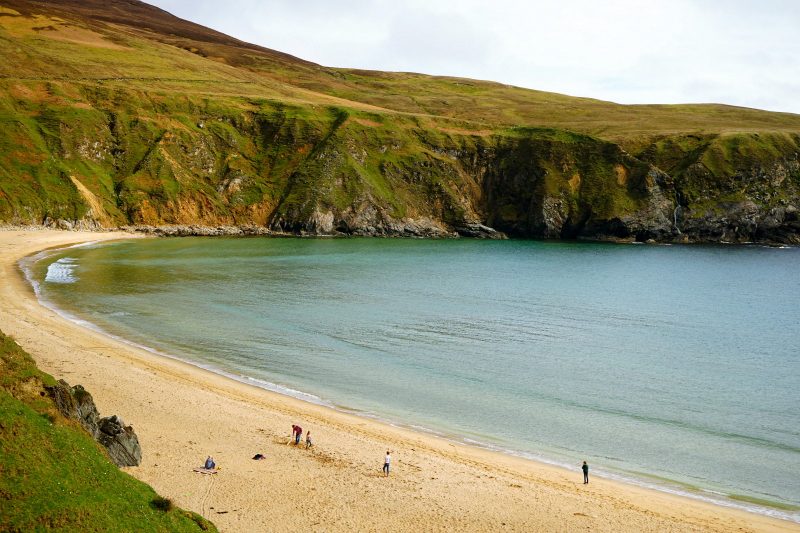
Continuing further west on Donegal’s Wild Atlantic Way, we ended up at the beautiful, crescent-shaped Malin Beg, just as the spring sunshine started to break through the clouds. I’ll publish more photos of this gem of a beach in a separate post.
Continuant toujours plus à l’ouest, sur le Wild Atlantic Way, nous avons atterri à la splendide plage de Malin Beg, juste comme le soleil printanier commençait à percer les nuages. Je publierai d’autres photos de ce bijou dans un article à part.
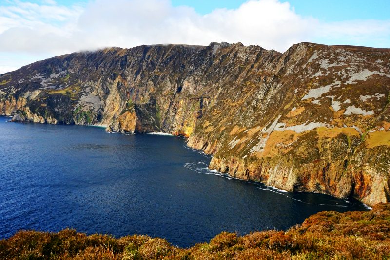
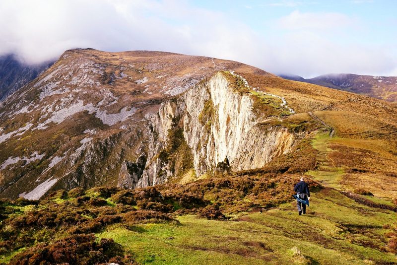
Following a relaxed mid-afternoon lunch in Glencolmcille’s An Chistin Café, we drove back to the Slieve League viewpoint at Bunglas to give the hike another go.
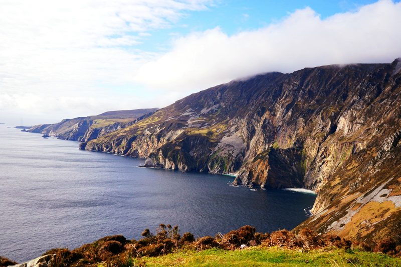
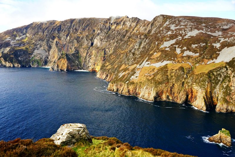
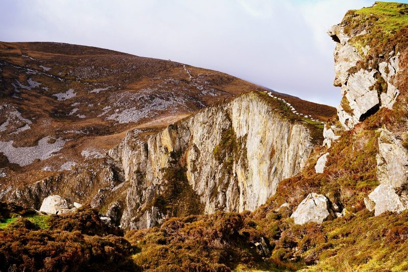
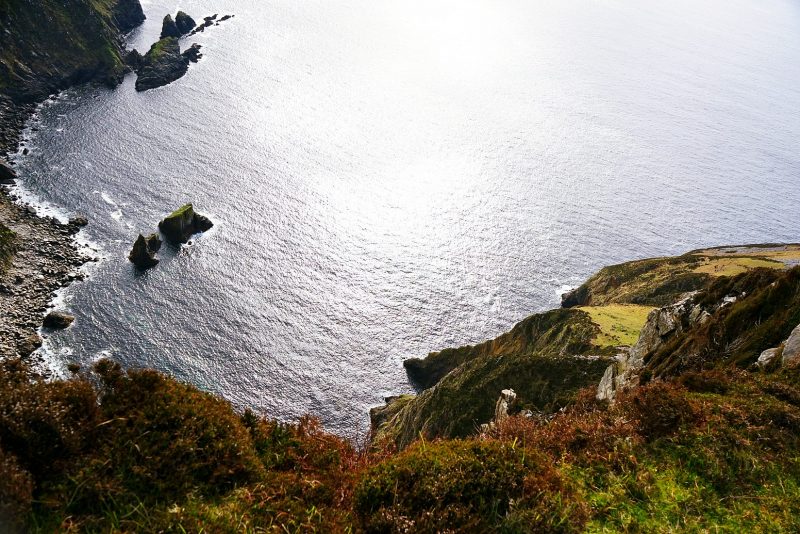
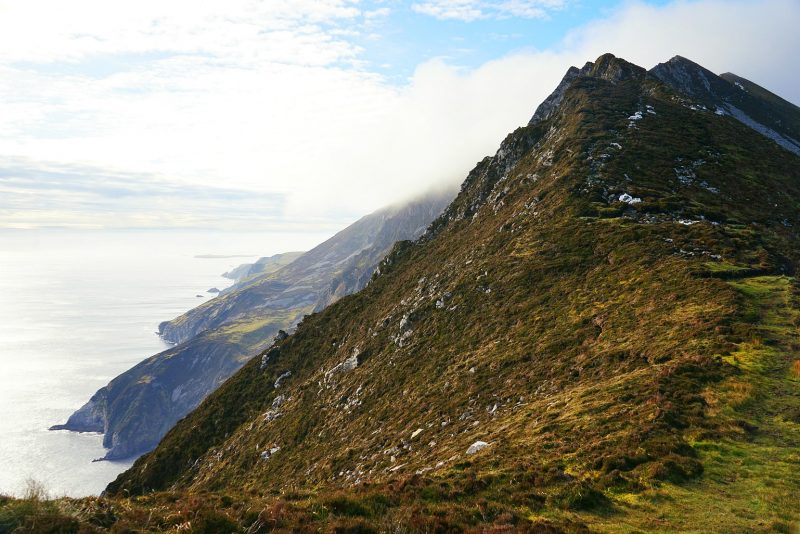
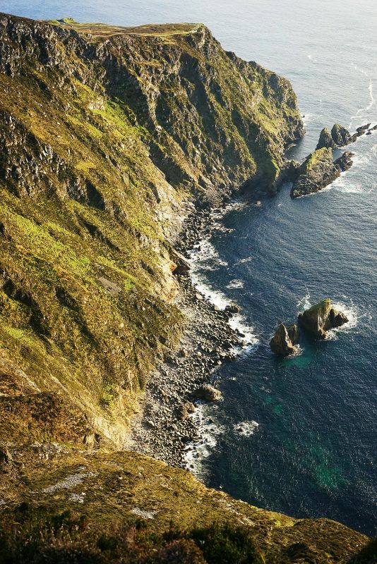
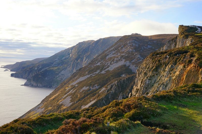
Slieve League (Sliabh Liag, in Irish) is a mountain whose southern side has been eroded by the wild Atlantic waves into a sheer drop 600 metres high (2,000ft). Although less famous than the cliffs of Moher, Co Clare, Slieve League reaches nearly three times higher.
It was 4pm when we set off and the sun was shining.
A la suite d’une pause casse-croûte au café An Chistin de Glencolmcille, nous sommes retournés au point de vue de Bunglas pour retenter notre chance.
Slieve League (Sliabh Liag, en gaélique) est une montagne dont la face sud a été érodée par l’océan jusqu’à former une falaise vertigineuse de 600 mètres de haut. Moins connue que les falaises de Moher, Co Clare, Slieve League s’élève pourtant presque trois fois plus haut.
Il était 16 heures et le soleil brillait.
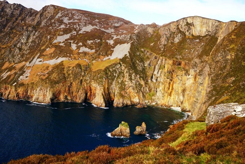
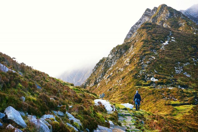
The Giant’s Table and Chair / La Table et la Chaise du Géant
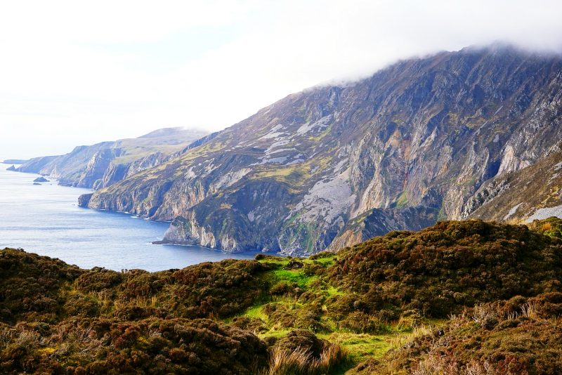
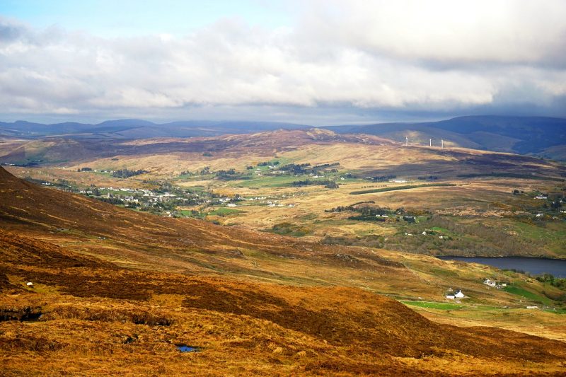
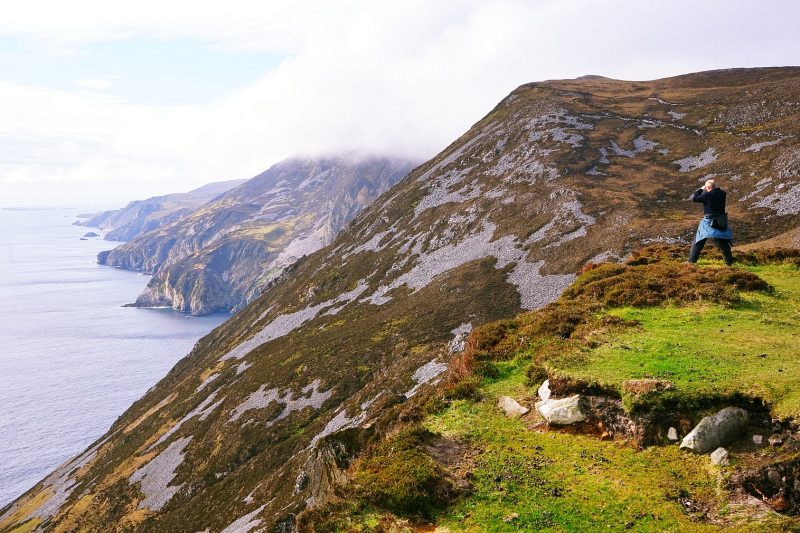
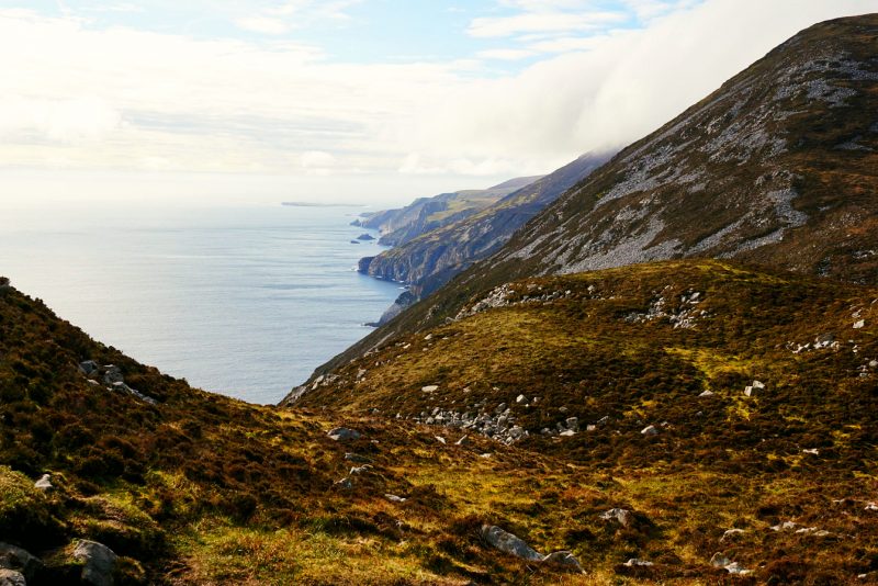
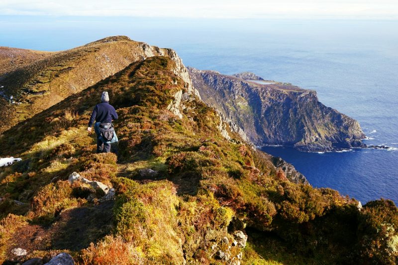
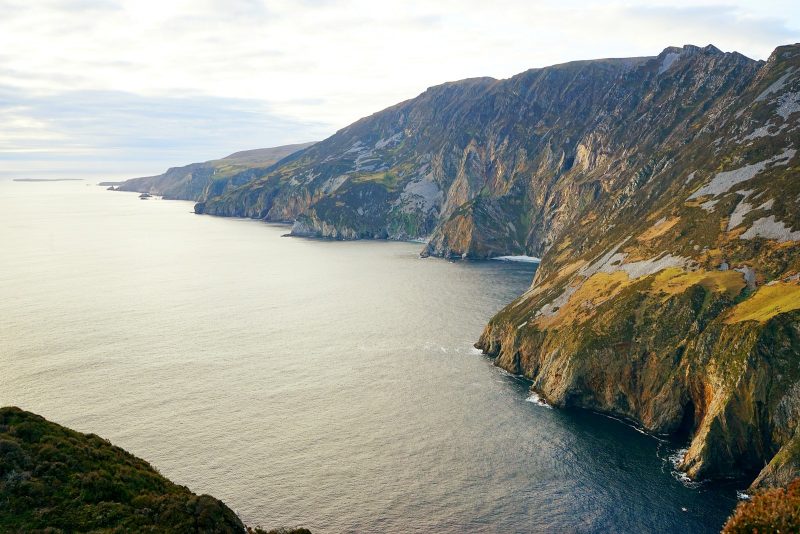
Following the well-beaten trail (lined with large white bags of stones for the ongoing restoration work), we trekked and we walked and we climbed, stopping often to catch our breath and to enjoy the stupendous views – on one side, the infinite waters of the Atlantic Ocean churning some 600 metres (2,000ft) below our feet, and on the other side, the undulating mountains of Slieve Tooey and the jagged coastline of Donegal Bay.
Ireland doesn’t get much more dizzyingly beautiful than that!
Suivant le sentier bien battu, marqué par de gros sacs blancs pleins de pierres pour les travaux de réparation, nous avons marché et gravi et grimpé, nous arrêtant souvent pour reprendre notre souffle et admirer la vue époustouflante. D’un côté, le bleu infini de l’Atlantique dont les vagues s’écrasaient quelque 600 mètres plus bas, et de l’autre, les sommets onduleux de Slieve Tooey et le littoral déchiqueté de la baie de Donegal.
L’Irlande d’une beauté à tourner la tête !
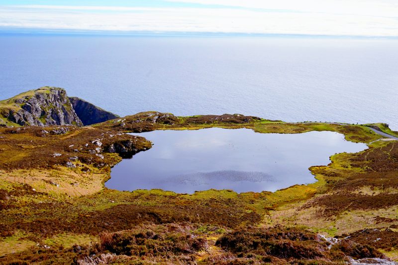
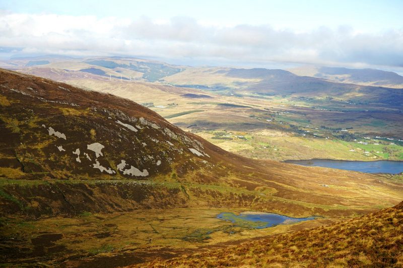
Lough O’Muilligan
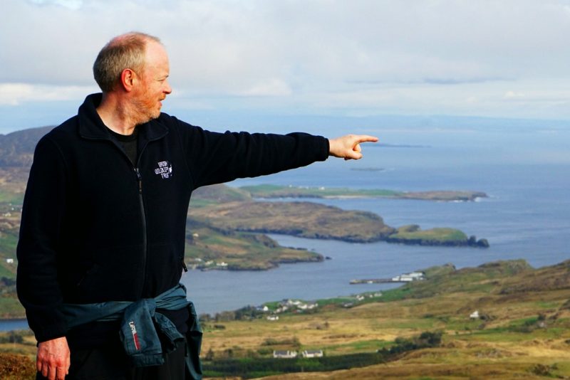
At the tip of Brian’s finger, St. John’s Point Lighthouse /
Au bout du doigt de Brian, le phare de St. John’s Point.
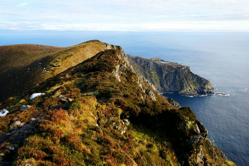
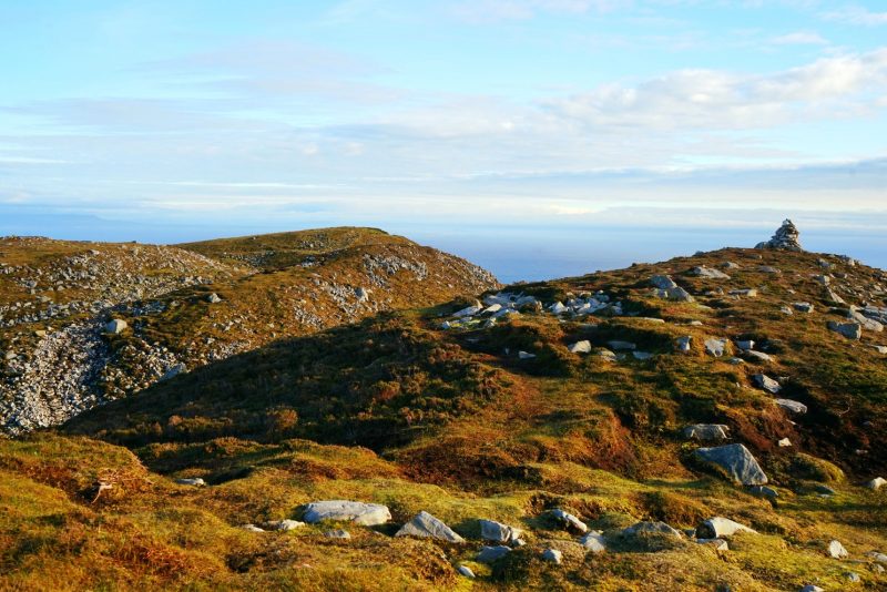
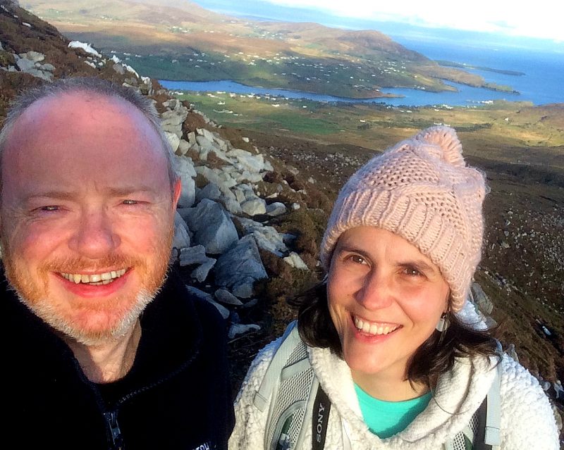
In the end, we reached the base of Slieve League itself (alt. 601m/1,972ft). The summit was still shrouded in wispy mist, and One Man’s Pass remained out of reach, much to my relief. Walking, or crawling rather, across a narrow ridge with a sheer drop on either side, may well be one step too far out of my comfort zone.
En fin de compte, nous sommes montés jusqu’au pied de Slieve League (alt. 601 mètres). Le sommet était encore voilé de brume, et le col One Man’s Pass demeurait hors d’atteinte. A mon grand soulagement. Traverser, à quatre pattes sans doute, une crête étroite flanquée de part et d’autre d’un précipice vertigineux, pousserait le bouchon un peu trop loin à mon goût.
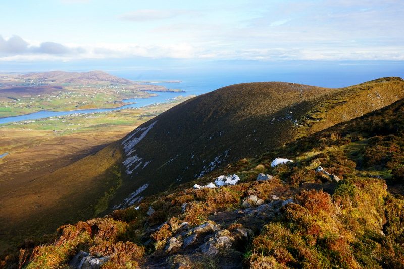
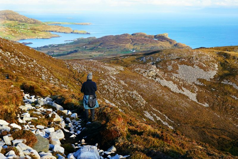
View from the base of Slieve League, with Lough O’Muilligan in the far distance /
Vue depuis le pied de Slieve League, avec Lough O’Muilligan au loin.
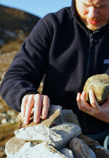
On the way down, Brian placed four stones, one for each of the acorns, on a small cairn marking the summit of Crockrawer (alt. 435m/1,427ft), or Cnoc Ramhar in Irish.
With the trail so close to the cliff edge, Slieve League is most definitely unsuitable for little legs. But one way to explore this stunning site with the acorns would be to go a boat tour, and see the soaring cliffs from the water.
A la descente, Brian plaça quatre pierres, une pour chaque graine de chêne, sur une petite stèle marquant le sommet de Crockrawer (alt. 435 m), ou Cnoc Ramhar en gaélique.
Avec le sentier si proche du précipice et en l’absence de garde-fous, la randonnée de Slieve League ne convient pas aux petites jambes. Mais il existe une façon d’explorer ce site extraordinaire avec les graines de chêne : en partant pour une visite guidée en bateau, pour voir les falaises vertigineuses depuis la mer.
![]()
Visitor information
Slieve League (Sliabh Liag in Irish) are known as the highest accessible sea cliffs in Europe, reaching a height of 1,972 feet/601 metres, which is almost twice as high as the Eiffel Tower in Paris and nearly three times the height of the famous Cliffs of Moher in Co Clare.
From the Bunglas viewpoint, you can walk to the highest point of the cliffs using the Pilgrims Path. However, this should only be undertaken by those with the correct walking equipment and boots (and with a strong head for heights!). It should never be attempted if there is any hint of fog or low clouds and children and dogs should never be taken up this path.
Getting there
The Slieve League cliffs can be found just outside Teelin, in Donegal Bay, 19km (12 miles) from Killybegs and a 1.5 hour drive from Donegal Town.
Take the N56 from Donegal Town to Killybegs, and then the R263 to Carrick. On arrival in Carrick, turn left in the middle of the village at the Sliabh Liag Lodge. Continue along this road for a distance of 5km to the Sliabh Liag Cliffs. There is a large car park with toilets at the start of the Slieve League Road, but it is possible to drive up the remaining 1.5km to the Bunglas viewpoint. Just make sure to close the farm gate behind your vehicle if you found it closed.
 En savoir plus
Slieve League (Sliabh Liag en gaélique) est la plus haute falaise maritime accessible d’Europe. A une altitude de 601 mètres, elle est deux fois plus haute que la Tour Eiffel et presque trois plus haute que les célèbres falaises de Moher, Co Clare.
Du point de vue de Bunglas, le point culminant des falaises est accessible à pied par le sentier des Pélerins (Pilgrims Path). C’est toutefois une option à réserver aux randonneurs correctement équipés et chaussés, et qui ne souffrent pas du vertige ! A éviter à tout prix par grand vent ou par brouillard et nuages bas. N’emmenez jamais ni enfants ni chiens sur ce sentier.
S’y rendre
Les falaises de Slieve League se trouvent près de Teelin, dans la baie de Donegal, à 19 km de Killybegs et une heure et demie de route de Donegal Town.
De Donegal Town, prenez la N56 jusqu’à Killybegs, puis la R263 jusqu’à Carrick. Au centre du village, tournez à gauche à l’hôtel-restaurant Sliabh Liag Lodge. Continuez sur cette route pendant 5 km environ jusqu’au falaises de Sliabh Liag. Il y a un grand parking équipé de toilettes au bas de Slieve League Road, mais il est possible de parcourir en voiture les 1500 mètres restant pour atteindre le point de vue de Bunglas. Veillez simplement à refermer la barrière derrière votre véhicule si vous l’avez trouvée close.
 Previous Post
 Next Post
Wow, the landscape is just breathtaking. Amazing photographs! #AdventureCalling
Love reading and seeing your photos of areas of Ireland I’ve never seen, which always look so much more mediterranean and exotic than I imagine Ireland to be! Great to get some time without the kids and I love that you placed stones on the cairn for each of them. #AdventureCalling
Fair play, this makes it straight onto my ‘must-do’ list. The cliffs are stunning and Malin Beg is just beautiful.. The area to seems to have a bit of everything! Thanks for linking up to #adventurecalling. I hope you can again when we open for more posts tomorrow.
Wow! I think that is what they call rugged beauty! The cliffs and views are absolutely stunning. It looks so wild and beautiful. It’s such a treat to have some adult time and get to do something different. You’ve got me yearning for a serious hike. I shall get researching ready for next year! Thanks for sharing #AdventureCalling