Luggala – Walk to the cliff side / Randonnée côté falaise
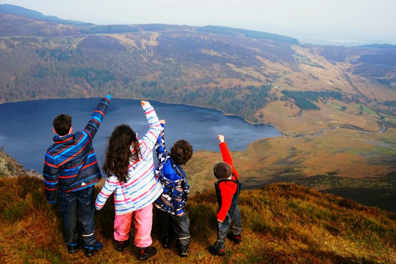
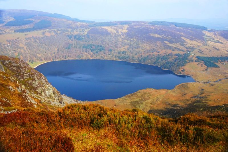
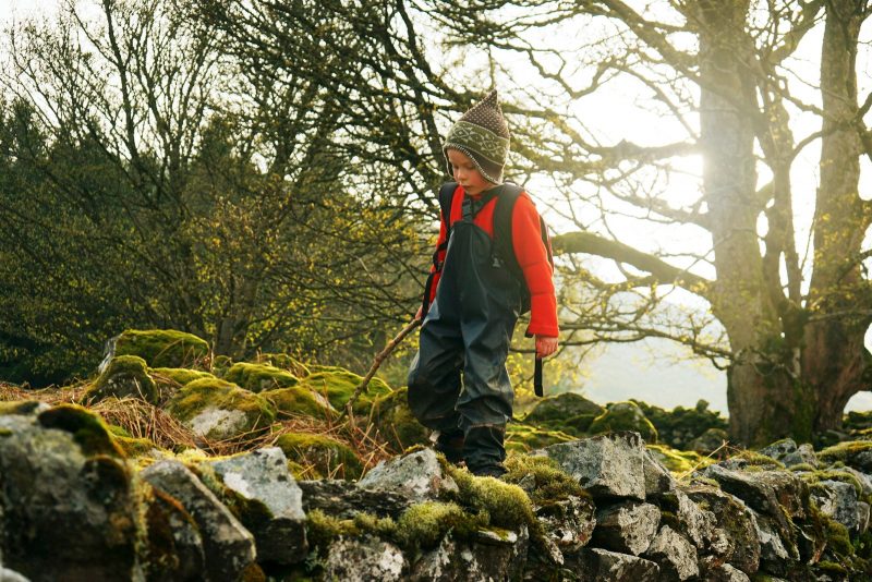
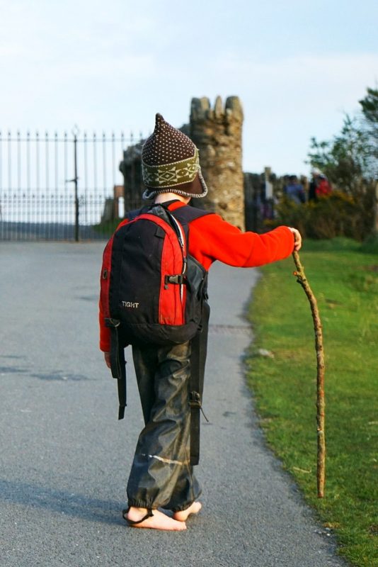
This is the acorns at the top of Luggala in the Wicklow Mountains, with the one and only Guinness Lake (a. k. a. Lough Tay) down below.
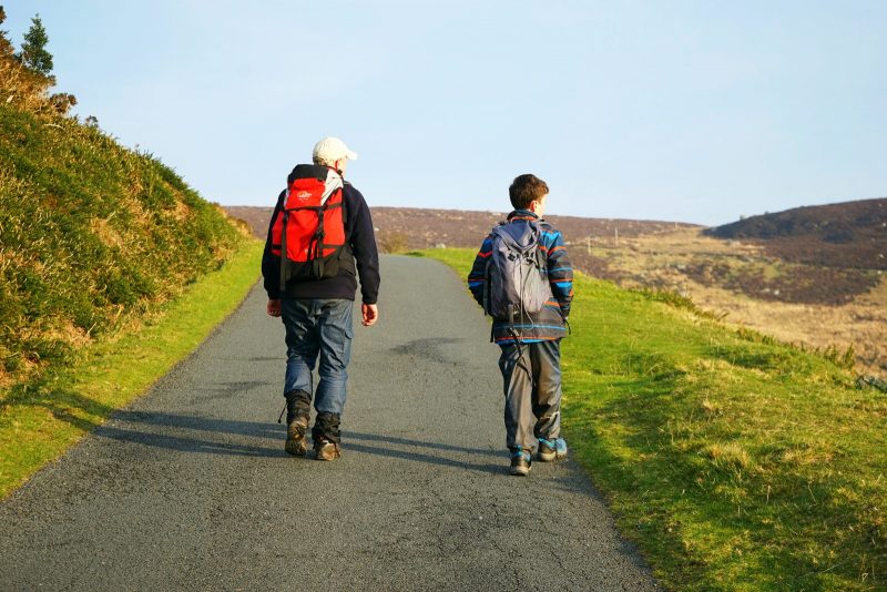
This weekend, for the first time in what feels like ages, we went on a proper family adventure. Just the six of us, exploring and hiking, chatting and making memories – it felt so good being outside again!
Of course, the weather and shorter days of winter make it hard to go on outdoor family adventures. Add to this a flurry of extracurricular activities and climate action-related meetings, and the past few months have been very much on the social side.
I needed to go on an adventure. We all needed to unplug, get outside and reconnect, with nature and with each other.
Luggala – a place apart
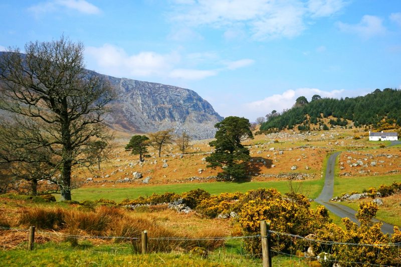
Luggala, in the Wicklow Mountains, is a place like no other. The name itself (Log an Lágh in Irish, meaning “hollow of the hill”) applies primarily to the summit also called Fancy Mountain (from Fuinnse in Irish, meaning “ash tree”), whose stark cliffs tower over the dark waters of Lough Tay.
But Luggala also refers to the valley stretching between Lough Tay and Lough Dan, and of course to the breathtaking estate owned by the Guinness family – read more on Luggala’s story.
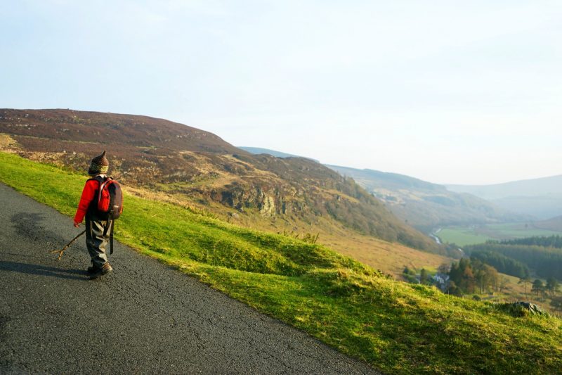
Having walked to Lough Dan a couple of years ago, the goal this time was to reach the summit of Luggala (alt. 595m/1,952ft) and stand at the top of the cliffs, overlooking Lough Tay.
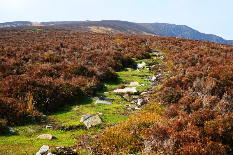
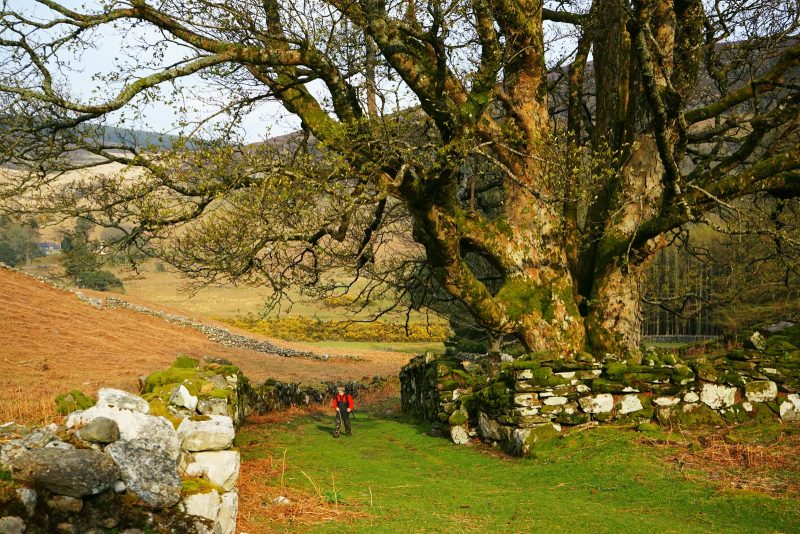
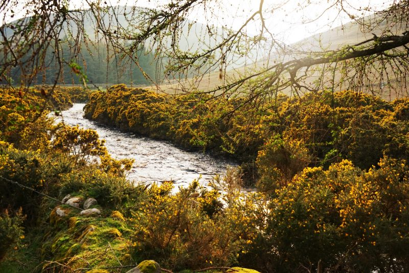
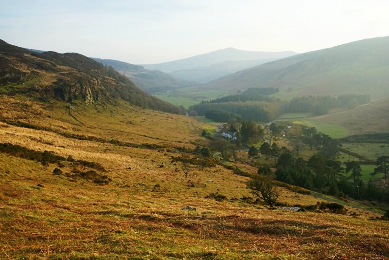
From the Pier Gates (read here for directions), a private road meanders down into the wide glacial valley – at either end, two ribbon-lakes, Lough Tay and Lough Dan, their deep, slate-coloured waters connected by the copper-tinged rapids of the Cloghoge River.
The light breath of the breeze,
the constant babbling of the river,
the occasional tweeting of a skylark –
nothing else breaks the exquisite silence.
Remote. Serene. Majestic. This epic landscape never fails to astound me, ground and uplift me all at once.
Voici les graines de chêne au sommet de Luggala dans les monts de Wicklow, avec le seul et unique “lac Guinness” (ou Lough Tay) en contrebas.
Ce weekend pour la première fois depuis bien longtemps, nous sommes partis pour une vraie aventure en famille. Juste nous six, marchant et explorant, bavardant et fabriquant des souvenirs. Qu’il a fait bon être en plein air !
En hiver, la météo et les journées courtes rendent difficiles les aventures plein nature en famille. Ajoutez-y un débordement d’activités périscolaires et de réunions liées à l’action climatique, et ces derniers mois se sont avérés du genre mondain.
J’avais besoin de partir à l’aventure. Nous avions tous besoin de débrancher et de reconnecter, avec la nature et les uns avec les autres.
Luggala, un endroit à part
Luggala, dans les monts de Wicklow, est un lieu à nul autre pareil. Le nom lui-même (Log an Lágh en gaëlique, ce qui signifie “creux de la colline”) désigne avant tout le sommet aussi dénommé Fancy Mountain (du gaëlique Fuinnse, signifiant “frêne”), dont les falaises de granite surplombe les eaux sombres de Lough Tay.
Mais Luggala désigne aussi la vallée qui s’étire entre Lough Tay et Lough Dan, et bien sûr le splendide domaine du même nom, propriété de la famille Guinness (découvrez l’histoire de Luggala ici).
Ayant marché jusqu’au rivage de Lough Dan il y a quelques années, l’idée cette fois était d’atteindre le sommet de Luggala (alt. 595 m), pour se tenir à la cîme des falaises dominant Lough Tay.
Des portails Pier Gates (itinéraire complet à lire ici), une route privée descend en serpentant dans la large vallée glaciaire – à chaque extrémité, deux lacs glaciaires, Lough Tay et Lough Dan, dont les eaux couleur d’ardoise sont reliées par les flots cuivrés de la rivière Clohoge.
Le souffle léger de la brise,
le clapotis constant de la rivière,
le chant intermittent d’une alouette –
rien d’autre ne brise le silence exquis.
Lointain. Serein. Majestueux. Ce paysage épique, tout à la fois apaisant et revigorant, ne manque jamais de m’ébahir.
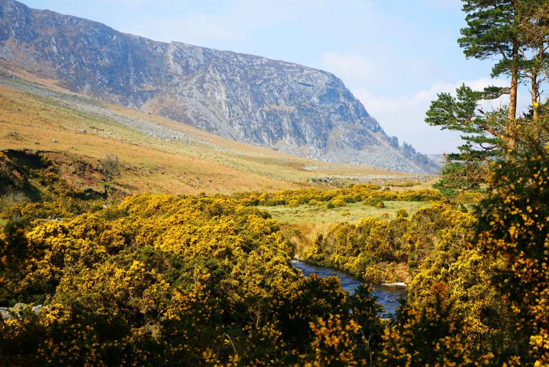
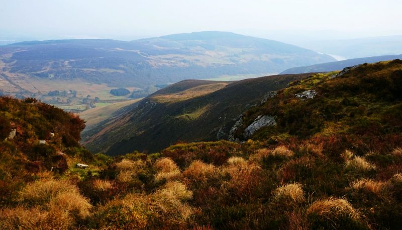
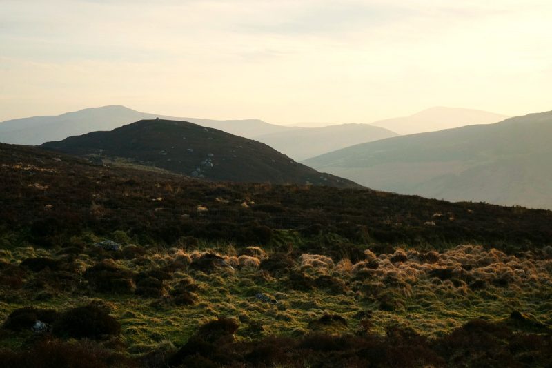
Luggala, or Fancy Mountain (alt. 595m), towers over a stunning glacial valley /
Luggala, ou Fancy Mountain (alt. 595 m), domine la splendide vallée glaciaire du même nom.
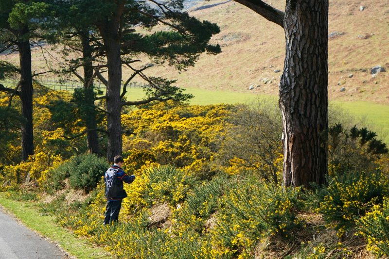
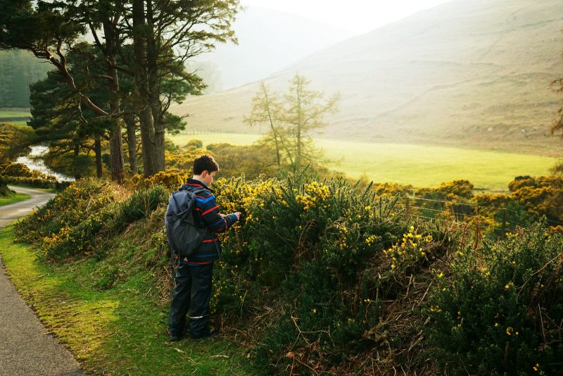
The coconut-scented gorse flowers are in full bloom /
Les ajoncs au parfum de noix de coco sont en pleine floraison.
As we started walking, the spring sunshine finished burning through the mist and cloud, lifting the veil of sadness that had weighed down on me since midwife Philomena’s passing. Deep breath. Sunshine on my face. Gratitude.
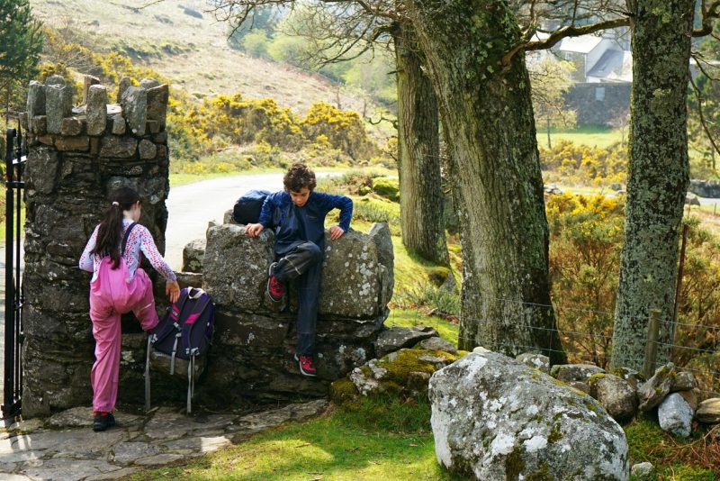
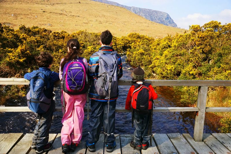
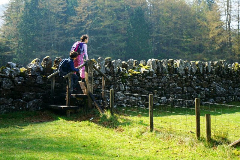
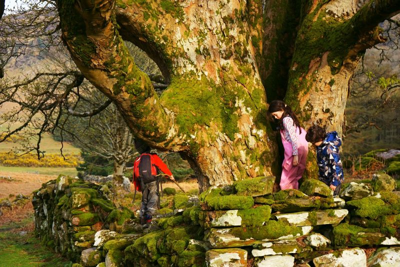
Once on the valley floor and the river crossed, we turned right at a stone wall and over a wooden stile. The going was about to get a whole lot tougher.
Comme nous commencions à descendre dans la vallée, le soleil printanier finit de dissiper la brume, soulevant le voile de tristesse qui m’enveloppait depuis le décès de ma sage-femme Philomena. Inspiration profonde. Soleil sur mon visage. Gratitude.
Une fois arrivés au fond de la vallée et le pont sur la rivière Cloghoge traversé, nous avons pris à droite au mur de pierre, enjambant un échalier de bois. La balade était sur le point de devenir une rando sérieuse.
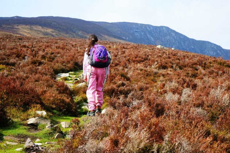
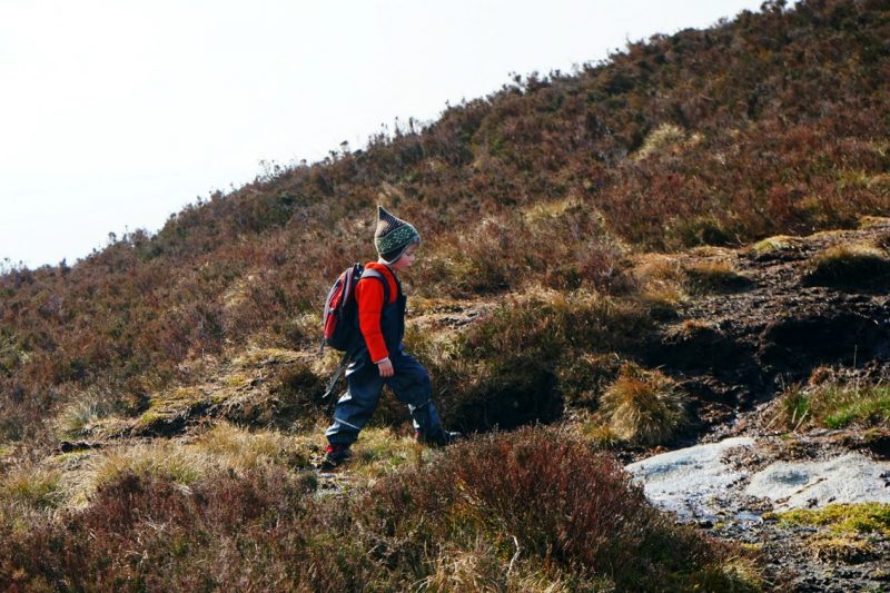
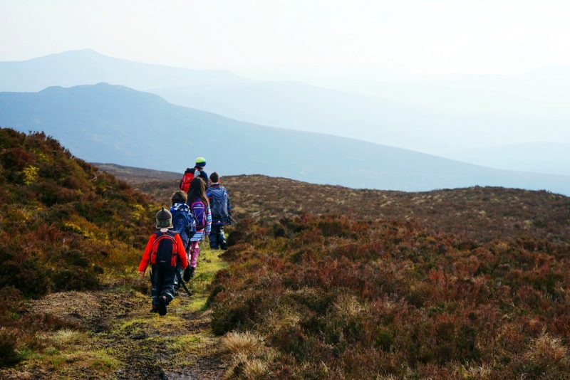
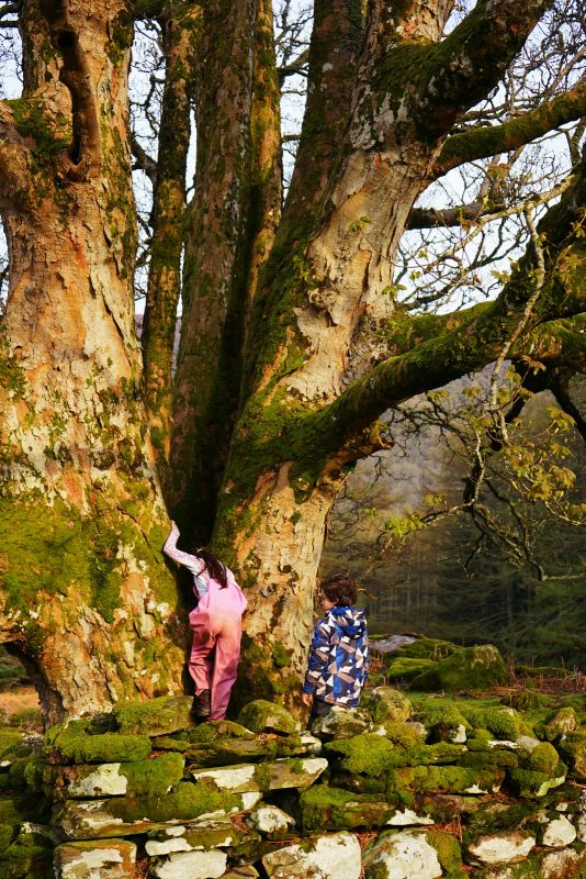
From there the trail goes straight up the mountain at a 45-degree angle. We plotted our snacks stops before heading up – at the first wall, then the second, and finally the lone tree up on the ridge.
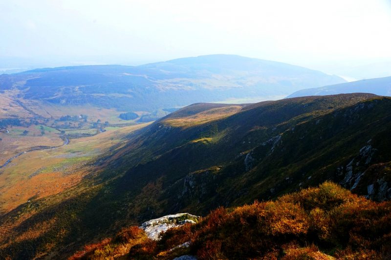
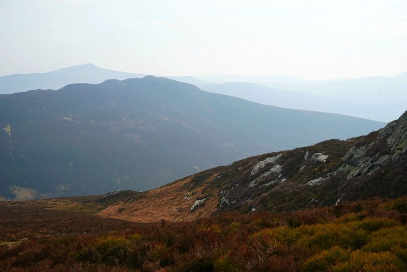
We were past the steepest section, plodding along on flater ground, when Brian realised we had made a slight “miscalculation”, as he put it. The top of Luggala was not just over the next ridge as we had assumed – it was a great deal farther. With Lough Tay partly visible down on our right, and snow-sprinkled Djouce looming across the valley, the cliffs of Luggala slowly appeared high and far beyond the rim we had just reached.
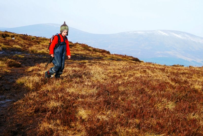
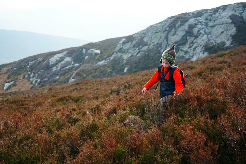
Mermaid started to complain. Thinking that the end point was so tantalisingly close, only to realise it was much further than anticipated, was one setback too many. She had already postponed a sleepover with her best friend to come on this family hike with us, so this was a cruel blow indeed.
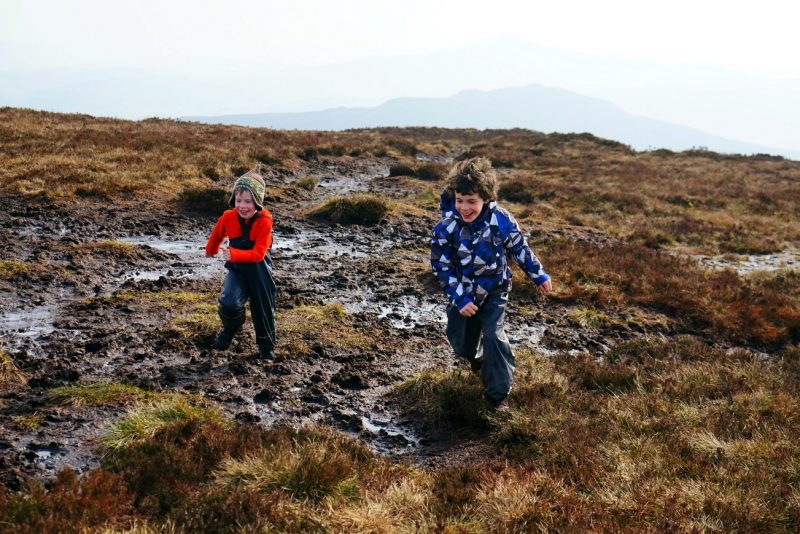
Ten minutes later however, she was happily sauntering along. The stony trail had turned to black, soggy peat, and she jumped in every muddy puddle along the way.
De là, le sentier monte tout droit à flanc de colline. Avant même de démarrer, nous avons prévu où nous arrêter pour reprendre haleine : au premier mur, puis au second, et enfin au petit arbre sur la crête.
Nous avions achevé la section la plus pentue, cheminant péniblement sur un terrain plus plat, quand Brian réalisa notre légère “erreur de calcul”, comme il dit. Le sommet de Luggala n’était pas derrière la prochaine crête, comme nous l’avions présumé, mais plus loin et plus haut encore. Avec Lough Tay partiellement visible en bas à droite et le mont Djouce saupoudré de neige barrant l’horizon, les falaises de Luggala apparurent lentement bien au-delà de la crête que nous venions d’atteindre.
Sirène commença à râler. Ce fut un revers de trop de réaliser que le sommet était encore si loin après avoir pensé que le but était atteint. Elle avait accepté de repousser une nuit chez sa meilleure amie pour venir marcher en famille, alors ce fut un coup dur.
Néanmoins, dix minutes plus tard, elle avançait d’un pas gaillard. Le sentier rocailleux avait fait place à une tourbe noire et détrempée, et elle sautait dans toutes les flaques sur son passage.
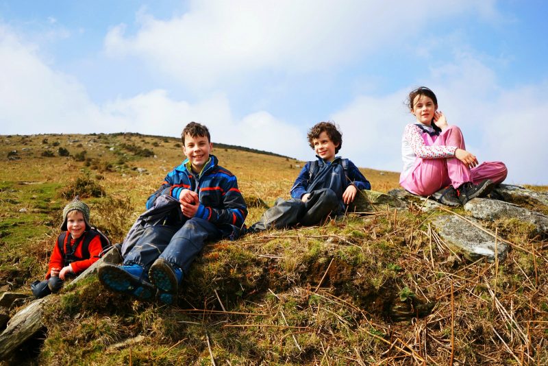
First rest stop by the stone wall /
Première pause au mur de pierre.
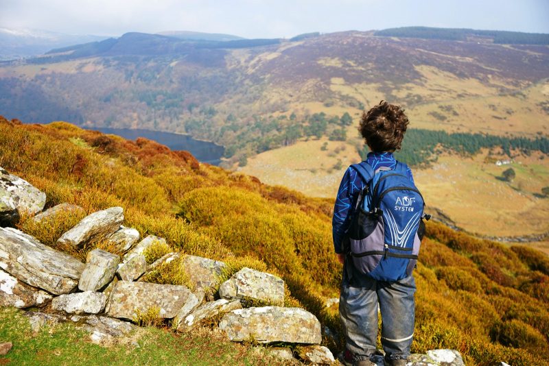
Lough Tay appears down below on the right, with snow-sprinkled Djouce in the background /
Lough Tay apparaît au fond à droite, avec le mont Djouce enneigé au loin.
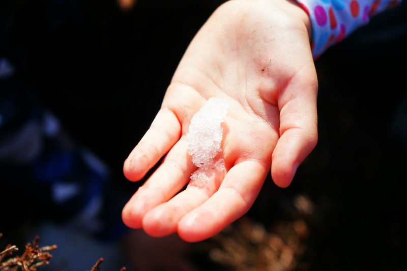
Brian spotted what surely was the very last bit of snow on Luggala – barely more than a handful of the white stuff, nestled deep inside a bog hole.
Puis Brian repéra ce qui devait être le dernier amas de neige sur Luggala – à peine plus qu’une poignée, blottie au fond d’un trou.
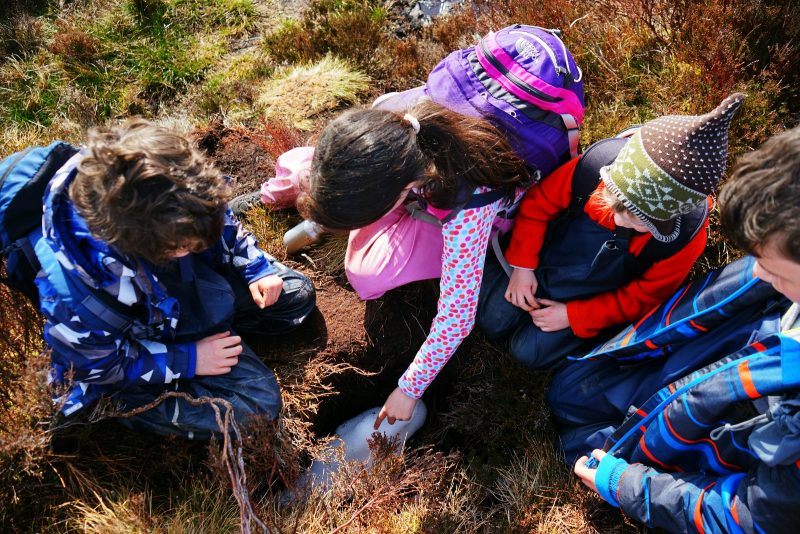
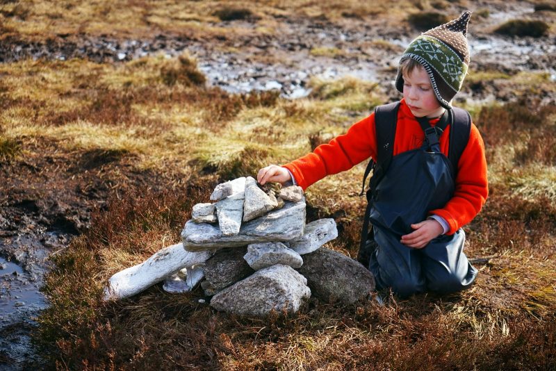
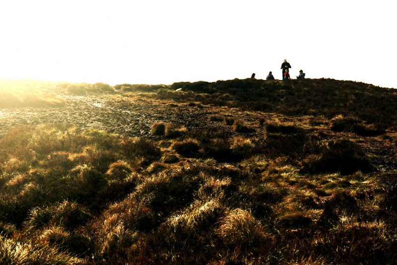
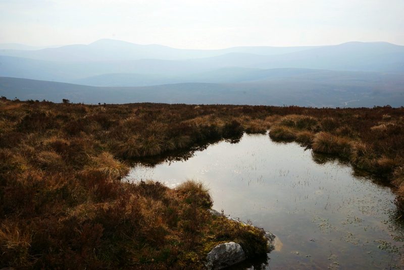
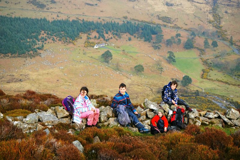
Soon we had reached the summit – a flat expanse of squishy bog, dark puddles and yellow deer grass, marked by a rather underwhelming cairn.
While the acorns claimed some islands (i.e. clumps of peat protruding from the surrounding bog) as their own, Brian and I took in the panoramic views over the Sally Gap, the large hump of Djouce (alt. 725m/2,379ft), still speckled with snow, and the silhouetted contours of Knocknacloghoge and Scarr in the misty distance.
Nous avons bientôt rallié le sommet – une étendue de tourbe spongieuse, de flaques sombres et d’herbe jaunie, marquée par une stèle un rien décevante.
Pendant que les graines de chêne jouaient à s’approprier des îles (en réalité, des monticules de tourbe saillant de la tourbière environnante) et à sauter à pieds joints dans la boue noire, Brian et moi avons préféré admirer la vue panoramique sur le Sally Gap, le mont Djouce (alt. 725 m) encore saupoudré de neige, et les silhouettes de Knocknacloghoge et Scarr dans la brume.
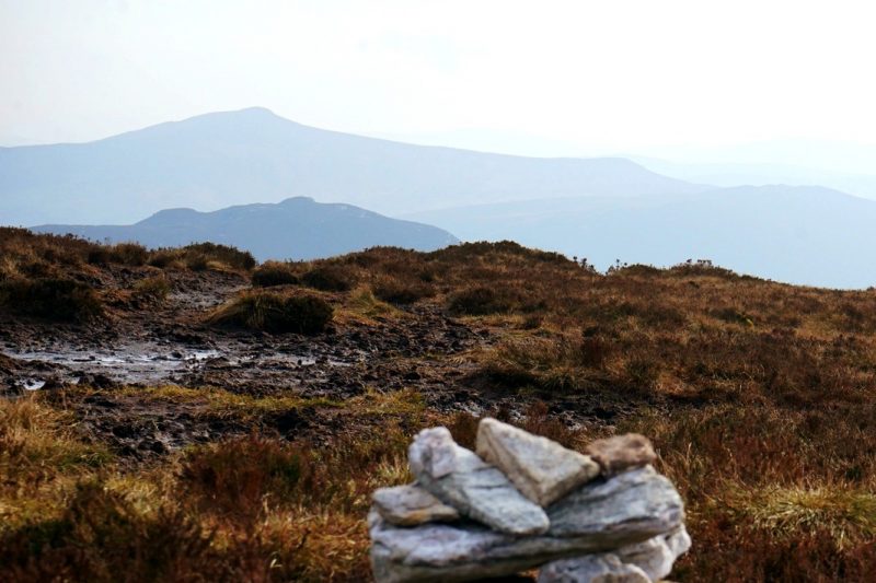
The cairn at the top of Luggala, with Knocknacloghoge and Scarr in the distance /
Stèle au sommet de Luggala, avec au loin, Knocknacloghoge et Scarr.
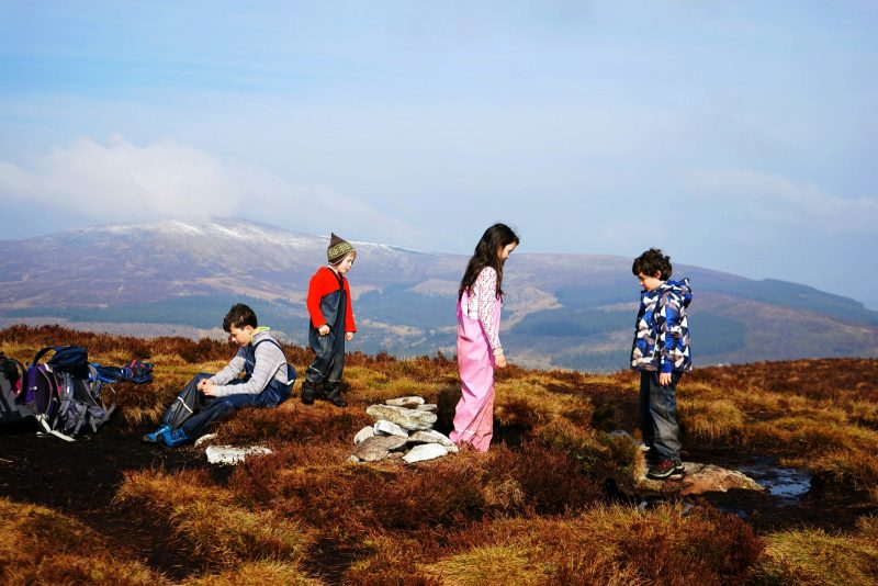
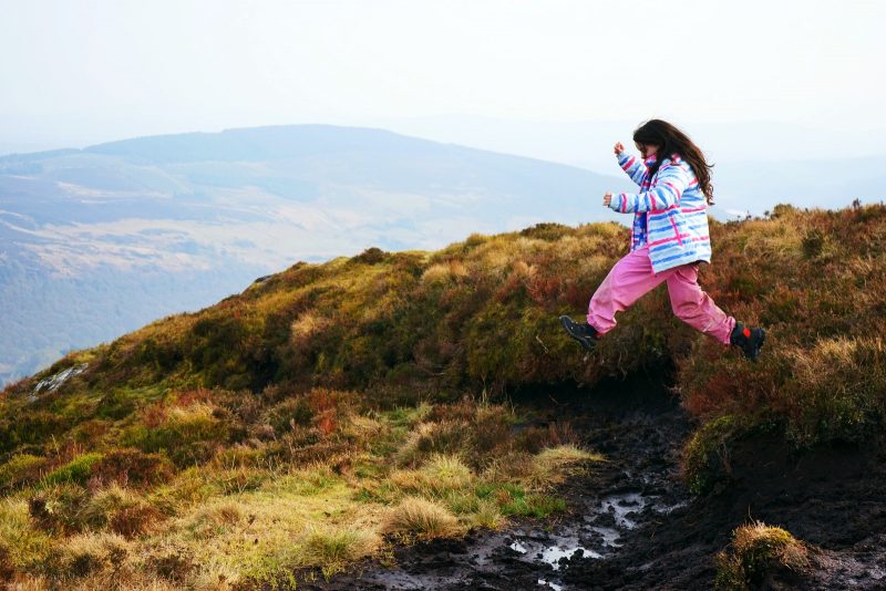
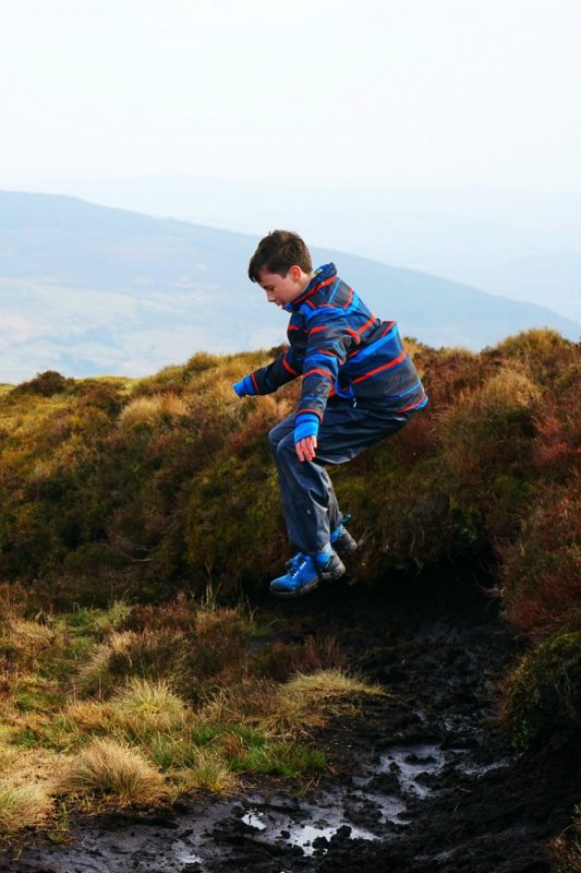
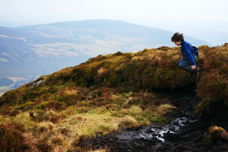
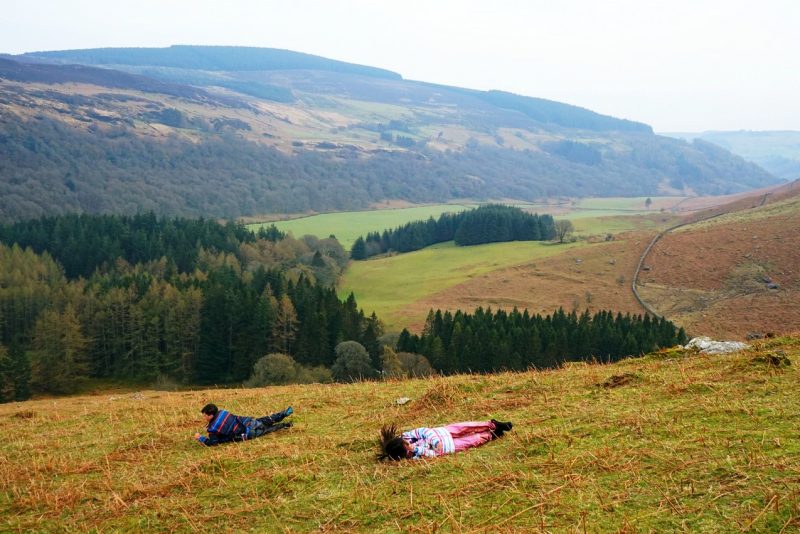
Claiming “bog islands” as their own /
Un îlot de tourbe chacun !
The mud will wash off, but the memories will last a lifetime /
La boue partira au lavage, mais les souvenirs resteront marqués toute la vie.
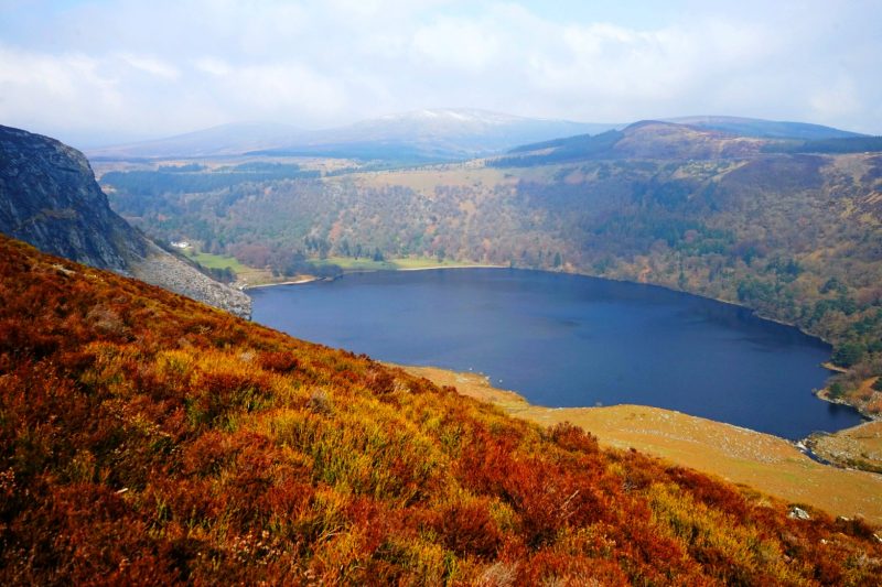
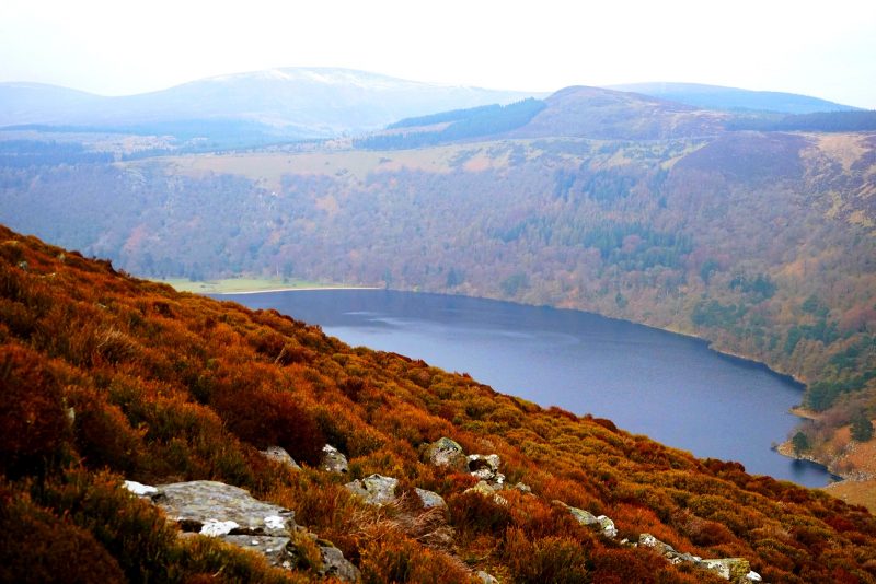
But the real reward came as we made our way to the edge of the rock face.
Standing there on the seemingly inaccessible clifftop we always see from the opposite side, overlooking the dark waters of the Guinness Lake down below (which, by the way, is very nearly shaped like a pint glass!), spotting the Vartry Reservoirs and Lough Dan at the end of the valley.
Mais le clou de la randonnée se produit à l’approche du bord de la falaise.
Debout là, à la cîme de cette montagne qui paraît inaccessible vue de l’autre versant de la vallée, plongeant le regard dans les eaux sombres du lac Guinness en contrebas (il a véritablement la forme d’une pinte de bière !), repérant les lacs de Vartry et Lough Dan à l’autre bout de la vallée.
Even at this height, the only audible sound was the gentle murmur of the Cloghoge River echoing between the steep hillsides of the Luggala valley.
Même à cette hauteur, seul le murmure de la rivière Cloghoge était audible, résonnant entre les versants escarpés de la vallée de Luggala.
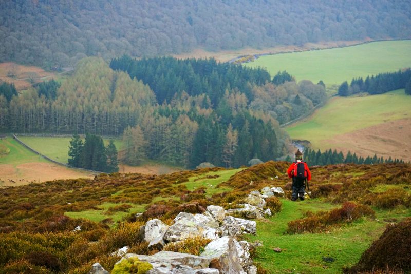
After our obligatory bowl of instant noodles, cooked and eaten by the summit cairn, it soon was time to head back down. The acorns followed the trail of mud and puddles, which landed us opposite Knocknacloghoge, i.e. off course!
Après notre incontournable bol de nouilles instantanées, préparées et dévorées près de la stèle du sommet, il fut bientôt temps de redescendre. Les graines de chêne suivirent un sentier de flaques et de boue, qui nous conduit directement en face de Knocknacloghoge, soit dans la mauvaise direction !
Trekking through treacherous heather and soggy bog, we soon found ourselves back on track and heading down, or rolling down, the thigh-busting trail.
Coupant à travers bruyères hasardeuses et tourbe détrempée, nous avons fini par retrouver notre chemin, avant de reprendre, à la descente cette fois, la section la plus pentue de l’itinéraire.
Back on track and last pit stop before the thigh-busting descent /
De retour sur le bon sentier, dernière pause avant la descente la plus raide.
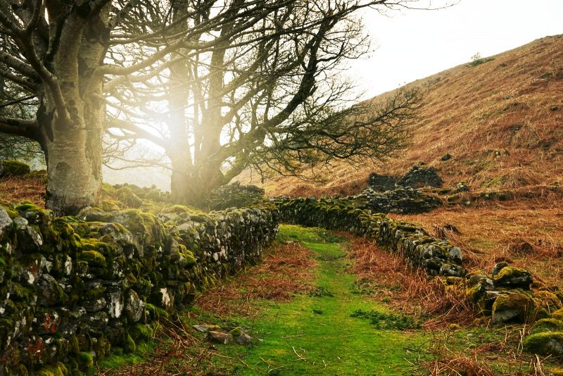
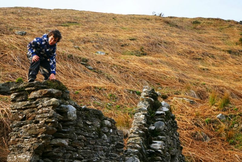
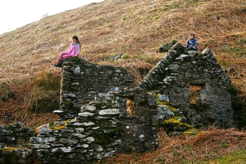
As the evening sun came out to bathe the valley in golden light, we took a few minutes to check out the ruins of an abandoned house nestled by the Cloghoge Brook. There is something compelling about old stones and the mysterious stories they conceal – like the so-called Scotch village that we discovered a few months ago.
Comme le soleil de fin d’après-midi venait baigner la vallée de lumière dorée, nous vons fait un petit détour pour aller inspecter les ruines d’une chaumière abandonnée près du ruisseau Cloghoge. Les vieilles pierres et les histoires mystérieuses qu’elles recèlent exercent un attrait envoûtant, à l’instar du village déserté que nous avons découvert il y a quelques mois.
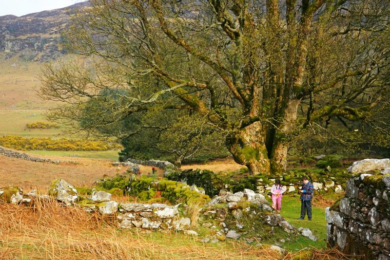
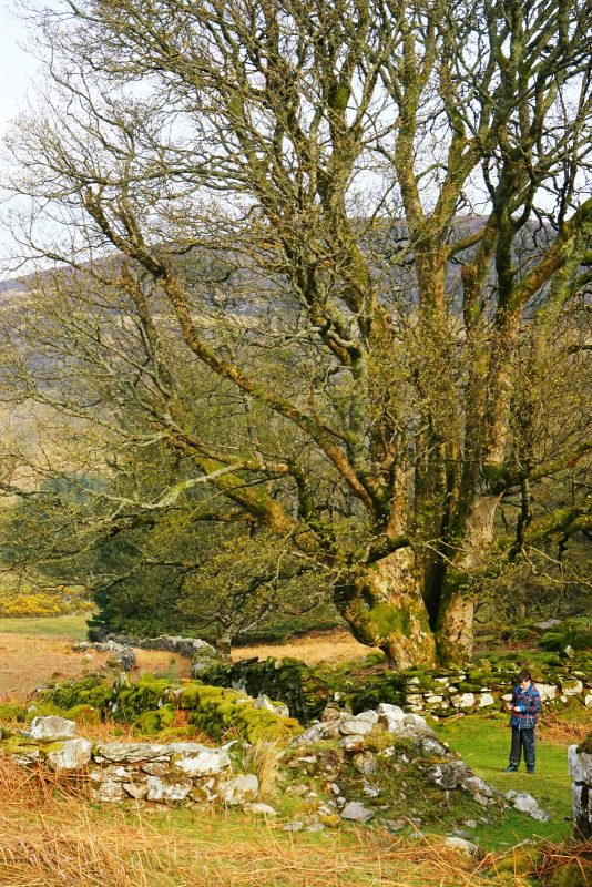
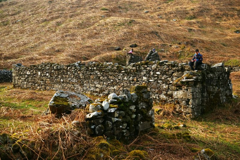
Local historian Chris Corlett mentions this specific settlement in his article The Ruined Farmhouses of the Cloghoge and Inchavore Valleys, “One house near the Cloghoge Brook has a large range of outbuildings that imply winter housing of cattle and dairy farming.”
The acorns would have loved more time there to explore the ruins and scale the humongous birch tree, so we will be back!
L’historien local Chris Corlett mentionne spécifiquement ce vestiges dans son article pour la Société d’histoire de Roundwood : “Une des maisons près du Cloghoge Brook présente plusieurs dépendances impliquant l’hivernage du bétail et une exploitation laitière.”
Les graines de chêne auraient bien aimé rester plus longtemps pour explorer les ruines à leur gré et escalader l’énorme bouleau, alors nous y retournerons !
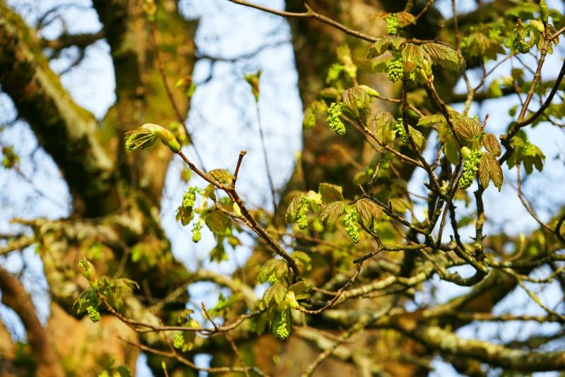
Budding leaves and catkins of silver birch (Betula pendula) /
Feuilles à peine écloses et chatons de bouleau (Betula pendula).
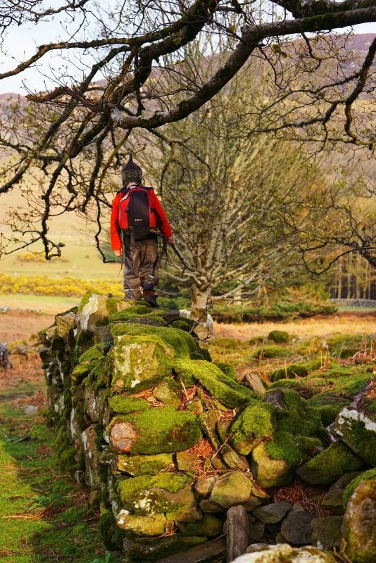
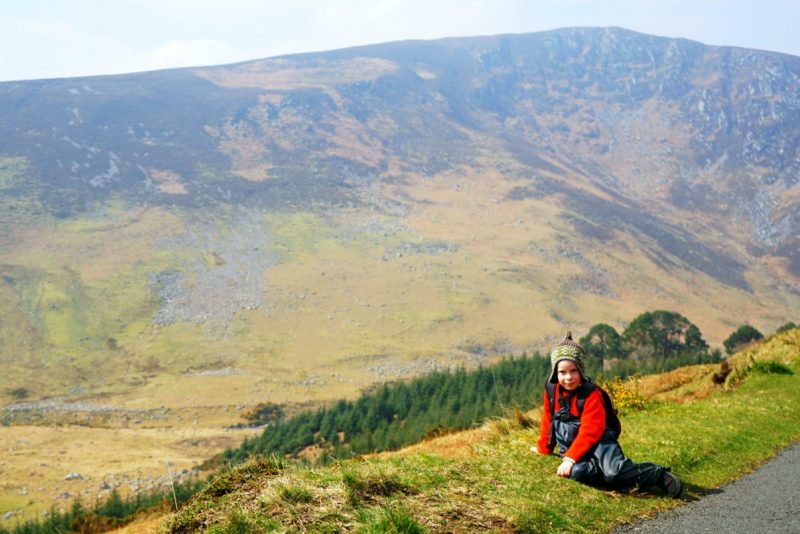
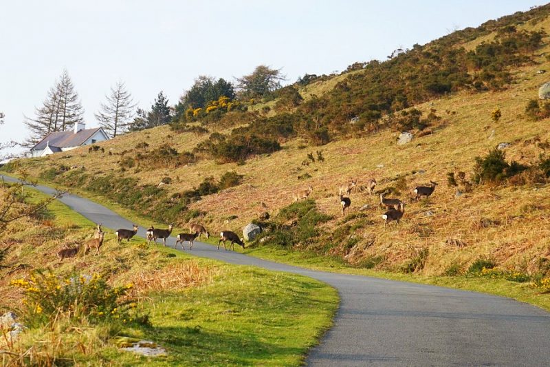
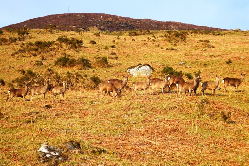
As we started the long trek up the road back to the Pier Gates, wild deer by the dozen were staring at us from the beige hillsides. A small herd even crossed the road ahead of us.
Comme nous reprenions la longue ascension de retour aux Pier Gates, d’innombrables daims nous scrutaient de toutes parts. Une petite harde s’enhardit même à traverser la route devant nous.
Six hours and 17,848 steps after setting off, we got back to our car. Exhausted for sure, but also deeply happy. Luggala had once again worked its magic.
Six heures et 17 848 pas après notre départ, nous étions de retour à la voiture. Exténués, certes, mais aussi profondément heureux. La magie de Luggala avait à nouveau opéré.
“I’m not Yoda, I’m Batman!” /
“Je suis pas Yoda, je suis Batman !”
The Luggala story
The Luggala Demesne has been in the hands of the Guinness family since 1937, when Ernest Guinness bought it as a wedding present for his daughter Oonagh, Lady Oranmore and Browne. Her son Garech Browne (1939-2018), art collector and co-founder of Claddagh Records, later became the custodian of Luggala.
One of the extraordinary things about Luggala is that it almost looks like a different place every single day.
Garech Browne,
grandson of Arthur Ernest Guinness
While the white-painted, castellated Luggala Lodge by the shore of Lough Tay welcomed countless musicians and artists, the estate was used as a film location for numerous international productions.
The public has long enjoyed unrestricted access over this most iconic landscape. But this could change. In 2017, the entire estate, owned by a Guinness family trust called Barbican International Corporation, was put up for sale, with an asking price of €28 million.
 After some contentious signage was erected on the estate boundaries and access gates, Mountaineering Ireland and Keep Ireland Open called on the Irish government to purchase 4,000 acres of Luggala (excluding Luggala Lodge and its surroundings). The lands could then be added to the Wicklow Mountains National Park, and Luggala would remain open to the public for recreational use.
A petition asking for the purchase of Luggala by the State has already attracted nearly 12,000 signatures. You can sign it here.
Getting there
Travelling northbound (Dublin) on the N11, take Exit 8 (Kilmacanogue), then the first exit on the roundabout, signposted for Roundwood and Glendalough (R755). At the next roundabout, take the second exit and continue straight ahead on the R755.
Travelling southbound (Wexford) on the N11, take Exit 8 (Kilmacanogue), immediately after the Topaz petrol station, following signposts to Roundwood and Glendalough (R755). At the roundabout, take the last exit, to Kilmacanogue and Roundwood (R755). At the next roundabout, take the first exit for the R755.
Keep driving on the R755 for 11km, until you reach the junction with the R759, signposted for the Sally Gap on the right-hand side.
Drive for another 3.5km on the R759, until your reach the so-called Pier Gates, on the left-hand side. There are a few parking spaces by the roadside, and near a farm gate on the right; the area is often busy at the weekend with hikers walking the Wicklow Way.
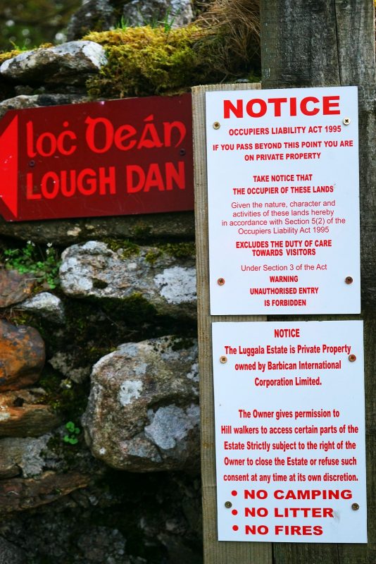
The walk to Lough Dan and Luggala starts at the Pier Gates; use the kissing gate on the left to enter the Luggala Estate. From then on, you are on private grounds. No cars or dogs are allowed on the estate.
L’histoire de Luggala
Le domaine de Luggala appartient à l’illustre famille Guinness depuis 1937, quand Ernest Guinness l’offrit à sa fille Oonagh en cadeau de mariage. Son fils Garech Browne (1939-2018), collectionneur d’art et co-fondateur de Claddagh Records (label de musique traditionnelle irlandaise), en devint ensuite le gardien.
Un des aspects les plus extraordinaires de Luggala, c’est qu’il paraît un lieu différent à presque chaque jour qui passe.
Garech Browne,
grandson of Arthur Ernest Guinness

Tandis que la superbe résidence gothique Luggala Lodge, au bord de Lough Tay, accueillait d’innombrables artistes et musiciens au fil des ans, le domaine servait de lieu de tournage à maints films.
Depuis toujours, ce paysage emblématique d’Irlande est en libre accès pour le public. Mais cela pourrait changer. En 2017, le domaine tout entier, qui appartient à la fondation Guinness par le biais d’une société appelée Barbican International Corporation, fut mis en vente, au prix de 28 millions d’euros.
 Après l’apparition de pancartes contentieuses aux limites et portes d’accès de Luggala, Mountaineering Ireland et l’association Keep Ireland Open ont exhorté le gouvernement irlandais à acquérir 1600 hectares du domaine (excluant Luggala Lodge et ses environs immédiats), pour les incorporer au Parc national des Monts de Wicklow. Ainsi, Luggala resterait ouvert au public.
Une pétition demandant l’aquisition de Luggala par l’Etat a déjà attiré près de 12 000 signatures. Elle est visible ici.
S’y rendre
Circulant en direction du nord (Dublin) sur la N11, prenez la sortie 8 (Kilmacanogue) puis, au rond-point, la première sortie, en direction de Roundwood et Glendalough (R755). Au deuxième rond-point, prenez la deuxième sortie et continuez tout droit sur la R755.
Circulant en direction du sud (Wexford) sur la N11, prenez la sortie 8 (Kilmacanogue), tout de suite après la station service Topaz, et suivez les panneaux indiquant Roundwood et Glendalough (R755). Au rond-point, prenez la dernière sortie pour Roundwood et Glendalough (R755). Au rond-point suivant, prenez la première sortie pour la R755.
Continuez sur la R755 pendant 11 km, jusqu’au croisement avec la R759, sur la droite ; un panneau indique le Sally Gap.
Continuez sur la R759 pendant 3,5 km, jusqu’au portail nommé Pier Gates, sur la gauche. Stationnement sur le bas-côté ou près de la barrière sur la droite (veillez à ne pas l’obstruer). Cette section de la route est très fréquentée par des marcheurs empruntant le Wicklow Way.
La randonnée vers Lough Dan commence aux Pier Gates ; empruntez la grille immédiatement à gauche du grand portail pour entrer sur le domaine de Luggala. A partir de là, vous entrez sur une propriété privée. Véhicules à moteur et chiens sont interdits sur l’ensemble du domaine.
Related / Similaire
- Lough Dan – Walk to the lake side / Randonnée côté lac
- A deserted village in a deserted forest / Un village abandonné dans un désert forestier
- An ice-breaking hike to Djouce Mountain / Randonnée brise-glace au mont Djouce
- 7 tips for hiking with kids / 7 conseil pour la randonnée en famille
- Adventures R Us / Des aventures et nous
Further reading / A lire


Disclosure: This post contains some affiliate links. Should you choose to make a purchase after clicking on one of them, I may receive a small commission and your purchase will help support this site.
Avertissement : Cet article contient des liens partenaires. Si vous décidez d’effectuer un achat après avoir cliqué sur l’un d’eux, je recevrai une commission qui contribuera à soutenir ce site.
 Previous Post
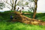 Next Post
Love the bog island jumping. Stunningly beautiful as I come to expect from all of your posts #365
What wonderful views from the top of Luggala and what a fabulous place for a family adventure together. You certainly had a beautiful day for your hike and I’m glad that the spring sunshine helped lift some of the sadness after the passing of your midwife Philomena. Glad that the muddy puddles helped spur Mermaid on too to reach the summit. I love how your acorns claimed some of the bog islands for their own. Your photos of the views are just stunning. Love the deserted house on the way down – there’s something quite magical about places like these. Thank you for sharing your adventure with #CountryKids
WOW these photos are absolutely amazing – the scenery and landscape looks incredible. Great family time too 🙂
#CountryKids
Magical! The Cloghoge house sounds just like a ruined farmstead near us, and I feel for your little Acorn over the ‘miscalculation’; on our D of E gold hike years ago our leader miscalculated and our route was ‘just over the next ridge’ about 6 times!! Fabulous outdoor adventure you guys. Thanks for sharing with us at #CountryKids
I LOVE THIS! Cheered me up on a dreary Tuesday morning when I have so much work to do! I want to go on adventure now. Aren’t we so lucky to have such beautiful landscapes to enjoy here in Ireland? The kids looked like they had a great time getting muddy and as usual your wonderful photos capture a very special adventure. Look forward to a joint hike over the summer with you all! x
Your comment cheered me up on a dreary Tuesday morning, so thank you so much! I also need an adventure real soon, thakfully we’re going camping this weekend. Really looking forward to going on a joint hike in Wicklow soon 😉
What a stunning walk. I am hoping to get my gang across to Ireland at some point.
Luggala is a very special place. Unfortunately I’m not sure what the situation is with access for ramblers, now that the estate was bought by a foreign landlord.