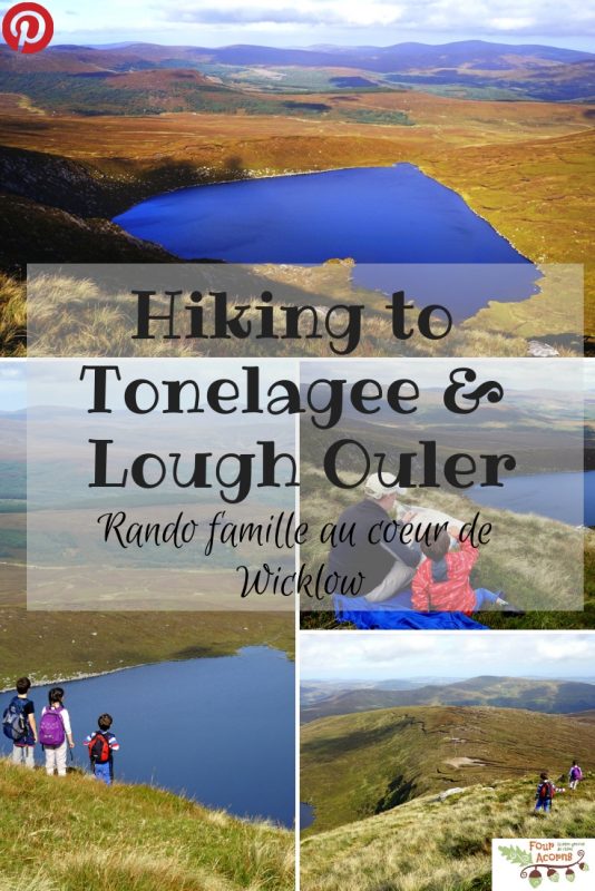
Tonelagee, the “heart” of Wicklow / Tonelagee, au “cœur” de Wicklow

There were three options for the weekend’s outing. On Saturday, the sun was shining, and so we went for the most challenging one – a hike to Tonelagee Mountain to see Lough Ouler.
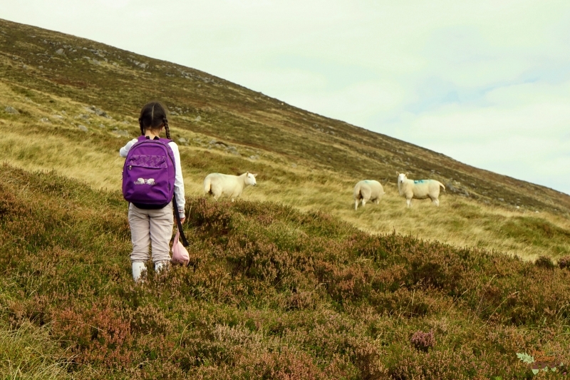
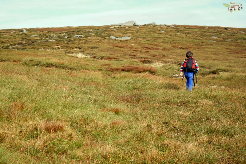
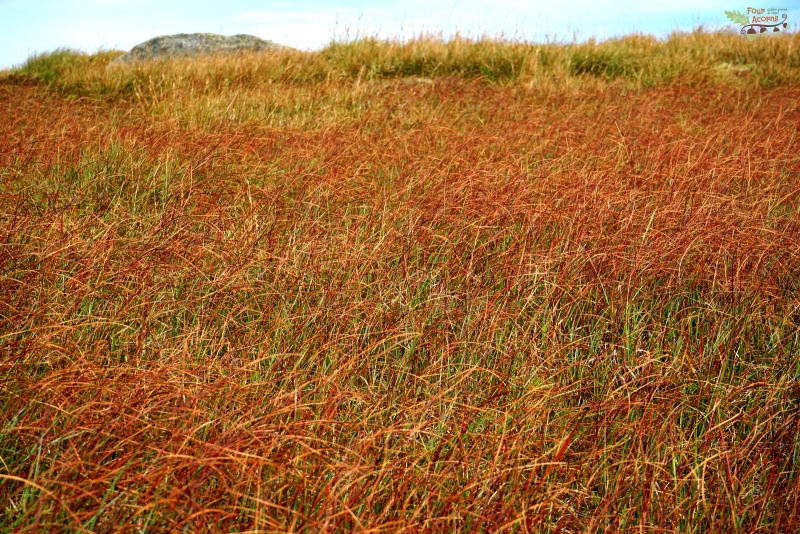
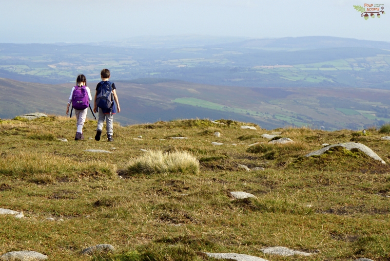
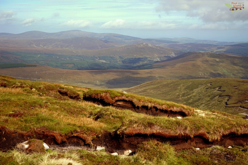
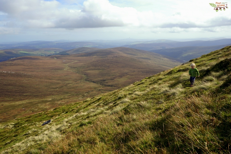
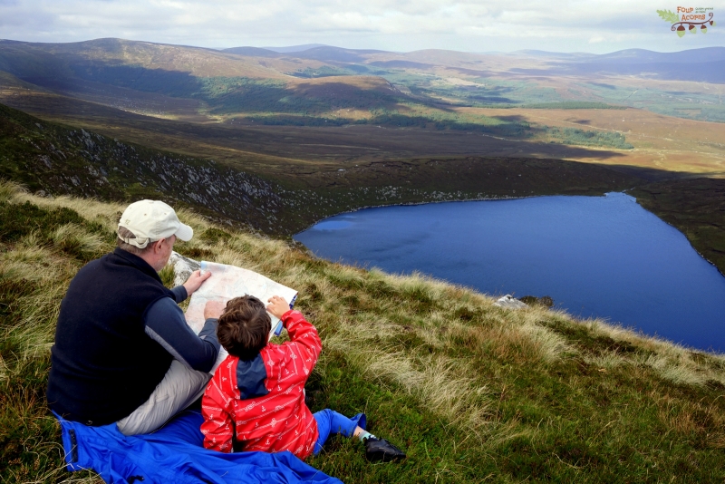
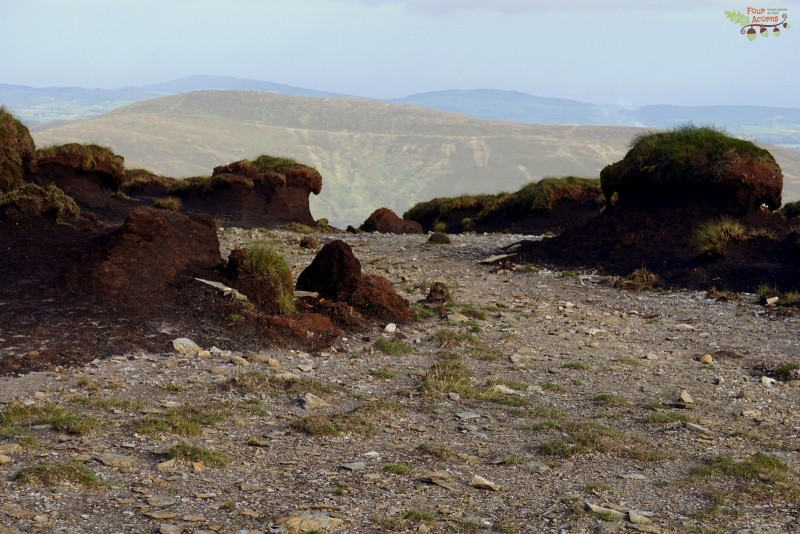
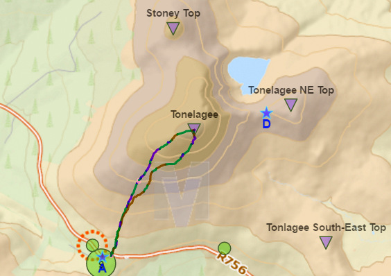
Starting from the Wicklow Gap (alt. 470m/1,540ft), the hard-to-find trail goes straight up the mountain side, through soggy bog and up steep, soft, grassy ground. The going was tough, and progress, slow. Pebbles needed a few lifts up on Brian’s shoulders.
For reaching the top of Tonelagee is no mean feat, especially for little legs. With a height of 817m/2,680ft, it is the third highest summit in the Wicklow Mountains.
Des trois idées de sortie que nous avions pour le weekend, nous avons choisi la plus difficile, la plus stimulante aussi. Le soleil brillait, alors nous sommes partis en randonnée à Tonelagee (prononcez “to-neu-la-gui’).
Au départ du Wicklow Gap (alt. 470 m), le sentier à peine visible monte tout droit à flanc de montagne, traversant la tourbe gorgée d’eau et gravissant la pente escarpée et spongieuse. L’allure était lente, l’ascension pénible. Brian dut porter Caillou sur ses épaules à plusieurs reprises.
Car gravir Tonelagee n’est pas une balade dans le parc, notamment pour les petites jambes. A 817 mètres d’altitude, c’est le troisième sommet des monts de Wicklow.
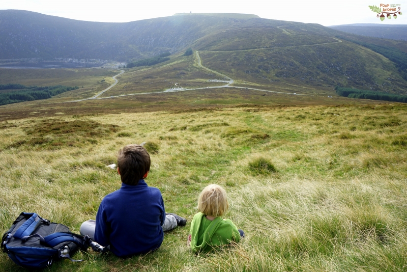
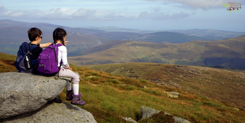
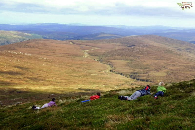
The summit is marked by a trig pillar, which Squirrel scaled effortlessly. Mermaid, with Brian’s phone in hand, made a beeline for the Tonelagee geocache (GCGT5C). It is located a few dozen metres from the summit, near a large flat rock which offers a perfect viewpoint. The cache unearthed and inspected, Mermaid sat beside Jedi to enjoy the stupendous panorama of rolling amber-coloured mountains, with the Irish Sea in the far distance.
Le sommet est marqué par une borne en béton qu’Ecureuil escalada aisément. Sirène, avec en main le téléphone de Brian, fila tout droit vers l’emplacement de la géocache Tonelagee (GCGT5C). Elle se trouve à quelques dizaines de mètres du sommet, près d’un rocher plat qui offre un point de vue idéal. La cache dénichée et inspectée, Sirène s’assit à côté de Jedi pour admirer le somptueux panorama de montagnes rousses, avec la mer d’Irlande au loin.

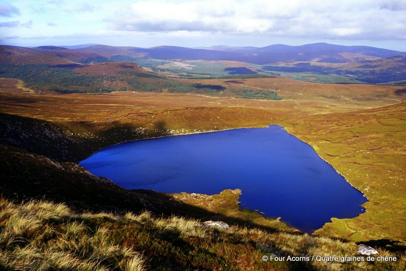
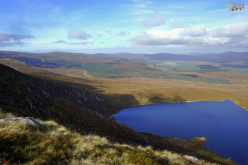
“You ain’t seen nothing yet”, Brian said with a smile as he ushered us around the mountain summit. Because the real reward of climbing Tonelagee comes as you make your way down the steep eastern side, and heart-shaped Lough Ouler slowly appears down below.
“Vous n’avez encore rien vu”, annonça Brian avec un sourire comme il nous entraînait autour du sommet. Car le clou de cette randonnée se révèle en descendant l’abrupt versant est : c’est alors que le pourtour en forme de cœur de Lough Ouler apparaît lentement en contrebas.

It is in the still silence of nature where one will find true bliss.
The merry tweeting of three skylarks circling high in the blue sky;
The occasional bleating of placid sheep grazing on the short highland grass;
The light whistling of the breeze ruffling the straw-like reeds and the russet heather;
The still silence of nature.
The hurried pounding of my exultant heart in my chest;
The warm touch of Brian’s hand in mine;
Beneath our feet, the glistening sapphire heart of Lough Ouler.
True bliss.
C’est dans le silence immobile de la nature que l’on trouve le bonheur absolu.
Le pépiement joyeux de trois alouettes virevoltant dans le ciel bleu ;
Le bêlement intermittent de moutons placides broutant l’herbe rase ;
Le sifflement léger de la brise caressant les joncs couleur paille et la bruyère fauve ;
Silence immobile de la nature.
Le tambourinement excité de mon cœur dans ma poitrine ;
La chaleur de la main de Brian dans la mienne ;
A nos pieds, le cœur de saphir scintillant de Lough Ouler.
Bonheur absolu.

Somewhat sheltered from the breeze by the brow of Tonelagee at our back, we cooked the obligatory noodles on a less-than-flat rock that Mermaid had earmarked as our table.
Heart-shaped Lough Ouler
While the acorns rolled down the steep hillside with shrieks of laughter, Brian laid out his rain jacket over a patch of heather. There, we toasted the moment with a cup of coffee (for lack of champagne!), the best we’ve ever had. The most romantic spot in Wicklow… which we visited with our four acorns!
Unfolding our ragged OSi Discovery Series 56 map, we matched the many summits around us with the names on the sheet – Mullaghcleevaun, Stoney Top, Kanturk, Knocknacloghoge, Luggala, etc. In the far distance, the white shape of a ferry seemed to float in the sky above the mountain tops. Down below, two hikers and their dog went for a wild swim in the lake’s blue waters.
Protégés de la brise par la cîme de Tonelagee derrière nous, nous avons préparé les incontournables nouilles instantanées sur un rocher plat, ou presque, que Sirène avait repéré.
Un lac en forme de cœur
Puis pendant que les graines de chêne dévalaient la pente en roulant, Brian étala sa veste imperméable par terre sur la bruyère. Là, assis côte-à-côte, nous avons savouré le moment avec une tasse de café (à défaut de champagne !), la meilleure que nous ayons jamais bue. Le lieu le plus romantique de Wicklow… que nous avons visité avec nos quatre graines de chêne !
Dépliant notre carte OSi Discovery Series 56 bien écornée, nous avons repéré les nombreux sommets des alentours : Mullaghcleevaun, Stoney Top, Kanturk, Knonknacloghoge, Luggala, etc. Au loin, la silhouette blanche d’un ferry flottait dans le ciel au-dessus des montagnes. Tout en bas, deux randonneurs et leur chien se jetèrent dans les eaux cobalt du lac.

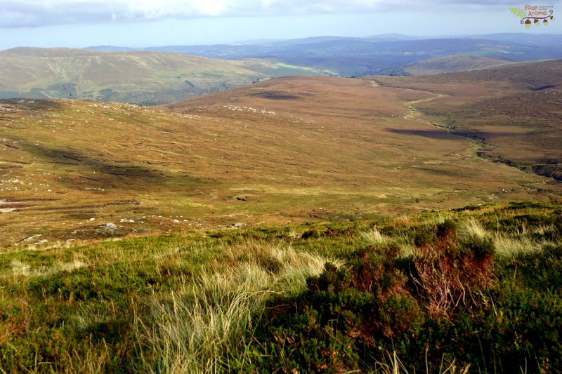
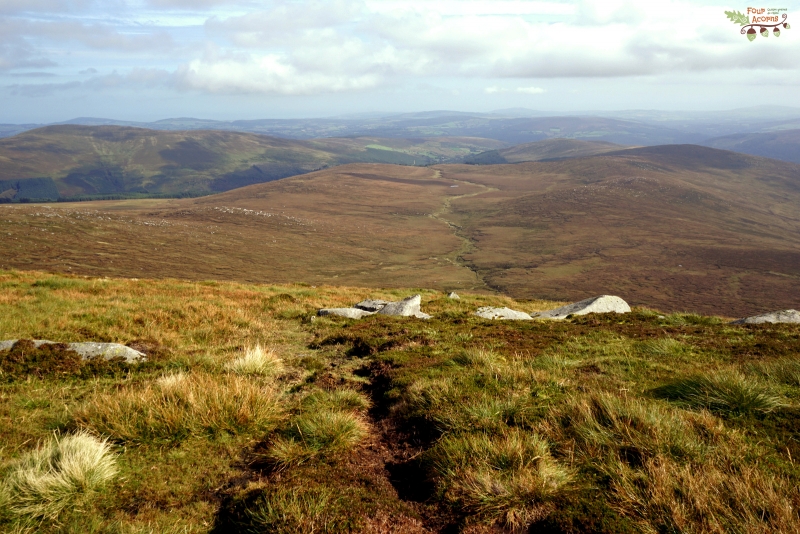
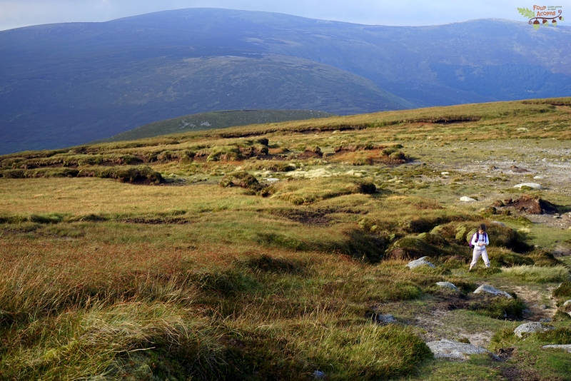
Before heading down, we contoured the summit, walking between strangely-shaped peat hags, sculpted by wind and rain. In the muted light, the tufts of moss and lichen shone bright around the polished granite boulders.
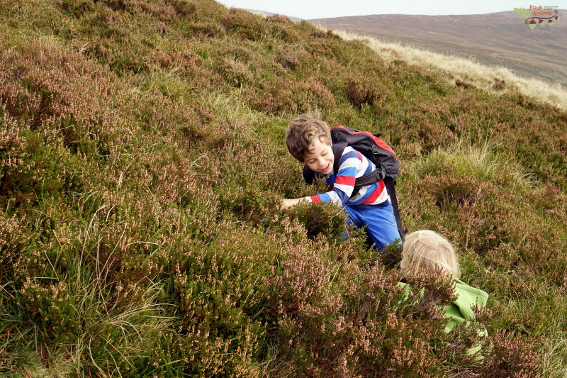
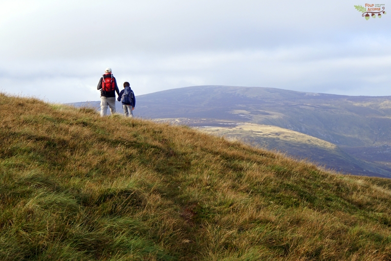
Skipping Tonelagee’s summit, we started on the toe-squashing, knee-spraining descent. The acorns joyfully rolled down the mountainside, until the ground became too marshy again. A few blueberries along the way made the home stretch ever so slightly easier.
Squirrel fell asleep soon after starting on the journey back home. A well-earned rest after climbing to the top of a mountain to see a heart-shaped lake most people know nothing about.
Avant de redescendre, nous avons contourné le sommet, marchant entre d’étranges formations de tourbe sculptées par le vent et la pluie. Sous la lumière voilée, les touffes de mousse et de lichen luisaient entre les rochers de granite poli.
Passant le sommet de Tonelagee, la longue descente à tordre les genoux commença. Les graines de chêne préférèrent descendre en roulant, jusqu’à ce que le sol devienne trop marécageux. Quelques myrtilles glanées çà et là rendirent la dernière ligne droite un tant soit peu moins pénible.
Le trajet de retour à peine entamé, Ecureuil s’endormit. Un repos bien mérité après avoir gravi une montagne pour voir un lac en forme de cœur dont peu de gens connaissent l’existence.

Getting there
![]() Driving through the Wicklow Gap on the R756, park at the Turlough Hill car park, at the highest point in the road. Across the road from the car park, one wood marker for the Wicklow Mountains National Park wood marker shows the trail head. Well, sort of, as the trail is whichever way you can find through the thick heather and treacherously wet ground. In clear weather, the summit of Tonelagee remains within sight at all times.
Driving through the Wicklow Gap on the R756, park at the Turlough Hill car park, at the highest point in the road. Across the road from the car park, one wood marker for the Wicklow Mountains National Park wood marker shows the trail head. Well, sort of, as the trail is whichever way you can find through the thick heather and treacherously wet ground. In clear weather, the summit of Tonelagee remains within sight at all times.
Lough Ouler is also accessible from the Glenmacnass Valley, for a longer hike that will take you to the bottom of the heart, where Lough Ouler flows into Lough Brook.
S’y rendre
![]() En arrivant au Wicklow Gap par la route R756, garez votre voiture au parking de Turlough Hill, près du col. De l’autre côté de la route, un piquet du Parc national des Monts de Wicklow marque le départ du sentier. En quelque sorte, car il s’agit plutôt de faire son chemin à travers la bruyère épaisse et entre trous d’eau et flaques de boue. Par beau temps, le sommet reste visible en permanence.
En arrivant au Wicklow Gap par la route R756, garez votre voiture au parking de Turlough Hill, près du col. De l’autre côté de la route, un piquet du Parc national des Monts de Wicklow marque le départ du sentier. En quelque sorte, car il s’agit plutôt de faire son chemin à travers la bruyère épaisse et entre trous d’eau et flaques de boue. Par beau temps, le sommet reste visible en permanence.
Lough Ouler est aussi accessible par la vallée de Glenmacnass ; c’est un itinéraire plus long qui aboutit à la pointe du cœur, là où Lough Ouler s’écoule en un ruisseau nommé Lough Brook.
More Wicklow hikes / D’autres randos en Wicklow
- Hiking on sunshine to Arts Lough / Randonnée plein soleil à Arts Lough
- Luggala – Walk to the cliff side / Randonnée côté falaise
- Hiking up a hill and back in time / Randonnée à remonter le temps
- On Glendalough’s beaten track / Sur le sentier battu de Glendalough
- Lough Dan – Walk to the lake side / Randonnée côté lac
- Time trial in Crone Wood / Contre la montre dans le bois de Crone
Disclosure: This post contains some affiliate links. Should you choose to make a purchase after clicking on one of them, I may receive a small commission and your purchase will help support this site.
Divulgation : Cet article contient des liens partenaires. Si vous décidez d’effectuer un achat après avoir cliqué sur l’un d’eux, je recevrai une commission qui contribuera à soutenir ce site.

 Previous Post
 Next Post
Beautiful photos and such stunning landscapes. I’ve never been to Ireland, but I think your writing might just persuade me!
Thank you so so much Lauren! You are quite the photographer yourself so your comment means the world to me. Chuffed too that you enjoy my writing so much! I’ve never been to Scotland myself, so maybe we could sort something out? 😉 (only half-kidding!) xx
Now this is what I call an adventure and the reason I don’t bother with the gym. #familyfun
Never liked the gym anyway – #GetOutside! 🙂 x
Oh wow that view is just stunning and your pictures are gorgeous. I am seriously impressed with your little ones hiking abilities, they did brilliantly! What a fab day out for you all. Thanks for sharing at #familyfun xxx
Thank you! It was in my view our best adventure of 2016 – you can’t beat that view! Thanks for hosting #familyfun xx
Love that lake, and your fab bi-lingual posts. We’ve got to put Ireland on our list, not been for over 20 years!
Ireland is a stunning place, I never tire of it!
Thanks for your comment!
Beautiful views and photographs, this looks like a great walk. I am a huge walker myself and love the feeling you get up on the hills! #farawayfiles
It is a stunning walk indeed, and remote enough to make you feel like you’re on top of the world when you get there.
gorgeous photos! that lake kind of looks like a heart:) #farawayfiles
Thanks for your comment! 🙂
You have such a great eye! These are all gorgeous photos that I could stare at all day… that hike looks particularly strenuous though, so well done on getting everyone up and back again! #farawayfiles
Oh thank you so much!!! I have been known to look at this post again to cheer myself up on dreary winter days. 😉
Thank you for sharing with #farawayfiles. We are fellow geocachers. What beautiful photos and an incredible day out- those views are magical.
Jo, had we not found the cache before seeing the lake, I would have forgotten all about it! 🙂
The hike may not be easy but the views from the top are wonderful. I really love that lake (looks like a heart.). So nice you hike with your kids. #FarawayFiles
Hiking with the kids is not always easy but even they stopped complaining when they spotted that lake! 😉
The views and landscapes are so worth the effort – especially the gorgeous heart shaped lake. What an amazing experience for your little tribe. Who doesn’t like a roll down the hill. Thanks for sharing your wonderful adventures on #FarawayFiles
This adventure was the highlight of the year for me. It had been on our radar for a long time, and it didn’t disappoint. Magical place! x
Oh my goodness, how beautiful is this! I would LOVE to be walking up in the hills right now, eating noodles, drinking coffee and watching my kids do roly polys. What a fabulous day. Thanks for sharing your beautiful photos and poem on #FarawayFiles
I would love to be up on the hills too! But the weather this week as not been friendly at all, with two storms coming our way within a few days of each other.
I’d never thought of those few lines as a poem, but I guess that’s what they are – thanks for pointing it out 🙂
Enjoyed reading about your weekend hike and to see the enthusiasm of your family for the strenuous hike. The heart-shaped lake looks beautiful, as do the rest of your photos of the Wicklow mountains #FarawayFiles
Thank you so much for your comment Ahila! It is a very special place and six months on, I still feel grateful to have seen it with my own eyes.
Gorgeous. This brings back so many happy memories of a misspent youth climbing mountains all over the north and west of Ireland (never made it down to Wicklow). On the occasions that I now return, I often try to get up into the hills again with at least one or two of my little acorns, and agree that Geocaching is a great way of motivating little legs. #FarawayFiles
Thank you Jonny! There is no such thing as “a misspent youth climbing mountains all over the north and west of Ireland”! I’m curious as to where you went back in the day… We often go to Donegal as my husband’s from that area, and it is a truly stunning part of the country.
It’d be great to meet up if you ever come this way again with your family! x
Stunning! I love your descriptions and seeing the sheer delight on your childrens’ faces. So grateful for your sharing this beautiful post with #FarawayFiles! Cheers from Copenhagen (where I will admit, I begin to crave a hill or a crest to even attempt a good tumble down!) Erin
Oh I know what you mean about craving for hills in Denmark! It’s funny how I forget how grateful we were for the Wicklow Mountains after three fabulous years in flat-as-a-pancake Denmark. xx